Neutral ENSO conditions likely to last into winter
The ENSO is considered to be in a neutral state when regions of the central and eastern Pacific have anomalies between 0.5 °C and -0.5 °C. Similar to the El Niño and La Niña extremes, neutral conditions impact weather across the country and around the globe. Typically, there are fewer changes in the jet stream, meaning more regional patterns may dominate local weather.
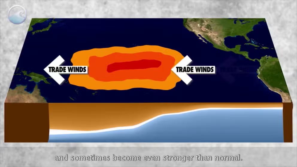
The meaning of El Nino and La Nina
The status of whether the world is being impacted by an El Nino or a La Nina is determined by water temperatures in the central and eastern Pacific. (NOAA)
Neutral conditions dominating large parts of the eastern and central Pacific are likely to persist throughout the rest of the year and into the upcoming winter, according to a recent NOAA outlook.
In the agency’s most recent update, researchers noted that much of the Pacific has anomalies between 0.5 °C to -0.5 °C, meaning neither El Niño nor La Niña is in control.
Once surface temperature anomalies reach at least -0.5 °C or colder, a La Niña is considered underway, which has global implications for weather patterns.
The agency said that if the status of the El Niño-Southern Oscillation, or what is commonly referred to as the ENSO, were to reach the cool phase later in the year, the changeover would likely not mean a whole lot of change, because the La Niña would be weak.
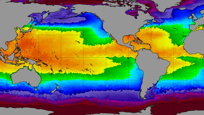
World water temperatures on 7/10/2025
(NOAA)
IS THERE A WEATHER PHENOMENON KNOWN AS THE ATLANTIC NINA?
Forecasters expect trade winds across the Pacific to strengthen in the coming months, as they often do this time of year, which should help to cool surface temperatures, but significant pockets of subsurface warmth will likely slow the overall cooling process.
Out of more than a dozen dynamical models depicting ENSO’s future status, only three drop to the threshold to officially declare a La Niña to be underway, while most remain in the neutral zone through next spring.
NOAA forecasters generally agree with that sentiment but note that if the world does slip into a La Niña regime, it will likely be brief, with odds increasing in the new year that neutral, or "La Nada," conditions will once again dominate.
Typically, during neutral ENSO cycles, the jet stream tends to have fewer kinks, and more regional patterns control local weather.
During winter, this usually means the southern U.S. stays warmer than average while the northern U.S. is cooler, with the transition zone often situated over the Ohio Valley.
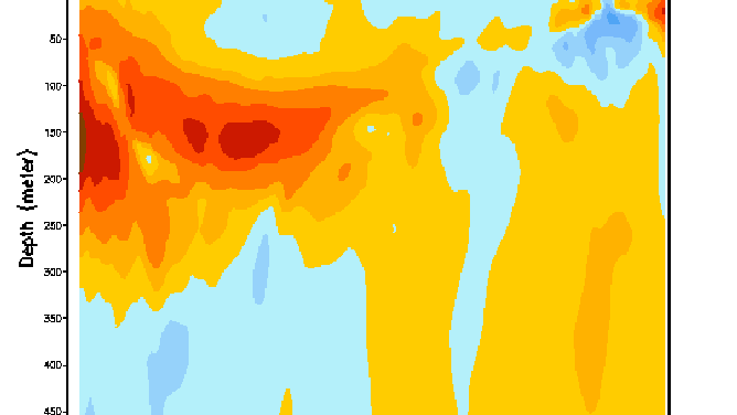
A look at the Pacific water temperatures below the surface.
(NOAA)
LITTLE-KNOWN WEATHER PATTERN WHEN EL NINO AND LA NINA ARE NO LONGER IN CONTROL
Last winter officially qualified as a La Niña event, although the signal was weak.
Despite the cool signal, the season ended as the third-warmest winter on record, with an average temperature of 1.9 °F above the long-term average.
Because the La Niña status was weak, atmospheric patterns resembled what is typically produced during a neutral ENSO season, meaning much of the country could see a similar repeat during the upcoming winter when compared to the 2024–2025 season.
There are only four more scheduled ENSO updates before the start of meteorological winter, which begins December 1 and runs through the end of February.
A strong La Niña generally brings colder, stormier weather to much of the country, while El Niños are known to produce more zonal patterns, which often leads to milder air.
![Model predictions of the ENSO.]() Image 1 of 2
Image 1 of 2Model predictions of the ENSO. ( The Columbia Climate School, Columbia University)
![NOAA ENSO probabilities through spring 2026.]() Image 2 of 2
Image 2 of 2NOAA ENSO probabilities through spring 2026. ( )

