Kansas City faces life-threatening flash floods as 1,000-mile storm grips nation's heartland
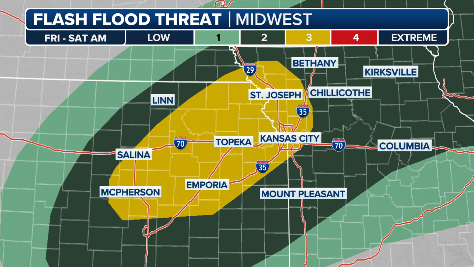
Due to the threat, NOAA’s Weather Prediction Center has also placed parts of northeast Kansas and northwest Missouri under a moderate threat of flooding or a Level 3 out of 4 on its risk scale.
Kansas City swaps heat for heavy rain, flooding; I-70 impacted
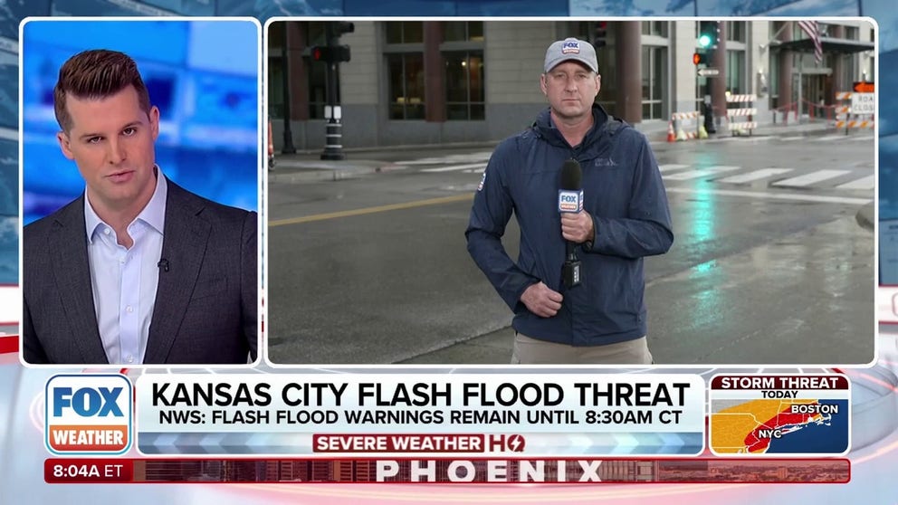
Kansas City is experiencing a reprieve from the recent heat wave, but it comes at a cost: severe storms and very heavy rain. The city already broke a daily rainfall record on Thursday, and the deluge isn't over yet. FOX Weather Correspondent Robert Ray is live from Kansas City, Missouri, where MoDOT has reported water over portions of Interstate 70, impacting the entire Kansas City metro.
KANSAS CITY, Mo. – Torrential rainfall from active thunderstorms is causing flash flooding problems across a 1,000-mile stretch of the Plains and Midwest on Friday, with Kansas City already hit particularly hard once, and another potential punch looms.

(FOX Weather)
NOAA’s Weather Prediction Center has placed parts of northeast Kansas and northwest Missouri under a moderate threat of flooding or a Level 3 out of 4 on its risk scale for Friday. Reports surfaced of cars submerged in rising waters across the Kansas City area early Friday morning.
The relentless downpours prompted numerous Flash Flood Warnings, with residents in warnings advised not to travel before sunrise due to the extreme danger.
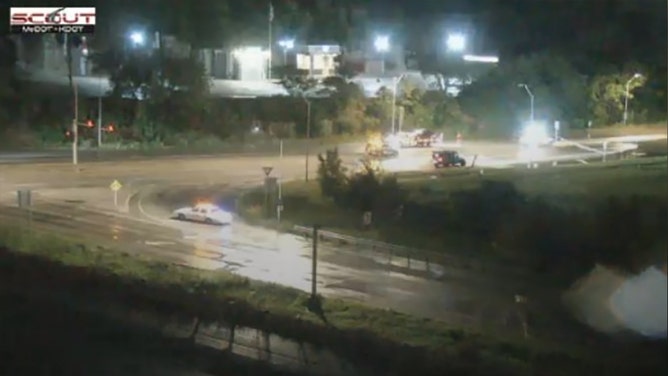
Heavy flooding has led to the closure of MO-78 east of I-435 in Jackson County, Missouri, causing significant traffic disruptions.
(MoDOT Kansas City)
Storms continued into Friday evening, taking aim once again at the Kansas City metro area. Some isolated locations in the regioin could see 9-12 inches of total rain, according to the National Weather Service office in Kansas City. Many areas had already received 3-4 inches through Friday morning, much of it falling in a short period, exacerbating the flood risk. On Thursday, Kansas City received 2.35 inches of rain, tying a 125-year-old record, the FOX Forecast Center said.
Counties in Kansas, Nebraska and Missouri remained under Flood Watches into Friday night as a slow-moving frontal boundary sets the stage for rounds of showers and thunderstorms into early Saturday.
(FOX Weather)
ONE OF THE MOST FLOOD-PRONE CITIES IN AMERICA IS ABOUT TO SEE A WHOLE LOT MORE WARNINGS
"Conditions are favorable for repeated thunderstorms with heavy rainfall which could result in flash and river flooding," National Weather Service meteorologists stated.
In the stronger convection, rainfall rates may exceed 2 inches per hour, especially north of the Interstate 70 corridor.
Forecasters reminded residents that just 6 inches of moving water can knock an adult off their feet, while a foot of floodwater can cause a vehicle to stall and float away.
Earlier in the week, authorities said a 62-year-old was killed after venturing too close to a flooded creek southwest of Kansas City, in Overland Park, Kansas.

(FOX Weather)
KNOW YOUR FLOOD TERMINOLOGY: WHAT FLOOD WATCHES, WARNINGS AND EMERGENCIES REALLY MEAN
Most of the activity is expected to remain below severe weather criteria, but there is a chance that a few cells could produce damaging wind gusts or trigger a brief Tornado Warning.
Forecasters will be monitoring the Topeka area closely, where rainfall rates over the past two weeks are running in the neighborhood 300-600% above normal. Additional rainfall on top of already saturated grounds can quickly lead to flooding with little warning.
After the rainfall, a ridge of high pressure is expected to build into the region, cutting rainfall chances and sending the mercury near 100 degrees starting over the weekend and lasting well into next week.