

Over 40 million at risk as severe storms target Mid-Atlantic, Carolinas following dangerous East Coast storms
While damaging wind gusts are the primary threat if storms develop on Sunday, localized flash flooding could present an even larger risk.
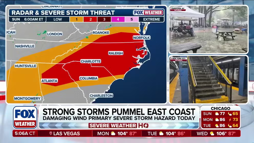
Over 40 million at risk as severe storms target Mid-Atlantic, Carolinas
Severe storm threats continue Sunday for over 40 million Americans across the Mid-Atlantic and Carolinas following Saturday's dangerous weather. While damaging winds are the main threat, localized flash flooding could pose an even bigger risk. Full forecast:
Sunday will continue this weekend's active severe weather pattern, putting over 40 million Americans at risk across the Mid-Atlantic and Carolinas. While damaging wind gusts are the primary threat if storms develop, localized flash flooding could present an even larger risk.
This follows a high-impact Saturday, which kicked off the weekend with a variety of dangerous impacts across the East Coast. Fortunately, this weekend's storms are at least breaking the warm, smoky pattern.
SUBWAY SOAKER ☔️: Heavy rain is drenching New York City, with water seeping into a subway station as downpours soak the Big Apple. pic.twitter.com/zucpljHVaU
— FOX Weather (@foxweather) July 18, 2026
On Saturday, the Northeast & Mid-Atlantic saw flooding rain, wind gusts over 70 mph and a few reports of tornadoes.
Localized flooding reported in parts of NYC. Don't enter flooded roads or buildings. Stay out of flooded basements. Move to higher ground/floor if needed. Call 911 if you need immediate assistance. Avoid unnecessary travel. Visit https://t.co/Y3FyFdSWDu or https://t.co/vplzSDf76I pic.twitter.com/YRgkGnPW1y
— NYCEM - Notify NYC (@NotifyNYC) July 18, 2026
In New Jersey, Gov. Mikie Sherrill asked residents to plan weekend travel accordingly for incoming storms.
As the system moved in, a Flash Flood Warning was issued for all five New York City boroughs through Saturday afternoon.
Officials warned residents that roads, basements, and subways could flood as rain rates between 2 to 3 inches per hour were possible into the evening hours.
Flash flooding was reported across the region, leaving several major interstates under water, with several reports of high water rescues that left several motorists trapped in Queens.
Outside the flood reports, high wind gusts were reported in several locations.
At the height of the storms, roughly 240,000 customers lost power, with Virginia leading the country at just over 64,000 outages.

(FOX Weather)
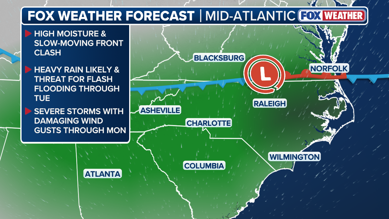
On Sunday, severe storms will continue to march south across portions of the Mid-Atlantic and Carolinas just ahead of a cold front.
A level 2 out of 5 severe threat will shift to include more of eastern North Carolina and Virginia, including Raleigh, Norfolk and Greensboro.
WHAT IS A HEAT DOME AND HOW CAN IT AFFECT YOU DURING THE SUMMER MONTHS?
(FOX Weather)
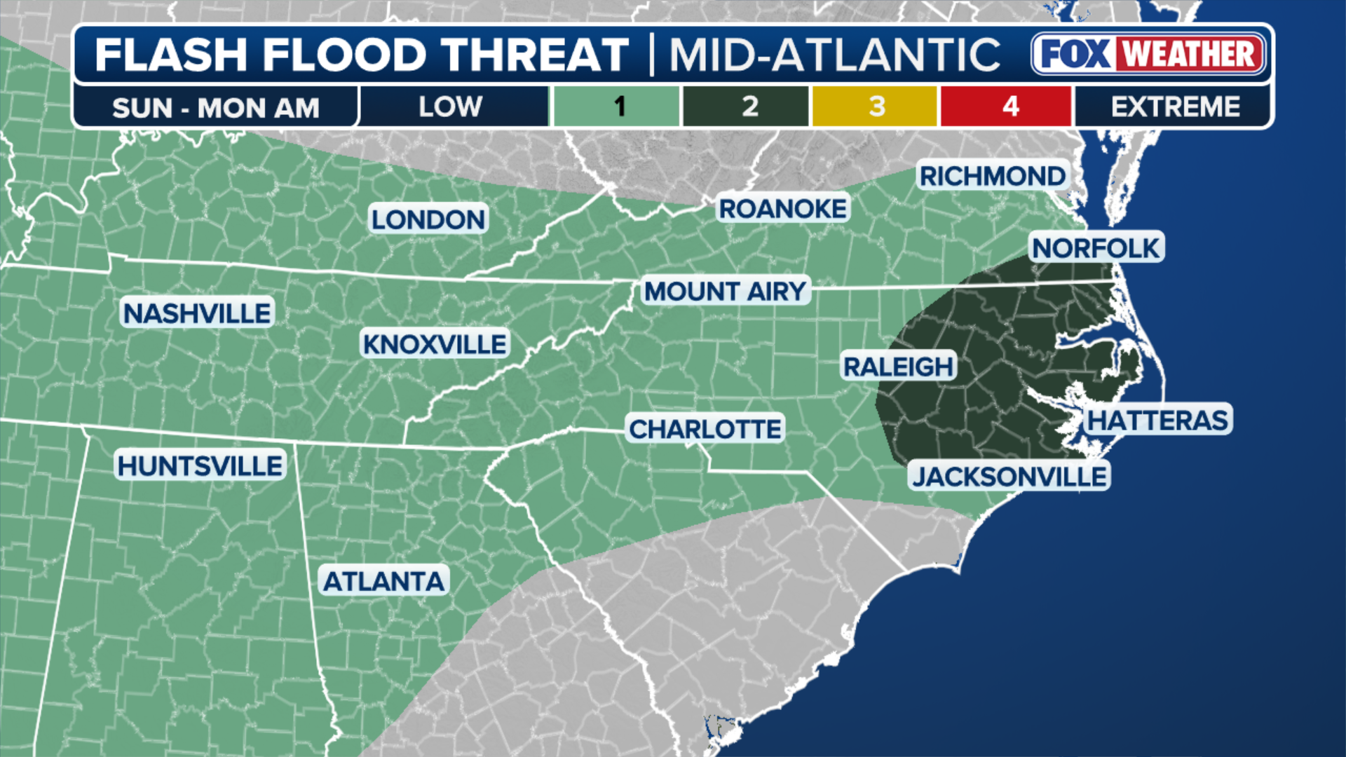
Damaging wind gusts will be the main threat with any severe storm that develops. However, the FOX Forecast Center warns that localized flash flooding could pose an even greater risk, as models indicate the front may stall over the region and allow rainfall totals to stack up.
(FOX Weather)
Storms will move across the same areas, thus allowing flash flooding to occur.
Rain totals could approach up to 3 inches in some locations. However, 1 to inches looks to be likely, the FOX Forecast Center said.
Additionally, severe storms will continue through Monday, where a level 1 out of 5 severe threat will still be in place for most of eastern North Carolina.
Stay with FOX Weather for the latest on this weekend's storms.