

Future Hurricane Isaias threatens more than coastline with impacts to push inland across South
Given the dangerous threat of landfall, it’s safe to say areas north of the Gulf coast will experience impacts.
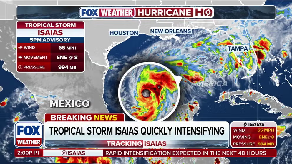
Tropical Storm Isaias is quickly intensifying with dangerous impacts on the horizon
Several Gulf Coast states are in the path of dangerous conditions as Tropical Storm Isaias continues to rapidly intensify. The system is expected to become a hurricane by Thursday before slamming the coastline Friday into Saturday. Stay with FOX Weather for the latest updates this hurricane season.
Future Hurricane Isaias continues to develop in the Gulf of America, prompting storm alerts and preparations for thousands, but those beyond the coastline will also feel its impacts.
As Isaias continues to churn, the FOX Forecast Center expects the storm to reach Category 2 strength by the time it becomes a hurricane, and it could make landfall on Friday anywhere between Gulfport, Mississippi and parts of Florida.
Given the dangerous threat of landfall, it’s safe to say areas north of the Gulf coast will experience impacts.
WHAT'S THE DIFFERENCE BETWEEN A HURRICANE MAKING A DIRECT HIT AND LANDFALL?
Heavy rain and flooding will push north from the Gulf coast into parts of the South, where the wet weather will persist through the weekend.
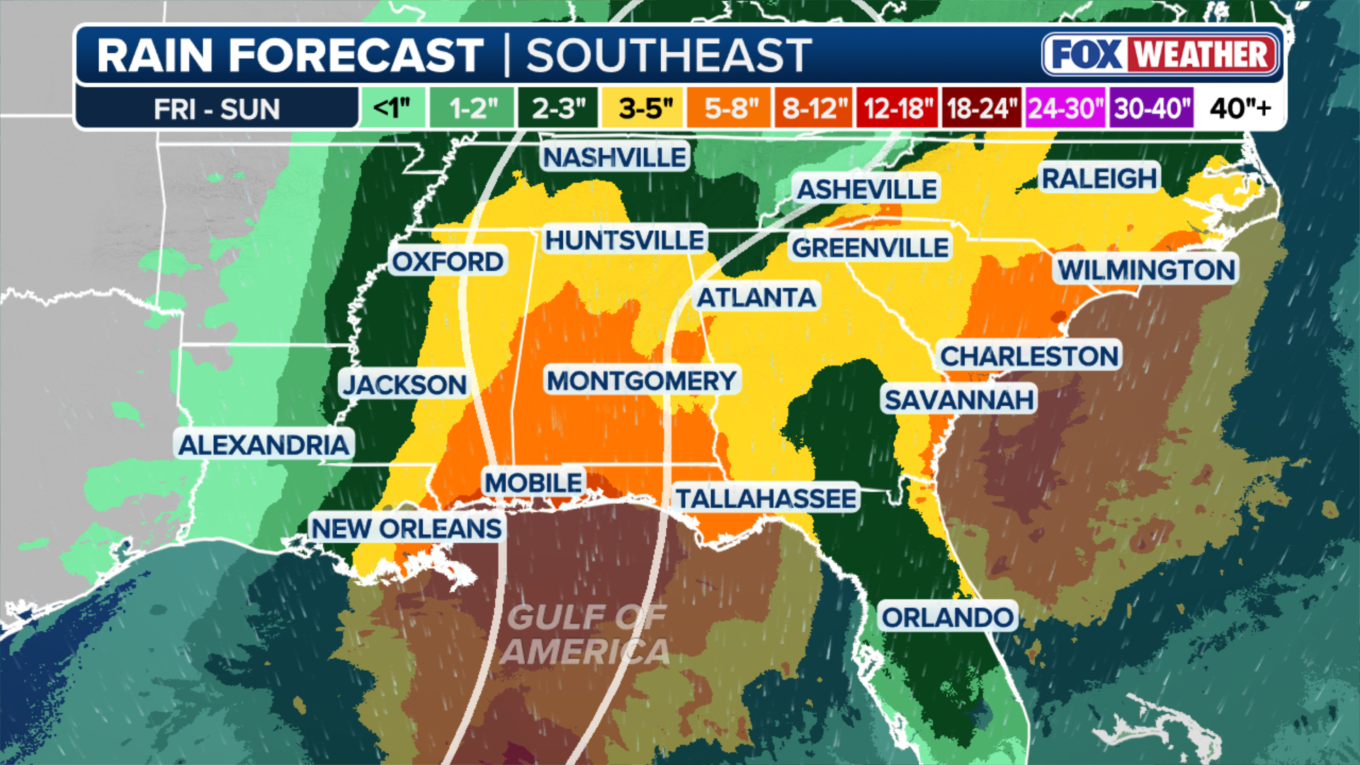
Popular southern cities such as Nashville, Memphis, Tennessee, New Orleans, Atlanta and Birmingham, Alabama, face elevated risk as wind gusts up to 75 mph, torrential rain and possible tornadoes begin to wreak havoc.
(FOX Weather)
In light of the growing threat, a Level 2 out of 4 flood threat is active for Atlanta and Montgomery, Alabama, before moving inland to the Carolinas and Tennessee Valley.
Officials in Charleston, South Carolina, have begun issuing Coastal Flood Advisories in preparation for Isaias producing high tides that could cause significant saltwater inundation of up to one foot above ground level.
From Friday through Sunday, areas such as Montgomery, Alabama, and Asheville, North Carolina, will receive 5 to 8 inches of rain, while other areas farther north, like Nashville and Jackson, Mississippi, will see 2 to 3 inches of precipitation.
A tornado threat also exists for the region, as Montgomery and Atlanta could experience a few isolated twisters.

(FOX Weather)
The dangerous future Hurricane Isaias will push impacts beyond the Gulf Coast, as more storm alerts will likely sound off leading up to a possible landfall on Friday.
STORM PREPARATIONS RAMP UP ACROSS SOUTHEAST AS FUTURE HURRICANE ISAIAS BARRELS TOWARD TO US
The main threat outside potential tornadoes will be repeated rounds of heavy rainfall and flooding, as the storm track passes through the southern region before shifting inland back toward the coast.
Storm impacts could reach as far as Cincinnati, New York City, Washington, D.C. and Pittsburgh, which could see approximately 2 to 3 inches of rain.

(FOX Weather)
A flood threat also exists for the Big Apple, Philadelphia and Washington, D.C.
These impacts will come from the remnants of future Hurricane Isaias and will last from Saturday through Monday.
Tune into FOX Weather all week long for updates.