Hurricane activity drops below normal as lull in Atlantic season continues
An average Atlantic hurricane season produces 14 named storms, seven hurricanes and three major hurricanes
Lull in Atlantic hurricane activity causing season to be quieter than normal
FOX Weather hurricane specialist Bryan Norcross breaks down the averages and how this hurricane season compares to 2021. Norcross expects an active hurricane season once dust from the Sahara Desert recedes in the Atlantic Ocean.
A rare sight is taking place across the Atlantic with a lack of tropical activity to track as the basin enters what are usually the busiest weeks of the year.
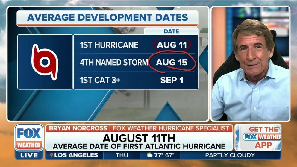
Typically, at 2.5 months into the season, the basin has cranked out four named storms and at least one hurricane.
So far, the 2022 season has come in with below the normal activity, producing only three tropical storms and none have reached the 75 mph threshold for hurricane status.
The lack of activity isn’t astounding to some tropical weather experts, but many will admit the season has been far from the classic definition of a La Niña influenced year.
HOW TO WATCH FOX WEATHER ON TV
Typically, during a La Niña cycle the Atlantic has no problems cranking out cyclone after cyclone, and the weather pattern has resulted in some of the busiest years on record in the basin.
This season, disturbances such as Invest 97L, which recently rolled off Africa, have simply fallen apart thanks to dry air and reduced instabilities.
The cyclones that have formed - Alex, Bonnie and Colin - remained relatively weak and did not produce large amounts of accumulated cyclone energy.
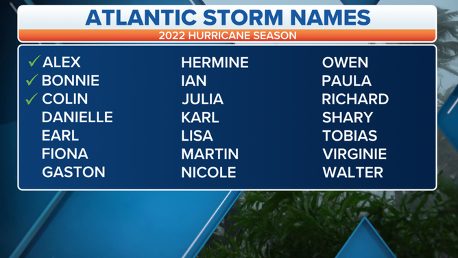
Three tropical storms have formed in the Atlantic during the 2022 season.
(FOX Weather)
Scientists measure the scope of a system’s wind speed and lifespan by ACE value.
So far, storms have produced 2.8 units, well shy of the 12.5 level that is usually achieved by mid-August.
Despite the slow start, forecasters say there is time for the dry air to subside over the basin and for the season to have a busy second half.
"Luckily for us so far, the Atlantic is quiet, but of course, that can change really quickly. Usually, August 20 is the date that the hurricane season tends to really kick in," FOX Weather Hurricane Specialist Bryan Norcross said.

The climatological peak is September 10, but there have been years that have seen more activity during the second half of the season than the first.
The FOX Forecast Center says 1999 and 1961 are both prime examples where a lull in activity was replaced dramatic uptick in the formation of cyclones and major hurricanes.
CLICK HERE TO GET THE FOX WEATHER UPDATE PODCAST
![Hurricane Season 1999]() Image 1 of 2
Image 1 of 2Hurricane Season 1999 ( )
![Hurricane Season 1961]() Image 2 of 2
Image 2 of 2( )


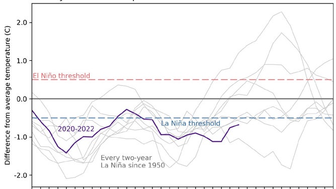
La Niña is sticking around
Experts with the National Oceanic and Atmospheric Administration’s Climate Prediction Center say a La Niña is in control of weather patterns and could be heading for a three-peat.
If the weather pattern survives through winter, it will be only the third time in 73 years that the triple occurrence has been observed.
Forecasters say a decrease in water temperatures in the central Pacific is what is driving the La Niña.
Monthly sea surface temperatures.
The eastern Pacific off the coast of Mexico has been an anomaly to the general pattern. Water temperatures have remained warm, which has been a key ingredient for an extremely busy tropical season.
Before the hurricane season started, NOAA believed the basin was likely heading for a below-average season.
The hurricane seasons in both the Atlantic and Pacific run through November 30.
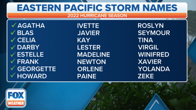
Nine tropical cyclones, including Bonnie, that crossed over Central America from the Caribbean to the Pacific, have formed this year.
(FOX Weather)