Hurricane Andrew timeline: On this day, August 20, 1992
That Thursday afternoon, we in South Florida weren’t worried. It was just a tropical storm likely heading somewhere else. In reality, of course, Hurricane Andrew was only 3 1/2 days from landfall less than 20 miles from Miami.
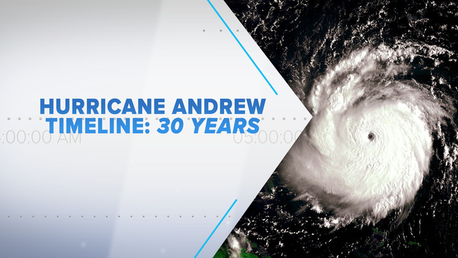
30 years later, Bryan Norcross re-lives Hurricane Andrew that devastated South Florida with a timeline detailing what happened.
(FOX Weather)
Thirty years ago today – Thursday, August 20, 1992 – was the most confusing day meteorologically in the lead-up to Andrew’s assault on South Florida. Tropical Storm Andrew was 1,150 miles from Miami and on shaky ground. Top winds were down to 45 mph. Hurricane Hunters could not find a center of circulation.
An upper-level low-pressure system to the northeast of Andrew was creating a hostile environment for the storm. There were indications that the big upper low would move away, which could create an atmospheric pattern more conducive to strengthening. But maybe not. We weren’t as confident in the computer forecast models as we are today. There was a lot of uncertainty, to say the least.
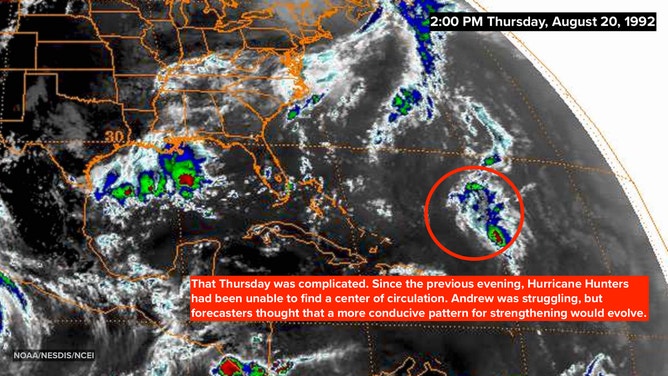
Satellite image on August 20, 1992 at 2:00 P.M. EDT showing an estimated 45-mph Tropical Storm Andrew.
(NOAA/NESDIS/NCEI)
Since there was no center of circulation, standard National Hurricane Center protocol said the storm should be downgraded. But NHC director Dr. Bob Sheets decided to keep the name Tropical Storm Andrew a bit longer. Since there was some reason to think it still might reorganize and strengthen, he thought it would be confusing to take off the name and then put it back. (He was right.)
The special forecast models that forecast a tropical storm’s track gave conflicting information. Most of them kept the storm moving slowly, showing it well east of the Bahamas or far off the Southeast coast in three days, though one took it to near Cuba at a much faster speed. The official forecast split the difference, following the idea that Andrew would move fairly slowly in the waters well east of the Bahamas but with steady, modest intensification.
In the 5:00 PM non-public Technical Discussion, which was a component of the advisory package, Andrew was predicted to intensify to a 70-mph tropical storm over the following three days. NHC forecaster Hal Gerrish wrote the discussion. You can tell there was a lot of uncertainty in his mind about the forecast.
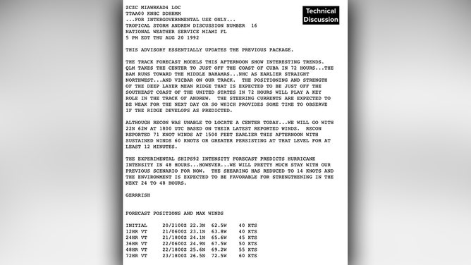
Technical Discussion from the National Hurricane Center at 5:00 P.M. EDT on August 20, 1992.
(NHC)
READ YESTERDAY'S POST FOR THE HURRICANE ANDREW TIMELINE: AUGUST 19, 1992
As it turned out, three days after this advisory was issued was Sunday afternoon – the last afternoon before landfall that night. In those three days, Andrew exploded into a 175 mph Category 5 hurricane that would devastate northern Eleuthera and the nearby islands in the Bahamas with a track locked on Dade County.
But that Thursday afternoon, we in South Florida weren’t worried. It was just a tropical storm likely heading somewhere else. In reality, of course, Hurricane Andrew was only 3 1/2 days from landfall less than 20 miles from Miami.
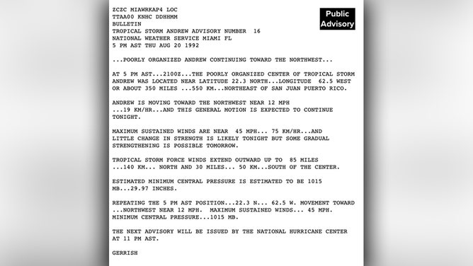
Public Advisory from the National Hurricane Center at 5:00 P.M. EDT on August 20, 1992.
(NHC)
Three decades ago, renowned hurricane specialist Bryan Norcross did a 23-hour marathon broadcast as Hurricane Andrew slammed into the Florida coast. His broadcast was the only one to stay on the air and many people’s only link to the outside world during the worst of the storm. He is credited with saving countless lives due to his life-saving advice. Now, 30 years later, Bryan will re-live the storm that devastated South Florida and look at the infrastructure changes that resulted. Watch The Wrath of Hurricane Andrew: Tragedy and Triumph on FOX Weather, premiering August 23rd and 24th at 10 P.M. EDT.
HOW TO WATCH FOX WEATHER ON TV
FOX Weather Hurricane Specialist Bryan Norcross has a podcast, Tracking the Tropics with Bryan Norcross, available now on FOX News Audio.