Hurricane Andrew timeline: On this day, August 19, 1992
Since there was a remote possibility that Andrew might affect Florida, Bryan Norcross decided to premiere a new cone-like graphic to talk about the uncertainty in the track forecast. Norcross had been working on new ways to communicate hurricane information for the past year, and this was the first chance to use the new graphic.
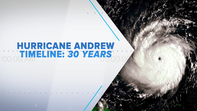
30 years later, Bryan Norcross re-lives Hurricane Andrew that devastated South Florida with a timeline detailing what happened.
(FOX Weather)
At 5:00 PM on Wednesday, August 19, 1992 – 30 years ago today - Tropical Storm Andrew's winds were estimated at 50 mph – the same as the day before. The official National Hurricane Center forecast showed steady movement in the general direction of Florida or the Southeast, but in South Florida, we weren't worried. For more than 25 years, storms had always turned north or stayed offshore. The center of Andrew was 1,400 miles from Miami.
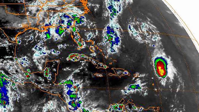
Satellite image on August 19, 1992 at 5:00 P.M. EDT showing an estimated 50-mph Tropical Storm Andrew.
(NOAA/NESDIS/NCEI)
A large upper-level low spinning to the north was keeping Andrew from developing by preventing the thunderstorms from wrapping around the center. They were all in a blob on the east side of the circulation.
In the Technical Discussion that was part of the Wednesday afternoon advisory, National Hurricane Center forecaster Hal Gerrish discussed the possibility that a high-pressure system might strengthen to the north of Andrew after about three days. It was just speculation at that point, but that possibility figured into my thinking later in the week. The stronger the high, the more likely Andrew would make landfall somewhere in Florida.
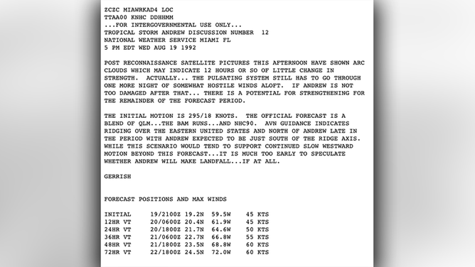
Technical Discussion from the National Hurricane Center at 5:00 P.M. EDT on August 19, 1992.
(NHC)
READ YESTERDAY'S POST FOR THE HURRICANE ANDREW TIMELINE: AUGUST 18, 1992
Since there was a remote possibility that Andrew might affect the state, I decided to premiere a new cone-like graphic to talk about the uncertainty in the track forecast. I had been working on new ways to communicate hurricane information for the past year, and this was the first chance to use the new graphic.
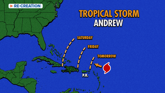
Premiere of the cone-like graphic on August 19, 1992.
(FOX Weather)
Over the winter of 1991/92, I contacted retired National Hurricane Center-modeling guru Charlie Neumann about my idea of showing what the average NHC forecast errors were in the 24, 48, and 72-hour forecasts. Forecasts only went out three days at that time. I made a dashed arc on the map at each forecast time representing those average errors. The arcs were wider with each successive day representing the increasing uncertainty as forecasts were made for days further in the future.
Four years later, those arcs eventually morphed into a cone graphic like we use today. TV weather-graphics software finally allowed us to draw an outline and fill it in when an upgraded graphics system became available in 1995. We drew the forecast cone by hand for eight years beginning in 1996 until the graphics software caught up and finally plotted it automatically.
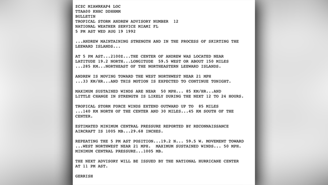
Public Advisory from the National Hurricane Center at 5:00 P.M. EDT on August 19, 1992.
(NHC)
The cone-like arcs that Wednesday in 1992 showed that Andrew would turn north and head out to sea if it stayed on the right side of the quasi-cone’s set of possibilities. On the other hand, if it tracked on the left side of the arcs, the storm would come toward South Florida.
I premiered the new graphic on the news that Wednesday afternoon and evening. Even though the arcs showed the possibility of a problem in South Florida, it looked remote. In Miami, we weren’t concerned. The vast majority of the track possibilities at that point showed Andrew turning well to the north.
In reality, Hurricane Andrew was only 4 1/2 days from landfall less that 20 miles from downtown Miami with 165 mph winds.
Three decades ago, renowned hurricane specialist Bryan Norcross did a 23-hour marathon broadcast as Hurricane Andrew slammed into the Florida coast. His broadcast was the only one to stay on the air and many people’s only link to the outside world during the worst of the storm. He is credited with saving countless lives due to his life-saving advice. Now, 30 years later, Bryan will re-live the storm that devastated South Florida and look at the infrastructure changes that resulted. Watch The Wrath of Hurricane Andrew: Tragedy and Triumph on FOX Weather, premiering August 23rd and 24th at 10 P.M. EDT.
HOW TO WATCH FOX WEATHER ON TV
FOX Weather Hurricane Specialist Bryan Norcross has a podcast, Tracking the Tropics with Bryan Norcross, available now on FOX News Audio. You can get it on your device by clicking here.