Massive winter storm spawns severe weather threat across Gulf Coast with possible tornadoes
This latest dimension of the already historic winter system is a result of Arctic air dipping farther south than initially expected — not so much at ground level, but a few thousand feet up. However, the associated dip in the jet stream is drawing in more warm air from the Gulf—the clash between these air masses is what set the stage for Sunday's thunderstorms.

Massive winter storm spawns severe weather threat across Gulf Coast, Tornado Watch issued
While a massive winter storm plunges much of the country into a deep freeze of ice and snow, the same system threatens nearly 10 million people across parts of the Deep South and Gulf Coast with a new hazard — severe thunderstorms. A Tornado Watch was issued Sunday afternoon through 6:00 p.m. CT for parts of southern Alabama, the Florida Panhandle, and southwestern Georgia. This latest dimension of the already historic winter system is a result of Arctic air dipping farther south than initially expected — not so much at ground level, but a few thousand feet up. However, the associated dip in the jet stream is drawing in more warm air from the Gulf—the clash between these air masses is what set the stage for Sunday's thunderstorms.
NEW ORLEANS – While a massive winter storm plunges much of the country into a deep freeze of ice and snow, the same system threatens nearly 10 million people across parts of the Deep South and Gulf Coast with a new hazard — severe thunderstorms.
A Tornado Watch was issued for Sunday afternoon until 6:00 p.m. CT for parts of southern Alabama, the Florida Panhandle, and southwestern Georgia.
There are reports of a confirmed tornado, based on radar indications of rotation. Tornado watches will continue throughout the night, as the risk of flying debris and roof damage is high with such an extreme threat.
The other primary severe weather hazard will be wind gusts in excess of 60 mph.

(FOX Weather)
NOAA'S Storm Prediction Center has issued a Level 2 out of 5 risk of severe thunderstorms which covers much of the same area across a small chunk of the Gulf Coast including part of southeastern Mississippi, southern Alabama, the Florida Panhandle and southwest Georgia.
LIVE UPDATES: DANGEROUS WINTER STORM BLASTING AMERICA WITH HEAVY SNOW AND CRIPPLING ICE
This includes the Montgomery and Mobile, Alabama, the Tallahassee, Florida and Albany, Georgia, metro areas.
A Level 1 threat covers New Orleans and Jackson, Mississippi.

(FOX Weather)
A line of thunderstorms organized to end the weekend across Louisiana and Mississippi, just south of the icing zone below the Interstate 20 corridor, before it was pushed into Alabama and the Florida Panhandle.

This graphic shows future radar.
(FOX Weather / FOX Weather)
This latest dimension of the already historic winter system is a result of arctic air dipping farther south than initially expected — not so much at ground level, but a few thousand feet up.
This has allowed some places across the southern Plains, like Little Rock, Arkansas, to tally more snow than forecast.
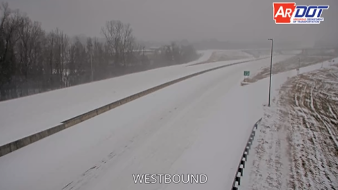
Snow blankets Interstate 440 outside the Little Rock Airport early Saturday.
(ARDOT / FOX Weather)
However, the associated dip in the jet stream is drawing in more warm air from the Gulf—the clash between these air masses is what set the stage for Sunday's thunderstorms.
Check back at FOX Weather for more updates as we continue to cover this event.