

Flood threat returns to millions across Ohio Valley, Appalachians as severe storms sweep east
East Tennessee and Western and Central North Carolina face the greatest threat of damaging wind gusts from severe storms.
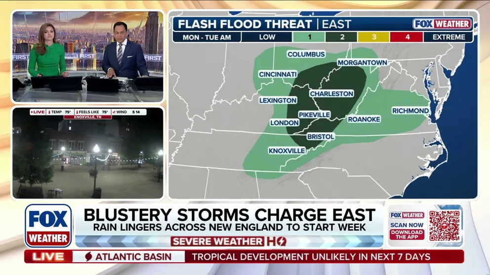
Severe storms threaten Ohio Valley, Central Appalachians, Mid-Atlantic with wind and flooding
Parts of the Ohio Valley, Central Appalachians and Mid-Atlantic face another flood threat beginning Monday afternoon as the latest round of severe thunderstorms sweeps east, after days of repeated storms triggered deadly flooding in Indiana and Ohio last week.
THE TAKEAWAY
- A Level 2 flash flood threat returns to parts of the Ohio Valley and West Virginia Monday
- Severe thunderstorms to develop across the Appalachians Monday afternoon
- Storms could produce wind gusts potentially exceeding 60 mph, particularly across parts of East Tennessee and Western and Central North Carolina
Parts of the Ohio Valley, Central Appalachians and Mid-Atlantic face another flood threat beginning Monday afternoon as the latest round of severe thunderstorms sweeps east, after days of repeated storms triggered deadly flooding in Indiana and Ohio last week.

(FOX Weather)
Meanwhile, rain will begin to clear across the Northeast through Monday morning, although clouds will stick around into the afternoon. Spot showers and downpours could pop up across parts of the morning and afternoon, but severe storms are expected to remain farther south.

Cars drive through minor street flooding in New Jersey
New Jersey and the Northeast are facing heavy rain with the potential of flash flooding on Thursday. Video shows cars in Rahway splashing through some pooled water as rain continued.
A Level 2 out of 4 flash flood risk covers parts of southeastern Ohio, eastern Kentucky, much of West Virginia and southwest Virginia Monday.
Monday's thunderstorms could produce rain rates between 1 and 2 inches per hour, threatening flooding, particularly in West Virginia and Ohio, where the ground is still saturated from storms last week and over the weekend.

(FOX Weather)
East Tennessee and Western and Central North Carolina face the greatest threat of damaging wind gusts from severe storms.
This includes the Chattanooga, Tennessee, and Charlotte and Raleigh, North Carolina metro areas.
WHY ARE HURRICANES SO RARE IN HAWAII
"Thunderstorms will quickly fire along the mountain ridges before moving southeast into the lower elevations," the FOX Forecast Center said.

(FOX Weather)
"Severe weather activity across the Carolinas and Southern Appalachians will peak during the late afternoon and evening hours before gradually weakening after sunset. "
Sporadic thunderstorms could develop across the Southeast coast Tuesday, but are currently expected to remain sub-severe as this round of bad weather exits the region.