

Flooding, severe storms target the South, Gulf Coast as threats shift following deadly Missouri flooding
Flood Watches remain in effect as the risk moves into eastern Tennessee, western North Carolina, and southern Virginia.
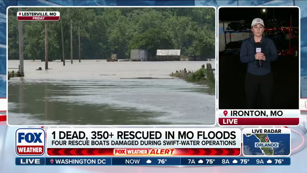
Recovery efforts continue after deadly Missouri flash flooding
FOX Weather Meteorologist Jane Minar continues her coverage live from Ironton, Missouri, following catastrophic flash flooding that tore through the region Friday, leaving one dead and prompting more than 350 water rescues. Latest on recovery efforts:
Following a day of intense flash flooding across the Heartland on Friday, the threat of both severe thunderstorms and flash flooding continues on Sunday, shifting much farther to the south and east.
Search and rescue teams recovered the body of a missing Missouri woman on Saturday, who was swept away from her home early Friday morning after dangerous floodwaters tore through Crawford County.
As of Saturday evening, all response groups continued searching for potential missing persons.
The Missouri State Highway Patrol said the body of Faith Gregory was recovered about a mile from her home around 11:30 a.m. on Saturday after an extensive search.
"It's definitely not the outcome we were hoping for, but its a tragic reminder of how strong Mother Nature can be, and how forceful it can be," Missouri State Highway Patrol Sergeant Eddie Young said on FOX Weather.
Many of the same areas will experience additional rainfall and possible flooding, with the threat expanding farther south.
![Flash Flood Emergency inundates homes in Lesterville, Missouri.]() Image 1 of 4
Image 1 of 4Flash Flood Emergency inundates homes in Lesterville, Missouri. (Amber Dawn Wilkins)
![]() Image 2 of 4
Image 2 of 4A horse stands in the middle of a flooded road in Lesterville, Missouri during a Flash Flood Emergency on July 10, 2026. (Nicole Spencer, Pacific Fire District Public Relations Officer)
![Floodwaters swamp home in Elvins, Missouri on July 10, 2026.]() Image 3 of 4
Image 3 of 4Floodwaters swamp home in Elvins, Missouri on July 10, 2026. (Danielle Love/Facebook)
![Black River in Lesterville, MO is flooded.]() Image 4 of 4
Image 4 of 4Black River in Lesterville, MO is flooded. (Katie Poliette-Hultberg/Facebook)
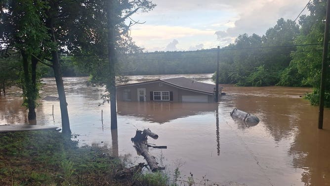
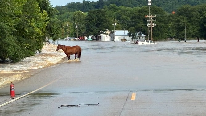
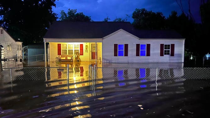
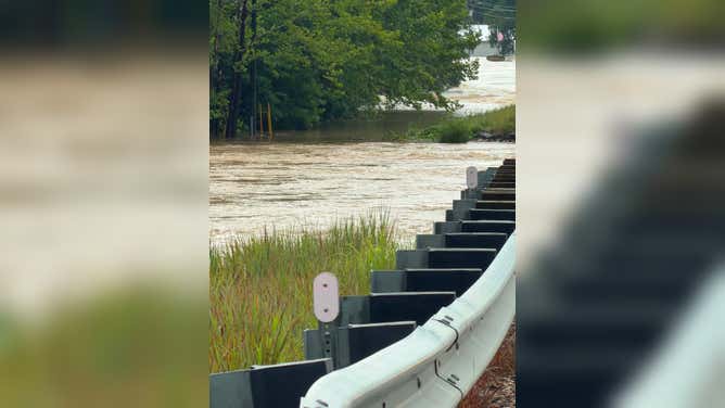
On Friday, a Flash Flood Emergency was issued across Iron and Reynolds counties in Missouri, where rain totals reached as high as 12.25 inches.
The Missouri Regent C Incident Command tells FOX Weather that more than 351 rescues were performed as of 9:45 p.m. on Friday.
Of those rescues were 200 children from Camp Taum Sauk, which were relocated to St. Louis last night.
According to the Crawford County Sheriff's Office, Gregory went missing after floodwaters entered her home.
As floodwaters rapidly rose around 3 a.m., Gregory and her boyfriend called 911 for help. As they tried to escape, part of the home's wall collapsed, sweeping Gregory away in the rushing water.
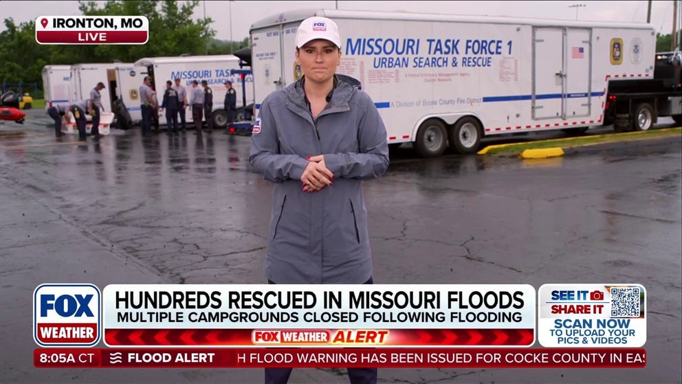
Over 350 water rescues performed as flash flooding tears through Missouri
Devastating flooding swept through Missouri on Friday, leading to over 350 water rescues to be performed. 200 children were rescued from a flooding campground, as well. FOX Weather Meteorologist Jane Minar is live in Ironton, Missouri with the latest:
The Weather Prediction Center continued to highlight a "concerning" heavy rainfall forecast across the Mississippi, Tennessee and Ohio Valleys on Saturday, with the overall pattern not expected to change much.
A strong ridge of high pressure over the Four Corners is causing an upper-level trough to slow as it moves east. With this, a cold front will sag through the Mid-Mississippi and Tennessee Valleys before stalling in a west-to-east orientation come Sunday morning, bringing repeated rounds of moisture and disturbances from the Southern Plains into the Mid-Atlantic through the weekend.
KNOW YOUR FLOOD TERMINOLOGY: WHAT FLOOD WATCHES, WARNINGS AND EMERGENCIES REALLY MEAN
(FOX Weather)
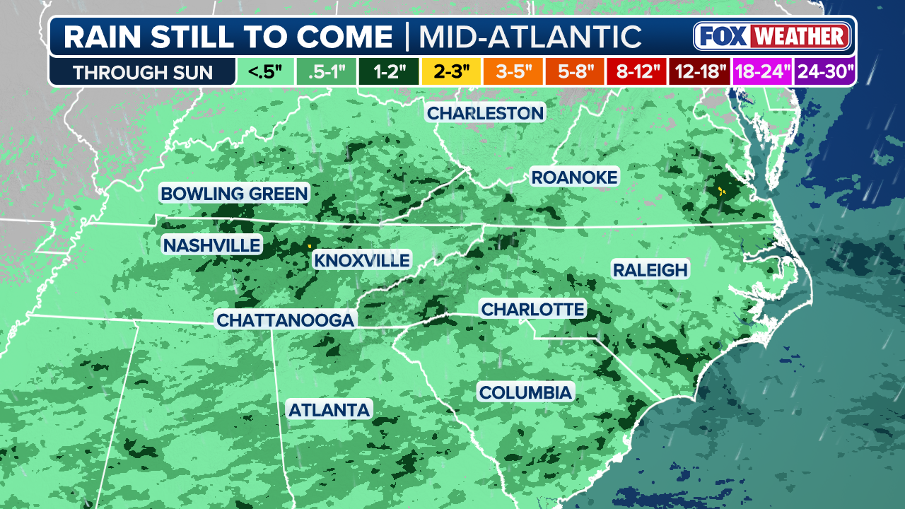
Flood Watches remain in effect as the risk moves into eastern Tennessee, western North Carolina, and southern Virginia. Concurrently, a Level 2 out of 4 flash flood threat spans from just east of Nashville to the Carolina coast.
Widespread rainfall totals of 2 to 3 inches are expected through Sunday from Kentucky through central Tennessee.
Additionally, as the ridge of high pressure over the western U.S. moves into the northeastern tier early next week, a setup for heavy rainfall will develop along the Gulf Coast.
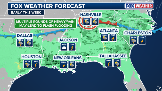
Rain setup across the South
HERE'S WHAT TO DO IF YOU ENCOUNTER A FLOODED ROAD
Deep tropical moisture and several disturbances will move in and create an environment of repeated rounds of thunderstorms along the southern edge of the ridge.
These storms are capable of producing torrential rainfall, triggering flash flood threats.
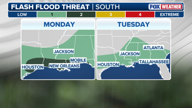
Monday through Tuesday flash flood threat outlook
(FOX Weather)
The greatest threat here is across eastern Texas and Louisiana, where a Level 2 out of 4 flash flood threat is in place through Monday. This includes cities like Houston and New Orleans.
By Tuesday, a broader level 1/4 flash flood risk will extend more than 1,000 miles from western Texas to the South Carolina coast as the moist, unsettled pattern persists.
Through the day, widespread rainfall totals of 1 to 2 inches are expected across eastern Texas, Louisiana, and southern Mississippi, with localized totals exceeding 3 inches possible, especially closer to the Gulf Coast, where repeated thunderstorms may develop over the same areas.