Hawaiian volcanoes show off fresh snow after 'Kona low' blizzard
NASA's Landsat 8 satellite showed the wintry wonderland that now sits atop Mauna Kea and Mauna Loa -- both with summits over 13,500 feet tall.
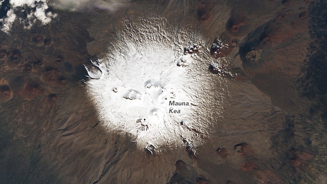
A snow-capped Mauna Kea on Hawaii on Dec. 7, 2021 as seen by Operational Land Imager (OLI) on Landsat 8.
(NASA)
HONOLULU -- The two large volcanic mountains that tower over Hawaii's Big Island received so much new snow after blizzard conditions struck the islands amid the "Kona Low" storm earlier this week that it was easily visible from space.
NASA's Landsat 8 satellite showed the wintry wonderland that now sits atop Mauna Kea and Mauna Loa -- both with summits over 13,500 feet tall.
Snow atop those mountains isn't rare, though blizzard conditions only happen every several years on average.
This week's snow was brought amid a strong Kona Low -- so named for a powerful area of low pressure that not only swings vast amounts of tropical moisture into the islands but reverses the wind direction to the south/southwest from the traditional northeasterly trades.
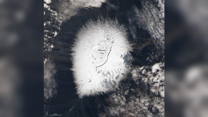
A snow-capped Mauna Loa on Hawaii on Dec. 7, 2021 as seen by Operational Land Imager (OLI) on Landsat 8.
(NASA)
The moist, southwesterly winds slam into the mountains on the island, squeezing out several inches of rain and causing widespread flooding, in addition to gusty winds and even potential hail and thunderstorms.
Just over 14 inches of rain was observed on the Big Island, while Honolulu had 7.92 inches on Dec. 6, breaking the city's December record and notching the second-wettest day on record for any date.
The official rain gauge in Maui recorded 12.86 inches of rain in the storm. However, according to NASA, National Weather Service forecasters estimated some of the south-facing mountain slopes may have collected up to 20 inches.