Gustnado collides with storm chaser in North Dakota
The gustnado formed in front of the storm chaser in North Dakota on Monday
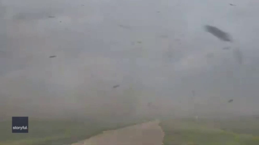
Extreme winds whip debris and dust towards vehicle in North Dakota
A storm chaser gets caught up in gustnado-like winds in Wild Rice, North Dakota during a severe storm on Monday. (Video: John Homenuk via Storyful)
WILD RICE, N.D. – A storm chaser quickly went from chasing the storms to the one being chased during a recent storm in North Dakota.
John Homenuk found himself in the path of a gustnado in Cass County on Monday.
Videos that Homenuk recorded show the incredible scene.
WATCH: ‘GUSTNADO’ WREAKS HAVOC AT PORTLAND BASEBALL FIELD
Extreme winds are seen throwing debris and dust into his vehicle.
While a gustnado may look like a tornado, meteorologists say the way it forms is different.
"A gustnado is a small, whirlwind which forms as an eddy in thunderstorm outflows. They do not connect with any cloud-base rotation and are not tornadoes," according to the National Oceanic and Atmospheric Administration. "Since their origin is associated with cumuliform clouds, gustnadoes will be classified as Thunderstorm Wind events."
The storm chaser noted that damage was visible following the whirlwind.
"Power lines were down throughout this area, some snapped," Homenuk said on Twitter.
DECODING THE SPIN: HOW TO TELL THE DIFFERENCE BETWEEN A WATERSPOUT AND A TORNADO
The National Weather Service indicated that hail the size of tennis balls and 80-mile-per-hour winds were possible in the area on Monday.
Be sure to download the FOX Weather app to track any storms in your area and receive potentially life-saving weather alerts issued by the National Weather Service. The free FOX Weather livestream is also available 24/7 on the website and app and on your favorite streaming platform. The FOX Weather Update podcast also provides weather information for the entire country.