Relentless rains in Texas lead to swift water rescues, swelling rivers
Saturday will remain a soggy day across much of the Lone Star State as a strong upper-level system will push northward from northeast Mexico.
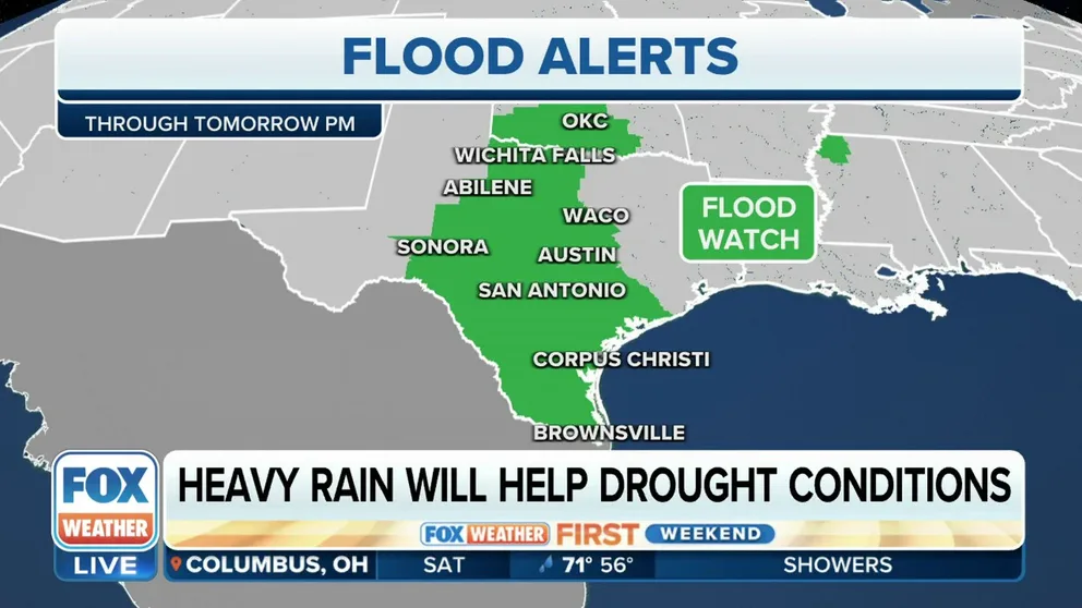
Up to 10 inches of rain possible in Texas through Monday
Multiple rounds of heavy rains, stretching from south to north-central Texas are expected this weekend.
Torrential rains continued to drench much of Texas on Saturday, helping to not only relieve a significant drought in the state but also cause flooding issues.
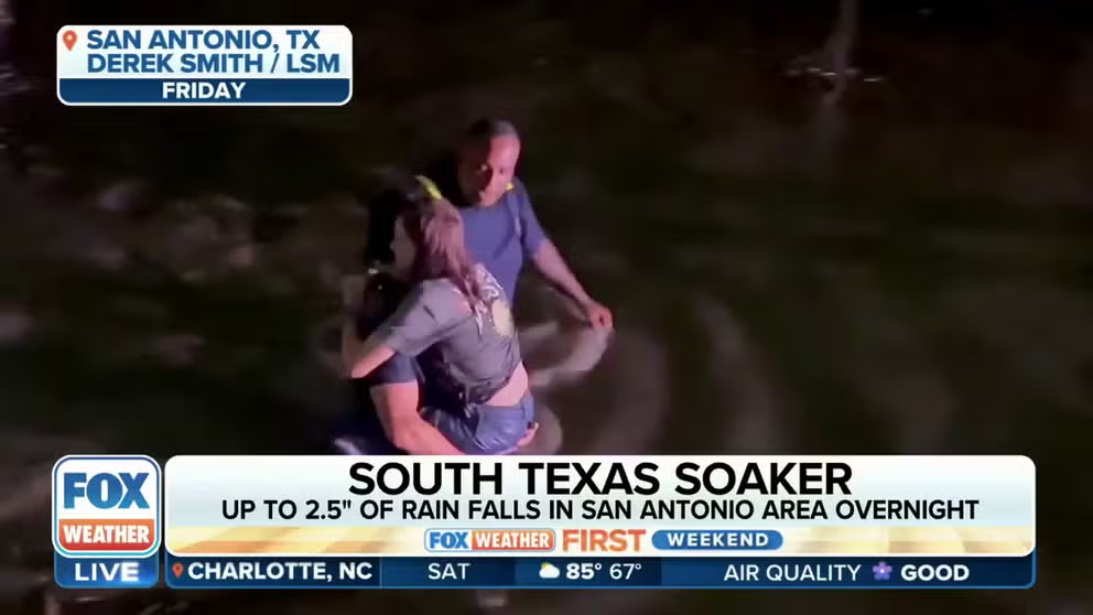
In San Antonio, where about 2.5 inches of rain fell through Saturday evening, several roads were flooded, including parts of Interstate 35.
Firefighters in San Antonio had to rescue three people trapped inside their car after driving onto a flooded road.
Heavy rain triggers flash flooding in South Texas
An exceptionally wet set of days is expected across the central U.S. FOX Weather's Brandy Campbell is live in San Antonio, Texas, where residents are preparing for drought-busting deluge, but it may come at a cost. A significant flash flood threat will be in place with up to 8 inches of rain possible through Monday.
At least one other woman was able to get herself out after getting trapped.
"I was going down the road, and all of a sudden, the water started coming up on me," said Lisa Contreras. "I got scared, and I was scared that I was going to die in my car, so I got out of the car and walked out. There were no barricades or nothing at all."
More than 24 areas in Bexar County were closed due to flooding Saturday morning. There were at least a dozen reports Saturday of water covering roads in the area between San Antonio and Victoria. According to the West Gulf River Forecast Center, several creeks and rivers in that same area were in either moderate or major flood stage. That included the Guadalupe River, which was at nearly 30 feet in Victoria as of Saturday evening.
FOX Weather's three-hour radar loop below shows where showers and thunderstorms have been ongoing. The green boxes indicate any active Flood Warnings.
EXPLAINING FLOOD ALERTS ISSUED BY THE NATIONAL WEATHER SERVICE

(FOX Weather)
Heavy rain continues Saturday in Texas
Saturday will remain a soggy day across much of the Lone Star State as a strong upper-level system will push northward from northeast Mexico and across western to central Texas and eastern New Mexico.
This system will produce multiple rounds of heavy rain stretching from south to north-central Texas, the FOX Forecast Center said. The heaviest rain fell Friday night and will continue into Saturday. About another 2-3 inches of rain is expected this weekend around San Antonio, with 1-2 inches likely in Austin and Oklahoma City and up to an inch in the Dallas-Fort Worth Metroplex.
Flooding is also possible Sunday across much of Texas, with possible flooding rains spreading into the central Plains and the mid-South. By the time the storms end, parts of South Texas may have received about 10 inches of rain, triggering more flash flooding.
HOW HEAVY IS IT REALLY GOING TO RAIN?

(FOX Weather)
"We do have a Flood Watch in effect for most of the state of Texas," FOX Weather meteorologist Jason Frazer said. "That includes those of you in Waco, Junction, San Antonio, Bay City, Corpus Christi, as well as the Brownsville area."
WHY RARE 'HIGH RISK' FLOOD DAYS NEED TO BE TAKEN SERIOUSLY

(FOX Weather)
Some drought relief for Texas
The heavy rains are a blessing for areas that can avoid the troubles of flash flooding. Much of the state has been in severe to even extreme drought ahead of the drier summer months.

(FOX Weather)