More than 20 million Americans targeted by flash flooding as severe storms sweep across the East
As an area of high pressure remained off the East Coast, abundant Gulf and Atlantic moisture was pulled northward across much of the Southeast, and more notably into the Mid-Atlantic and Ohio Valley.

Damaging winds, flash flooding threaten millions as severe storms target the East
Flash flooding and severe storms threaten over 20 million Americans today, especially in the Mid-Atlantic and Ohio Valley. While severe storms bring a primary threat of damaging winds, torrential downpours are keeping flood risks high. Stick with FOX Weather for the latest updates to keep you safe:
An ongoing surge of tropical moisture brought heavy rain and potentially damaging wind gusts to the Mid-Atlantic and Ohio Valley on Wednesday.
As an area of high pressure remained off the East Coast, abundant Gulf and Atlantic moisture was pulled northward across much of the Southeast, and more notably into the Mid-Atlantic and Ohio Valley.

(FOX Weather)
Early Wednesday morning, heavy rain impacted portions of Louisiana, Mississippi, Alabama and Georgia.
The downpours continued during the day, with a Level 1 out of 4 flash flood risk issued, mainly due to the persistent nature of this rainfall.
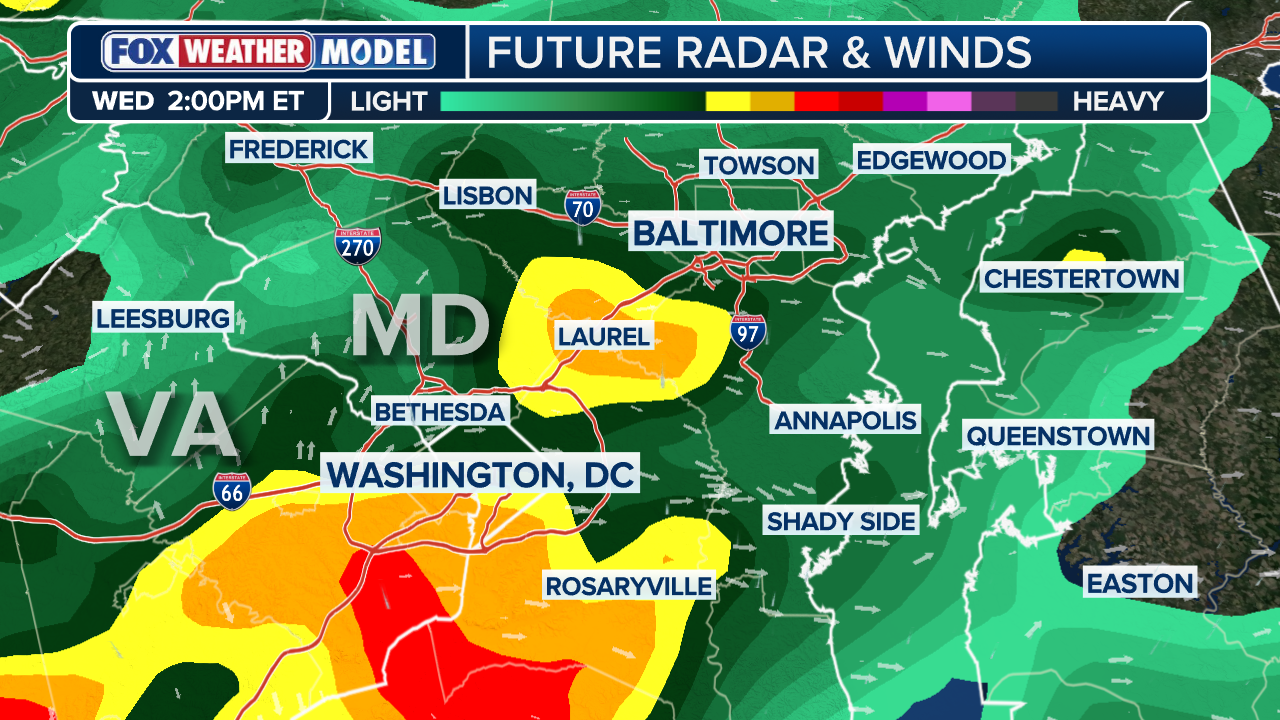
There was a Severe Thunderstorm Watch in effect for parts of Virginia. The FOX Forecast Center said tornadoes were a possibility, with wind gusts possibly reaching over 65 mph.

(FOX Weather)
KNOW YOUR FLOOD TERMINOLOGY: WHAT FLOOD WATCHES, WARNINGS AND EMERGENCIES REALLY MEAN
Already saturated soils cannot absorb much more rain, so even a smaller thunderstorm or downpour could increase the flash flood threat through the afternoon.
Extending northward, a bigger threat arose in the Ohio Valley, where Flood Watches remain in effect through the afternoon for areas including Columbus, Ohio; Cinncinati and Charleston, West Virginia.
(FOX Weather)
This is where an area of low pressure and its extended warm front will be slow to move. As heavy rain pivots along this front, persistent storms will increase the risk of flash flooding. This was a Level 2 flash flood threat issued.
Localized rain totals reached 1 to 2 inches or more throughout the day before high pressure to the north pushes the precipitation out of the region.
HOW HIGH PRESSURE AND LOW PRESSURE DRIVE THE WEATHER
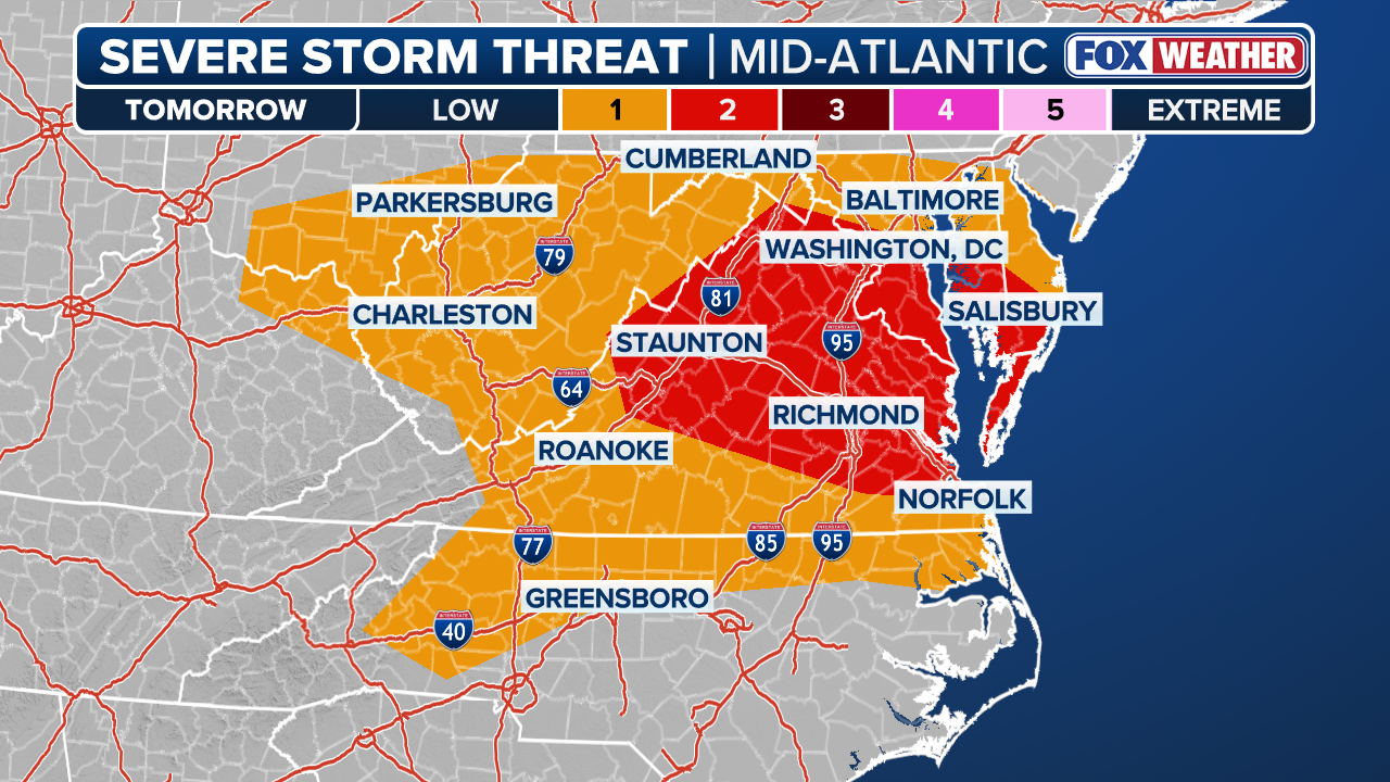
Farther east, as more sunshine breaks out, severe storms could erupt, mainly across the Mid-Atlantic.
(FOX Weather)
This is where a Level 2 out of 5 severe storm risk is in place, including major cities such as Washington, D.C., Richmond and Norfolk, Virginia. Storms that developed in the afternoon were capable of producing damaging wind gusts.
As high pressure builds across the Great Lakes, portions of the Mid-Atlantic and Ohio Valley started to dry out into Thursday and Friday.
Meanwhile, rain will continue to increase the flood risk across the Southeast into late this week.