

Taste of fall sweeps across the Midwest as severe storms, damaging winds and flooding threaten millions
This comes as stronger temperature gradients fuel a stronger and more southerly jet stream, bringing more fall-like air across the North along with periods of storms and rain.
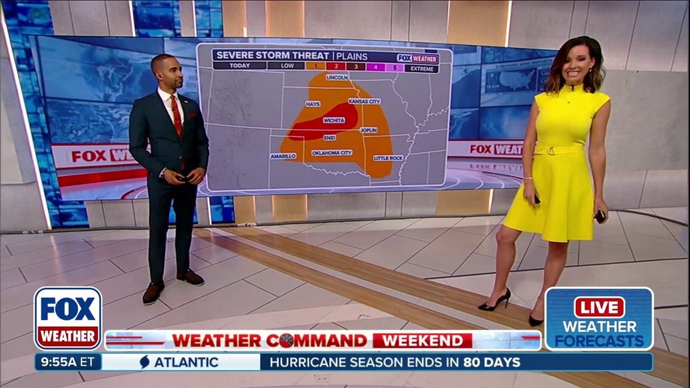
Severe storm threat firing up for the Plains, Midwest this weekend
A level 2 out of 5 severe storm threat is in effect Saturday for parts of the Midwest, stretching across a large section of Kansas and parts of the Oklahoma Panhandle. Damaging hail and gusty winds will be the primary threats with these storms.
THE TAKEAWAY:
- Severe storms and flash flooding will impact the Upper Midwest and Central Plains through the weekend.
- Large hail, damaging winds and heavy rain are all primary concerns of these storms.
- A Level 2 out of 5 is in place across parts of Kansas and Oklahoma on Saturday.
As fall weather approaches, severe storms and flash flooding are impacting the Upper Midwest and Northern Plains through the weekend, bringing damaging winds, large hail and heavy rainfall to millions of people.
SEVERAL DAYS OF HEAVY RAIN AND THUNDERSTORMS TO PERSIST ACROSS THE GULF COAST
This comes as stronger temperature gradients fuel a stronger and more southerly jet stream, bringing more fall-like air across the North along with periods of storms and rain.
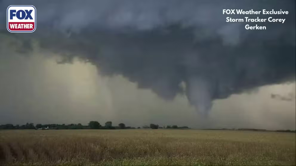
Severe storms fire up tornado in Minnesota
Severe storms were firing up across the Midwest on Friday night. FOX Weather Exclusive Storm Tracker Corey Gerken captured incredible video of a crazy-looking tornado in Minnesota.
Severe storms rolled through northern portions of the Upper Midwest on Friday, which was the first blast of stormy weather for the region which will last into the middle of next week, according to the FOX Forecast Center.
A Level 2 out of 5 severe storm threat is in place across Kansas and the Oklahoma Panhandle on Saturday.
NEVER-ENDING HEAT DOME TARGETS PLAINS AS NEARLY 45 MILLION AMERICANS FACE HEAT ADVISORIES
The FOX Forecast Center notes that once the front moves through, another system will quickly arrive on Sunday into Monday.

(FOX Weather)
This system will move through similar areas of the Plains and Midwest on Sunday, as a low-pressure system intensifies across Canada and its associated cold front pushes southeast.
Severe storms will once again become a risk, with a Level 1 out of 5 threat issued across Nebraska, Iowa, southern Minnesota and Wisconsin.
Warmer, moisture-rich air will fuel thunderstorms capable of producing several inches of rain.

(FOX Weather)
A Level 2 out of 4 flash flood threat has been issued across eastern Kansas into western Missouri for Saturday, before shifting northeast into Iowa and southern Minnesota on Sunday.
By Monday, the flash flood threat will shift to northern Wisconsin.

(FOX Weather)
The heaviest rainfall is expected Tuesday, when 2 to 3 inches of rain will be possible from Wisconsin through Iowa, eastern Kansas and northern Missouri, with localized amounts of 3 to 5 inches possible.
Multiple rounds of heavy rain could also lead to localized flash flooding into early next week.

FILE PHOTO: Thunderstorms loom over Lynnville, Iowa, on Wednesday, June 10, 2025.
(Heather / FOX Weather)
However, the flash flooding threat will be greatest where the front stalls across portions of the Plains.
Stay with FOX Weather for the latest.