Fall predicted to be warmer, drier than average across majority of US
The forecast for autumn isn't promising for those looking for relief from the heat and widespread drought across the nation.
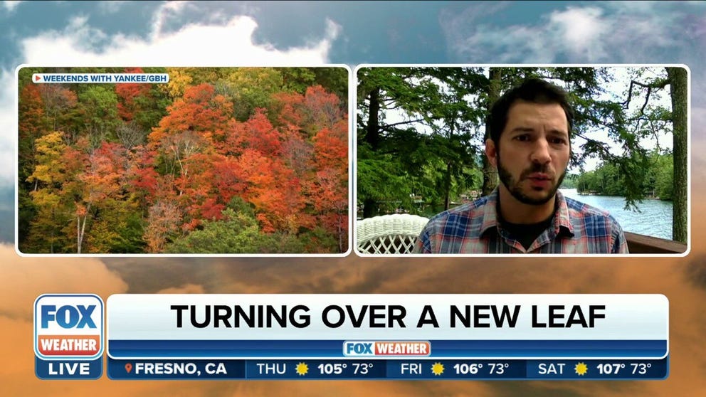
How does weather impact fall foliage?
Foliage expert Jim Salge on where in the U.S. fall will show off its colors
September marks the beginning of meteorological fall, but despite what the calendar shows, cool temperatures might be difficult to find over the next three months.
The National Oceanic and Atmospheric Administration's Climate Prediction Center released its outlook for September through November on Thursday, and the forecast isn't promising for those looking for relief from the heat and widespread drought across the U.S.
Meteorologists and climatologists divide the seasons into three-month periods based on the temperatures that would be expected during each season. Meteorological summer, the hottest three-month period, runs from June 1 to Aug. 31, and that's followed by meteorological fall from Sept. 1 to Nov. 30.
HOW TO WATCH FOX WEATHER ON TV
Fall temperature outlook
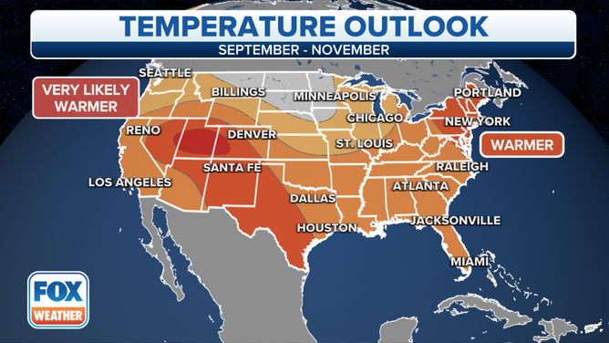
NOAA's temperature outlook for meteorological fall (September through November).
(FOX Weather)
According to NOAA, above-average temperatures are predicted for a majority of the nation this fall. The warmest temperatures relative to average are forecast to be in Utah, Colorado and parts of eastern and southeastern New England.
Well-above-average temperatures are also expected across much of the Northeast and coastal mid-Atlantic, as well as from the central and southern Rockies into West Texas.
While not as far above average, temperatures are still predicted to be warmer than average in most of the rest of the Lower 48.
WHY FALL SHOULD ACTUALLY BEGIN ON SEPTEMBER 1
No areas are expected to be cooler than average this fall, but near-average temperatures are forecast along the northern tier from Washington state into the northern Rockies and northern Plains.
It's important to note that this is an outlook for a three-month period. An upper-level area of high pressure or a cold front can provide a period of warmer or cooler weather, respectively, that bucks the overall three-month trend.
Fall precipitation outlook
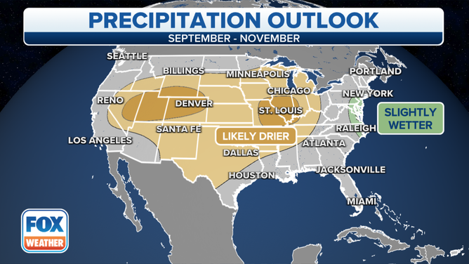
NOAA's precipitation outlook for meteorological fall (September through November).
(FOX Weather)
About 49% of the U.S. was experiencing drought conditions as of Thursday, according to the latest U.S. Drought Monitor. NOAA's precipitation outlook for the next three months doesn't look very promising to help alleviate it.
Drier-than-average conditions are predicted across much of the country, from the Rockies to the Appalachians, which means rain and/or snow will likely be hard to come by between September and November.
The most favored areas for below-average precipitation include parts of the lower Ohio and mid-Mississippi valleys and the central Rockies.
FIRST GLIMPSE OF FALL FOLIAGE PREDICTIONS FOR THE 2022 SEASON
Portions of the mid-Atlantic coastline might see a wetter-than-average fall, but the drought is most concentrated over the central and western U.S., where conditions are expected to be dry.
Near-average amounts of rain and/or snow are forecast along much of the West, East and Gulf coasts, as well as across the northern tier.