

Fall cold front to bring cooler temperatures, rain and storms across northern US into mid-September
A Level 2 out of 5 severe storm threat is in place for Friday afternoon across the Northern Plains and Upper Midwest, including major cities from Omaha to Minneapolis.
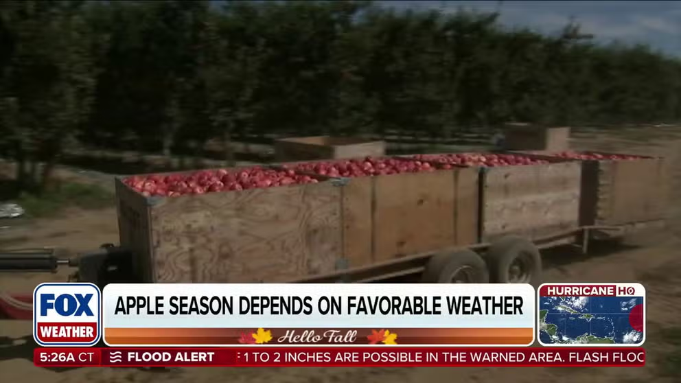
FILE: Apple picking season is dependent on good fall weather
Hard freezes, strong winds and hail can impact the fall's peak apple picking season. Kenny Bowman is the co-owner of Bowman Orchards in Rexford, New York, and talks about some of the things that come with running an orchard and all they have to offer.
THE TAKEAWAY
- Fall-like temperatures will push into the Northern Tier next week.
- Multiple storm systems could bring rain and severe weather from Friday into early next week.
- Warmer-than-average temperatures will persist across the Heartland and Southeast into mid-September.
September marks the transition from summer to fall, and a classic cold front will help cement the shifting of seasons, bringing cooler temperatures and scattered showers as summer gradually gives way to the chillier months ahead.
RECORD-WARM GULF WATERS COULD FUEL LATE-SEASON TROPICAL ACTIVITY DESPITE EL NIÑO SUPPRESSION
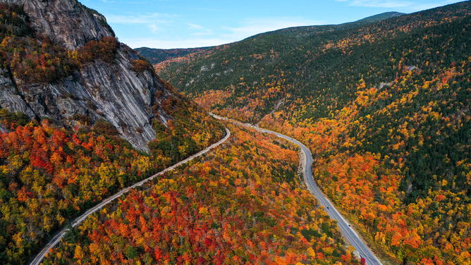
Scenic Railroad is seen during colorful fall foliage in New Hampshire, United States.
(Tayfun Coskun/Anadolu Agency via Getty Images / Getty Images)
Intrusions of fall-like air across the northern U.S. will arrive alongside periods of rain and thunderstorms. By mid-September, the pattern could take on a more widespread autumn feel, as strengthening temperature gradients help fuel a stronger, more southerly jet stream.
Fall fronts fuel severe weather, flood threat
Over the next week, several fall fronts will move across the Northern Tier of the U.S.
The first storm will develop Friday, pulling warm, humid air northward and increasing instability, bringing the ingredients that will fuel a recipe for severe weather.
RECORD-WARM GULF WATERS COULD FUEL LATE-SEASON TROPICAL ACTIVITY DESPITE EL NIÑO SUPPRESSION
A Level 2 out of 5 severe storm threat is in place for Friday afternoon across the Northern Plains and Upper Midwest, including major cities from Omaha to Minneapolis, with damaging winds and hail serving as the primary threats.
 Severe Storm Threat set up by sweeping cold front.
(FOX Weather)
Hot on the heels of Friday’s storm, another system could extend the severe weather threat into Sunday and Monday. Low pressure is expected to intensify across Canada as its associated cold front pushes southeastward through the same general areas.
Ahead of the front, warmer, moisture-rich air will fuel thunderstorms capable of producing several inches of rain.
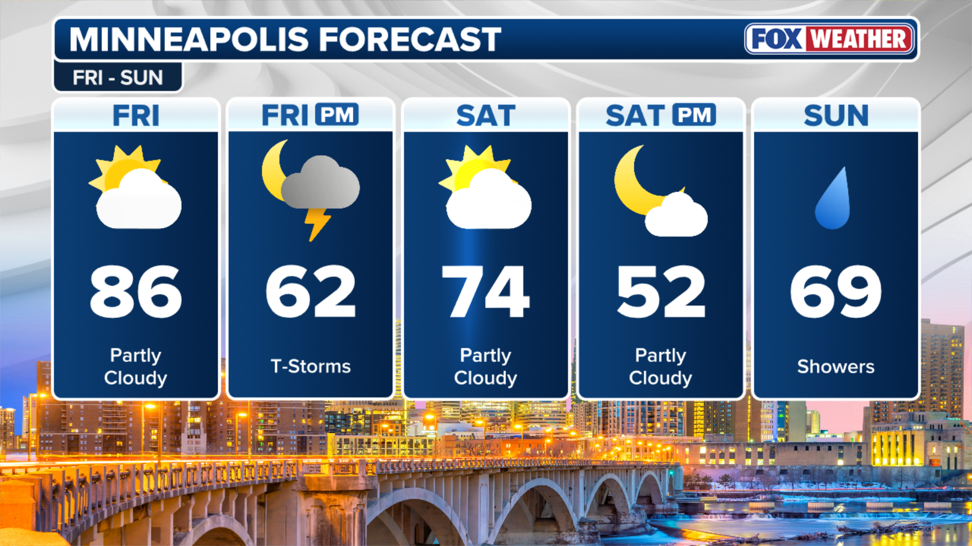 Minneapolis Three Day Forecast.
(FOX Weather)
Through Tuesday, widespread rainfall totals of 2 to 3 inches will be possible from Wisconsin through Iowa, eastern Kansas and northern Missouri, with localized amounts of 3 to 5 inches possible.
Multiple rounds of heavy rain could also lead to localized flash flooding into early next week, with flash flooding likely, especially where the front will stall out across portions of the Plains.
7 FACTS YOU SHOULD KNOW ABOUT FLASH FLOODS
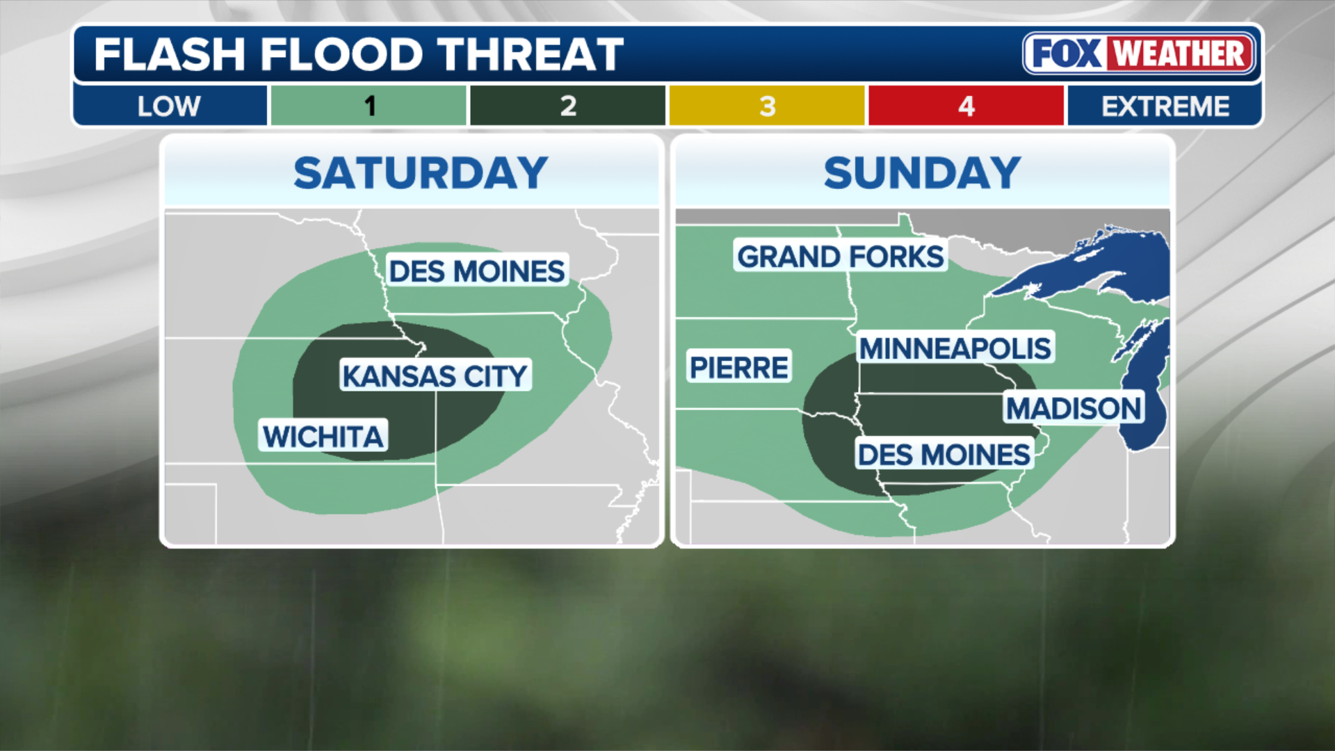 Weekend Flood Threat.
(FOX Weather)
A Level 2 out of 4 flash flood threat exists across eastern Kansas into western Missouri for Saturday and shifts northeast into Iowa and southern Minnesota for Sunday.
SURFER RECOUNTS TERRIFYING ENCOUNTER WITH MASSIVE, AGGRESSIVE TIGER SHARK IN HAWAII
Seasons change, temperatures shift
Leaf-peeping, pumpkin picking and Thanksgiving are textbook signs of fall, but nothing signals the seasonal shift quite like cooler temperatures, and they’re on the way.
Cooler air currently bottled up across Canada will surge southward early next week, sending temperatures across the Pacific Northwest and Rockies plunging 10 to 15 degrees below average.
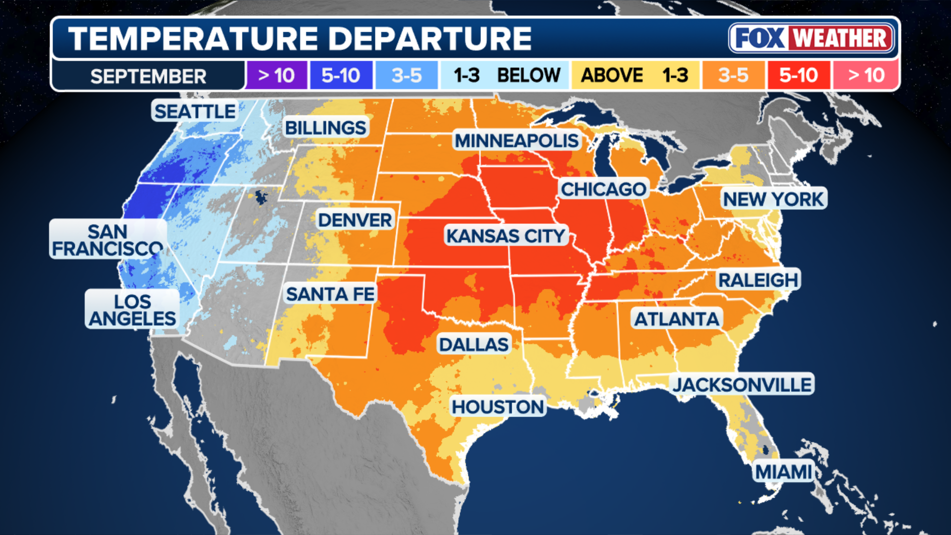 September Temperature Departure.
(FOX Weather)
These chillier conditions are not unusual for the region, with the first freeze across the higher elevations of the Northern Rockies typically occurring in early to mid-September.
With cooler air in the forecast, light snow could dust the higher elevations of the Rockies next week, the FOX Forecast Center said.
MILLIONS IN THE CENTRAL US EXPECTED TO CONTINUE SIZZLING IN LATE-SUMMER RECORD HEAT THROUGH FRIDAY
As cooler air settles across the Northwest, the high pressure system responsible for the extreme heat in the Central Plains will shift eastward, keeping temperatures warmer than average across the Heartland and Southeast into the middle and latter parts of September.
 Temperature Outlook.
(FOX Weather)
More than two dozen locations in these regions have already recorded their warmest start to September on record.
Forecasts reflect this pattern change, with much of the Northern Tier expected to remain below average through mid-month while warmer-than-average temperatures persist across the Southeast.