

Millions in path of violent tornadoes, flash flooding across the Midwest
The FOX Forecast Center said intense tornadoes and damaging winds are the biggest risk Wednesday across the Midwest.
Violent tornadoes and flash flooding fuel extreme risk zone across the Midwest
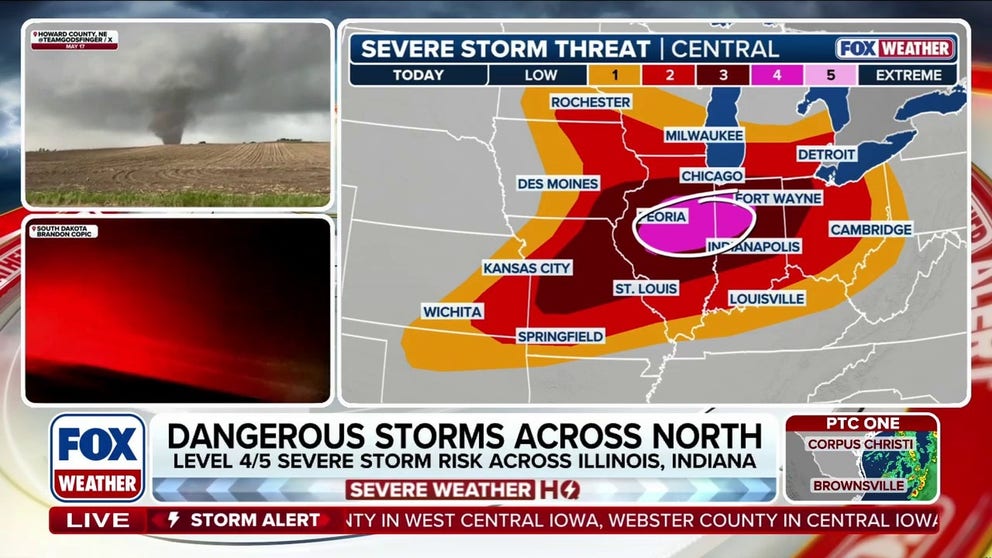
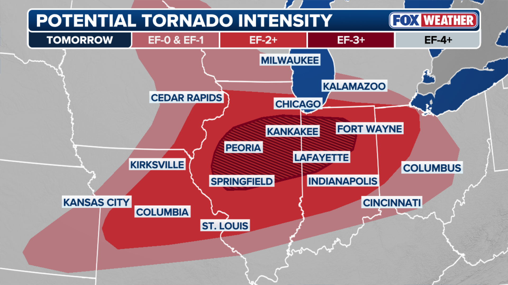
Millions are at an extreme risk across the Midwest as a dangerous severe weather outbreak looms Wednesday, capable of producing intense, long-track tornadoes (EF3+) and destructive winds. A Level 4 out of 5 risk has been issued for parts of the region. FOX Weather Meteorologist Craig Herrera breaks down the full forecast and increased hazards:
Just on the heels of last week’s severe weather outbreak across the Midwest, the threat of additional severe storms increased.
It comes just days after tornadoes, damaging winds and large hail battered many of these same areas.
The FOX Forecast Center issued an Extreme Risk for Wednesday just south of Chicago for portions of northern Illinois and northwestern Indiana for the risk of flash flooding and strong tornadoes.
SEE IT: FIREFIGHTERS USE RESCUE BOATS TO SAVE 15 CAMPERS STRANDED IN FAST-RISING FLOODWATERS
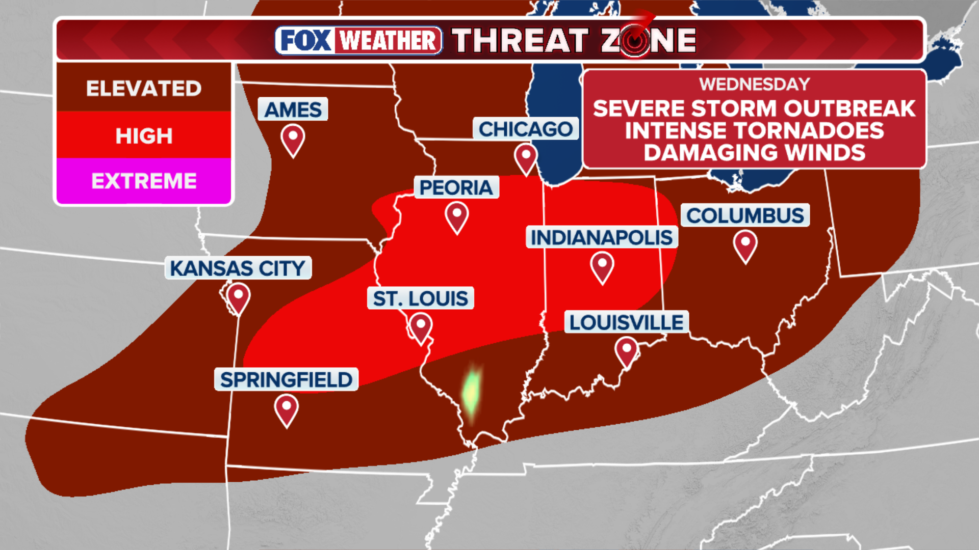
(FOX Weather)
Last week, a severe system unleashed dozens of tornadoes ranging from EF-0 to EF-3 across the region.
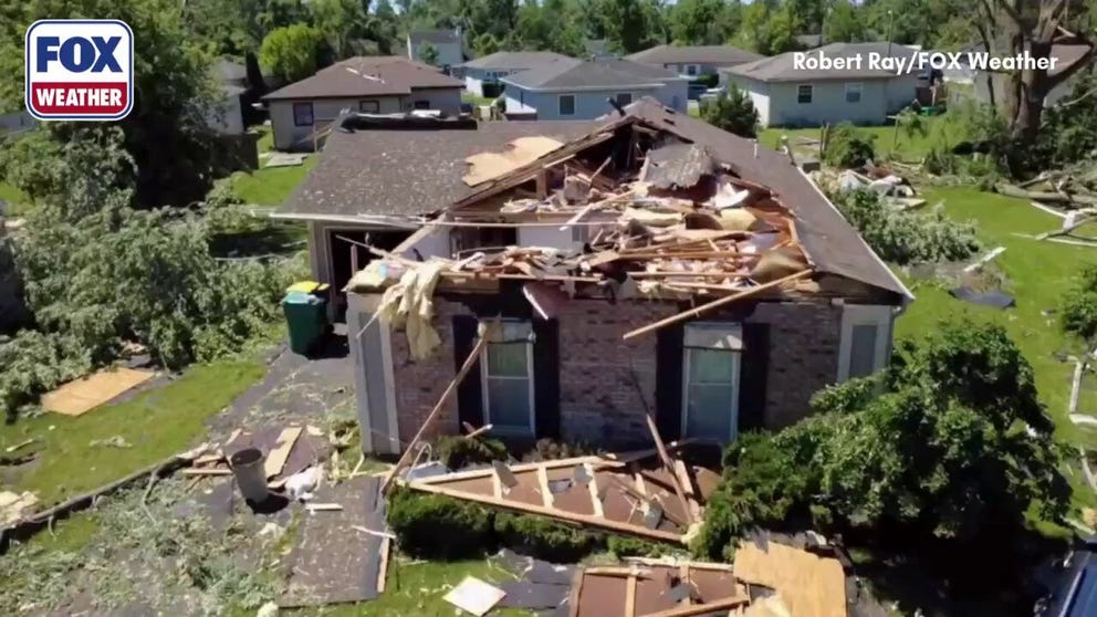
FILE: Extensive damage reported in Merrillville, Indiana after tornado
The city of Merrillville, Indiana, saw extensive destruction from a tornado that tore through the area on Thursday night. The National Weather Service was out surveying the area this afternoon to rate the tornado.
Accompanied by destructive straight-line winds, the storms left communities with catastrophic damage, destroying homes, toppling trees and downing power lines that knocked out electricity to thousands of residents.
WIDESPREAD DESTRUCTION: TORNADOES CAUSE CATASTROPHIC DAMAGE IN ILLINOIS AND INDIANA COMMUNITIES
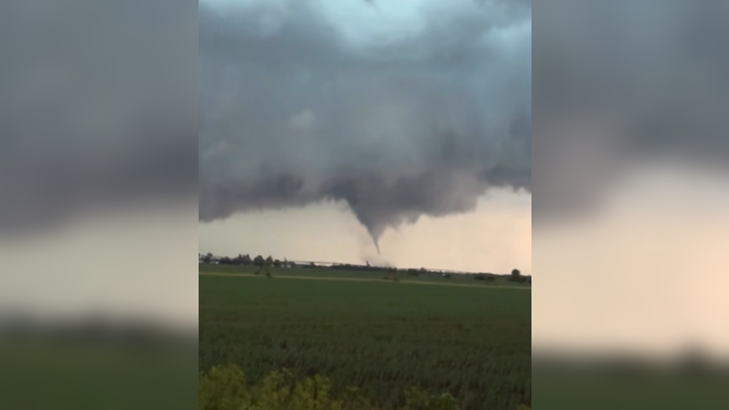
![Tornado in Lake County, Indiana near Interstate 65, north of the Kankakee River.]() Image 1 of 8
Image 1 of 8Tornado in Lake County, Indiana near Interstate 65, north of the Kankakee River. (Indiana State Police-Lowell Post/Facebook)
![]() Image 2 of 8
Image 2 of 8Tornado causes extensive damage in Streaton, Illinois. (Nemo Granados)
![]() Image 3 of 8
Image 3 of 8Damage reported in Streaton, Illinois, after a destructive tornado sweeps though the area. (Nemo Granados)
![Line of thunderstorms approaches Dwight, Illinois, Wednesday, June 10, 2026.]() Image 4 of 8
Image 4 of 8Line of thunderstorms approaches Dwight, Illinois, Wednesday, June 10, 2026. (Travis Lanham)
![]() Image 5 of 8
Image 5 of 8Trees down in Joilet, IL after severe thunderstorms. (@JolietWeather/X)
![]() Image 6 of 8
Image 6 of 8Downed trees blocking roads in Joilet, IL. (@JolietWeather/X)
![]() Image 7 of 8
Image 7 of 8Multiple road hazards across the city in Joliet, IL, currently being caused by trees & wires down due to severe storms. (@JolietWeather/X)
![]() Image 8 of 8
Image 8 of 8Countless trees down across the west side of Joliet, IL after severe weather impacted the city. (@JolietWeather/X)
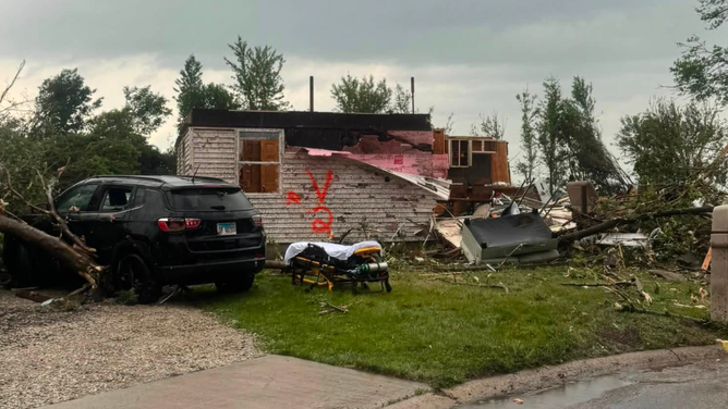
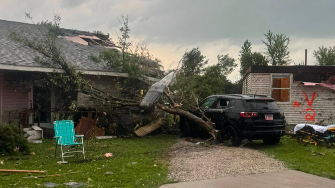
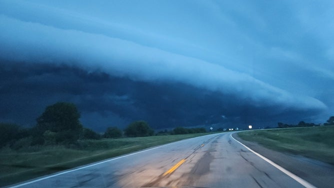
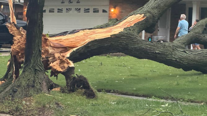
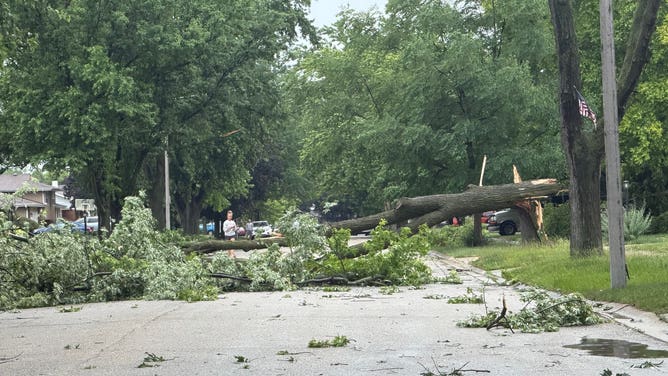
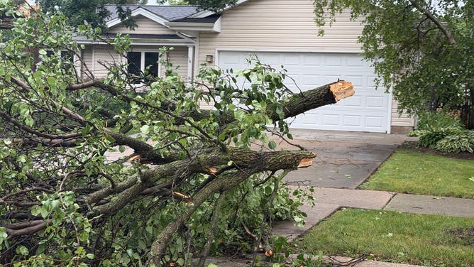
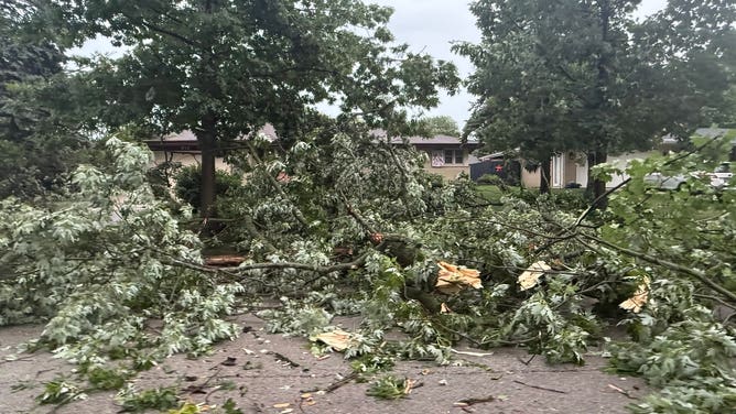
These hard-hit communities have faced a relentless onslaught since the severe season kicked off in March.
WATCH: HEAVY RAIN TRIGGERS DANGEROUS FLASH FLOODING ACROSS TEXAS, PROMPTING MULTIPLE WATER RESCUES
In fact, Illinois has been one of the hardest-hit states this year, leading the nation in tornado reports.
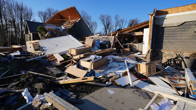
Photos from the ground in Aroma Park, Illinois, on March 12 capture the devastating destruction in Kankakee County after a tornado ripped through March 10
(FOX Weather Correspondent Katie Byrne )
A dangerous day of severe weather arrived as a stronger low-pressure system tracks from the Midwest into the Great Lakes on Wednesday.
The Storm Prediction Center issued a Level 4 out of 5 severe storm threat for across north-central Illinois and western Indiana.
DESTRUCTIVE DERECHO SLAMS MIDWEST WITH INTENSE WINDS, KNOCKING OUT POWER TO OVER 500K HOUSEHOLDS
Along with that, a Level 3 out of 5 risk spanned from Kansas City to St. Louis and northward into Chicago, while a broader Level 2 out of 5 risk blanketed a wider zone from Kansas to Louisville, Indianapolis and Columbus.
(FOX Weather)
There were two distinct rounds of severe storms: one in the morning to afternoon hours bringing damaging winds and large hail — up to 2.5 inches in diameter—followed by a second round as atmospheric conditions rapidly destabilized in the afternoon.
MAN KILLED BY FALLING TREE IN DES MOINES, IOWA, DURING SEVERE WEATHER OUTBREAK
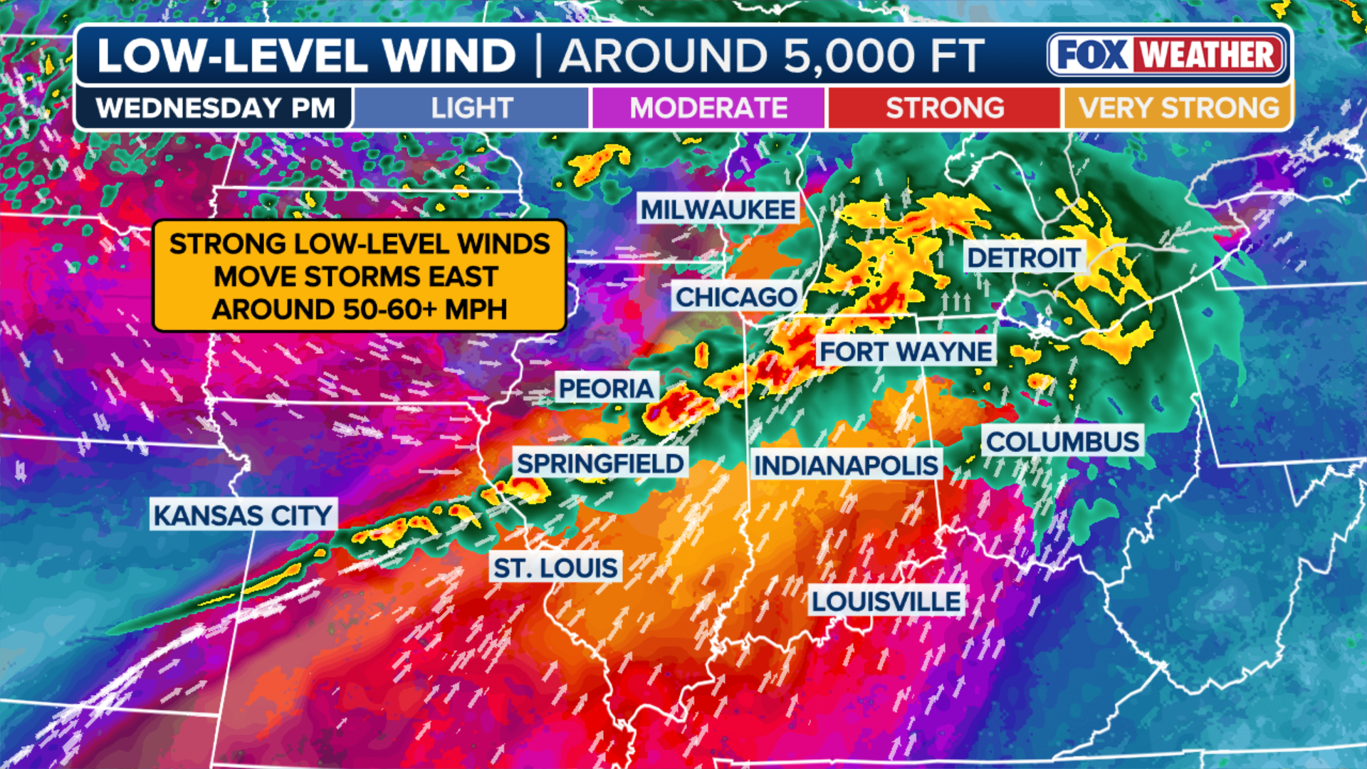
Through the evening hours, these storms developed into an intense line of severe storms, bringing a widespread threat of destructive, straight-line winds upwards of 75 mph across the region.
(FOX Weather)
The FOX Forecast Center said a powerful low-level jet stream caused storms to move rapidly as they developed, meaning dangerous weather impacted areas quickly—just in time for the evening commute.
(FOX Weather)
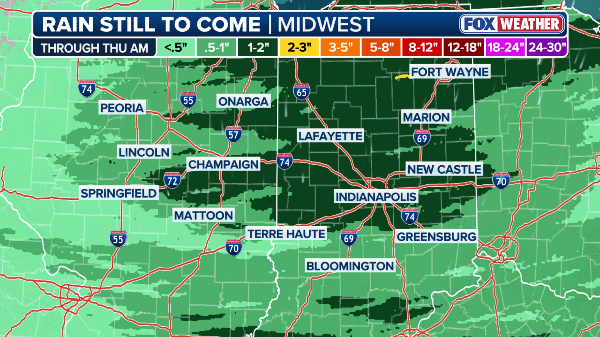
Additionally, with heavy rain falling over many of the same areas, a Level 3 out of 4 flash flood risk was in effect, along with Flood Watches in place from northern Illinois into southern Michigan.