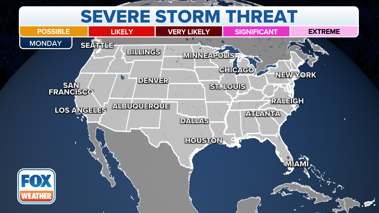
Cold front triggers threats of severe storms, flash flooding from Texas to western New York on Monday
Repeated rounds of heavy rain could impact areas from South and East Texas to the lower Mississippi Valley
Thunderstorms stretching from TX to Great Lakes could produce hail, damaging winds
Occasional strong to severe thunderstorms may produce isolated damaging winds along this entire stretch. Some hail is also possible.
A cold front stretching from Texas to western New York on this final Monday of April will trigger showers and thunderstorms packing threats of damaging winds and flooding rain.
The severe weather threat should remain isolated, but there could be an occasional strong to severe storm with gusty winds anywhere from parts of the Southern Plains to the lower Mississippi, Tennessee and Ohio valleys and western New York. Some hail is also possible in these regions.
(FOX Weather)
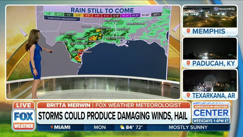
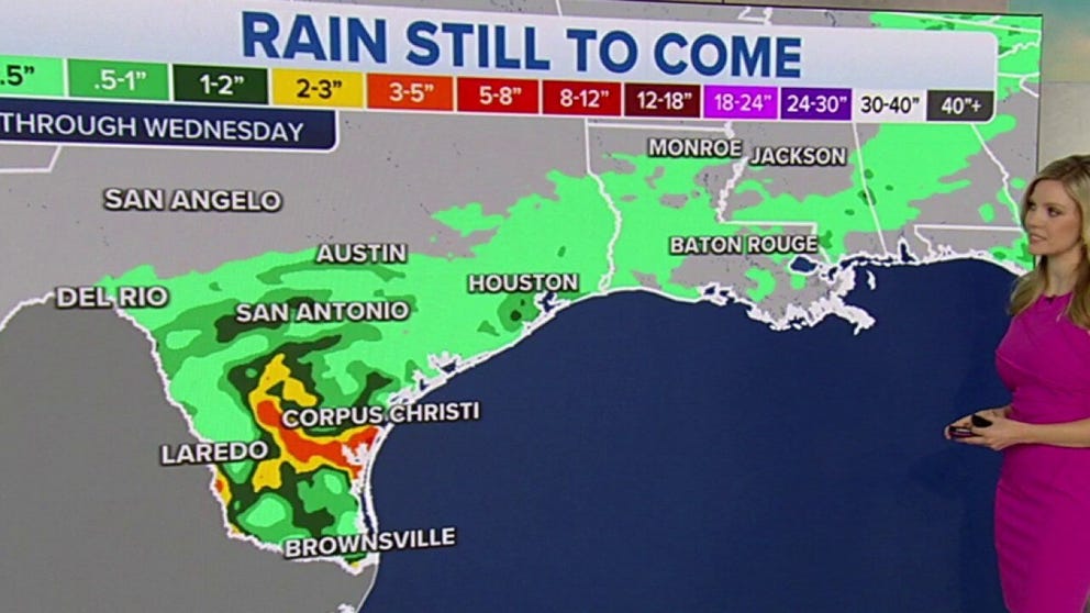
There is also the potential for repeated rounds of heavy rain to impact locations from South and East Texas to the lower Mississippi Valley.
This might lead to isolated flash flooding, particularly in urban and poor-drainage areas, but the bulk of the heavy rainfall is expected to target regions experiencing severe to exceptional drought, so widespread flooding is not expected.
HOW TO WATCH FOX WEATHER ON TV

(FOX Weather)
By Tuesday, the cold front will gradually slide south and eastward toward the East Coast and the northern Gulf of Mexico.
Isolated storms could deliver beneficial rain to South Texas
Parts of Texas that are experiencing drought conditions may pick up several inches of rain through Wednesday.
The threat of isolated flash flooding will continue across South Texas, with a few severe thunderstorms possible across parts of central and eastern North Carolina into southeast Virginia.

(FOX Weather)