Track Canada wildfires smoke map forecasts and air quality data
Here are several maps to keep tabs on the smoke, where it's going and its air quality impacts as it blankets millions of Americans.
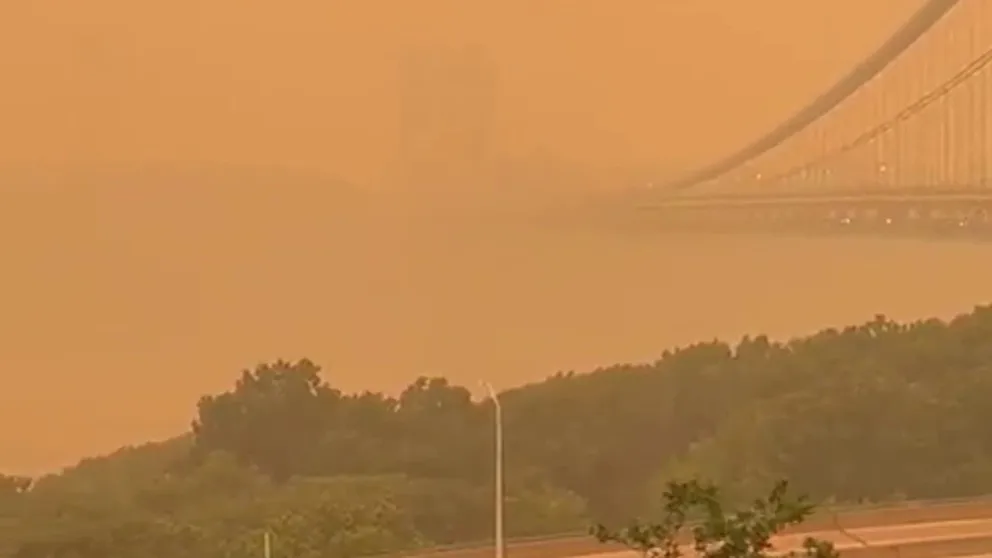
Smoke-filled skies over New York
Hazardous air quality readings reported over the New York tri-state area.
Wildfire smoke continues to pour out of Quebec and eastern Canada into the Northeast, mid-Atlantic and Great Lakes regions.
Here are several maps to keep tabs on the smoke, where it's going and its air quality impacts as it blankets millions of Americans.
Where is the Canada wildfire smoke now?
Current satellite imagery of wildfire smoke:

(FOX Weather)
Where is the Canada wildfire smoke going?
3-hour Canada wildfire smoke forecast:
(FOX Weather)
6-hour Canada wildfire smoke forecast:

(FOX Weather)
12-hour Canada wildfire smoke forecast:

(FOX Weather)
24hour Canada wildfire smoke forecast:

(FOX Weather)
Current air quality across the Northeast:
(FOX Weather)
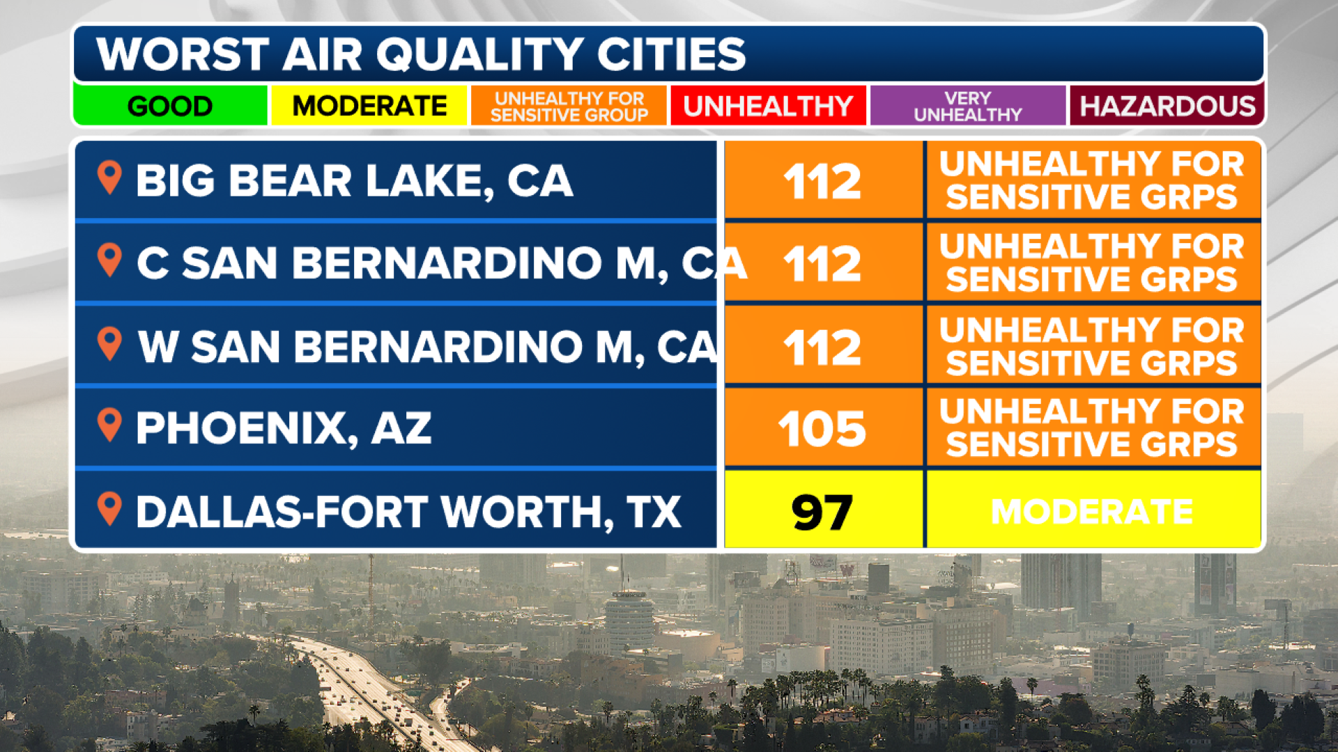
Top-5 worst air quality readings in the US right now:

(FOX Weather)
Current Visibility Readings Amid Smoky Skies:

(FOX Weather)