Bryan Norcross: Tropical Storm Lee is likely to become a powerful hurricane
Lee is just getting organized, but it will move into an area of exceptionally warm water and an atmospheric pattern that’s extremely conducive for development of an intense hurricane when it’s near the islands in a few days.
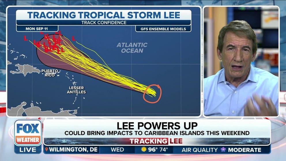
Bryan Norcross: Tropical Storm Lee to become very strong hurricane
FOX Weather Hurricane Specialist Bryan Norcross explains what forecasters are looking at for Tropical Storm Lee's cone and track. Lee is forecast to become a major hurricane in the coming days.
UPDATED Wednesday at 9 a.m. ET
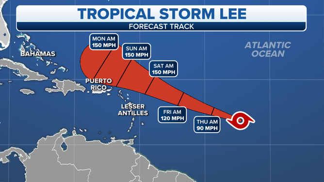
Tropical Storm Lee is barreling through the tropical Atlantic with a scary-looking cone. Even though the end of the cone is rounded, it’s easy to imagine it as an arrow pointing in the direction that the storm could go. In the case of Lee, it seems to be aimed at Florida or the Southeast.
However, soon-to-become-Hurricane Lee is NOT likely to be a direct threat to Florida, Georgia, or South Carolina. The storm will generate very high surf with powerful, dangerous waves, which could do damage along the coast, but the powerful winds should stay well offshore of the Bahamas and the Southeast U.S.
Still, impacts from North Carolina to New England along the East Coast are still an open question. Although most computer forecasts keep Lee well offshore, enough show a track close enough to the coast that everybody along or near the Mid-Atlantic and Northeast coast should plan to stay aware of future forecasts through next week.
Tropical Storm Lee cone.
(FOX Weather)
Lee is just getting organized, but it will move into an area of exceptionally warm water and an atmospheric pattern that’s extremely conducive for development of an intense hurricane when it’s near the islands in a few days. The National Hurricane Center is forecasting Lee to intensify into a high-end Category 4 hurricane, and their forecast is below some computer projections.
There is a strong consensus among the various computer forecasts that Hurricane Lee will track far enough north of Puerto Rico, so the islands only get a fringe effect. In their advisories, however, the National Hurricane Center reminds us that average errors in forecasts 4 or 5 days in advance are significant – errors reflected in the width of the cone. So while significant impacts are not expected, they also can’t totally be ruled out.
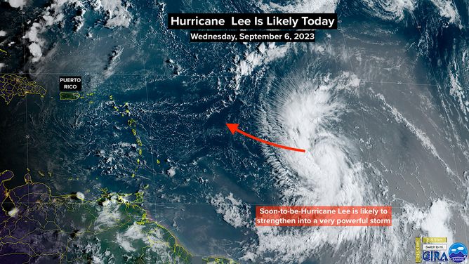
NOAA Satellite view of Lee.
The bigger question marks in Lee’s future track come after the 5-day cone. The steering currents are forecast to weaken when powerful Hurricane Lee is east of the Bahamas. When the storm starts to move north in earnest mid to late next week, the exact angle the system will take is an open question.
Lee will likely have increased in size a week from now, so a direct hit isn’t required for significant coastal impacts to occur. Everybody along the coast from North Carolina to Maine and into Atlantic Canada will have to monitor the situation next week.
On the far side of the Atlantic, Tropical Disturbance #1 (officially Invest #96L) has not yet organized. The system will affect the Cabo Verde Islands today as it moves toward the northwest. It still has a decent chance to organize into a tropical depression or Tropical Storm Margot before it dies in the open ocean.
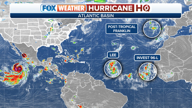
Atlantic tropical activity overview.
(FOX Weather)
Off the coast of Portugal, the system that was formerly Hurricane Franklin has a slight chance of developing into a tropical system once again. Even if that happens, it is not expected to have a significant impact on land.
Otherwise, we’ll watch for another system to move off Africa late tomorrow or Friday as we head to the day in the hurricane season when, on average, we are most likely to have an active named storm.