NHC's Jamie Rhome joins Bryan Norcross to answer questions on Hurricane Erin
In an hour-long live-stream hurricane Q&A on Tuesday, National Hurricane Center Deputy Director Jamie Rhome joined FOX Weather Hurricane Specialist Bryan Norcross to answer several questions from viewers about Hurricane Erin.
Hurricane Erin to expand and brush North Carolina and Virginia with strong winds
Tropical Storm Watches and Warnings have been issued for Virginia and North Carolina respectively. FOX Weather Hurricane Specialist Bryan Norcross has the latest expected impacts for the East Coast.
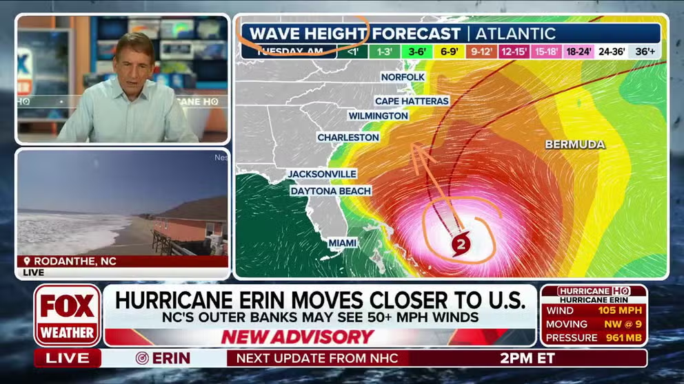
MIAMI - Hurricane Erin continues to pose a serious coastal threat to parts of the Carolinas and mid-Atlantic, as the cyclone churns several hundred miles off the coast.
In a more than hour-long live-stream hurricane Q&A on Tuesday, National Hurricane Center Deputy Director Jamie Rhome joined FOX Weather Hurricane Specialist Bryan Norcross to answer several questions from viewers about Hurricane Erin.
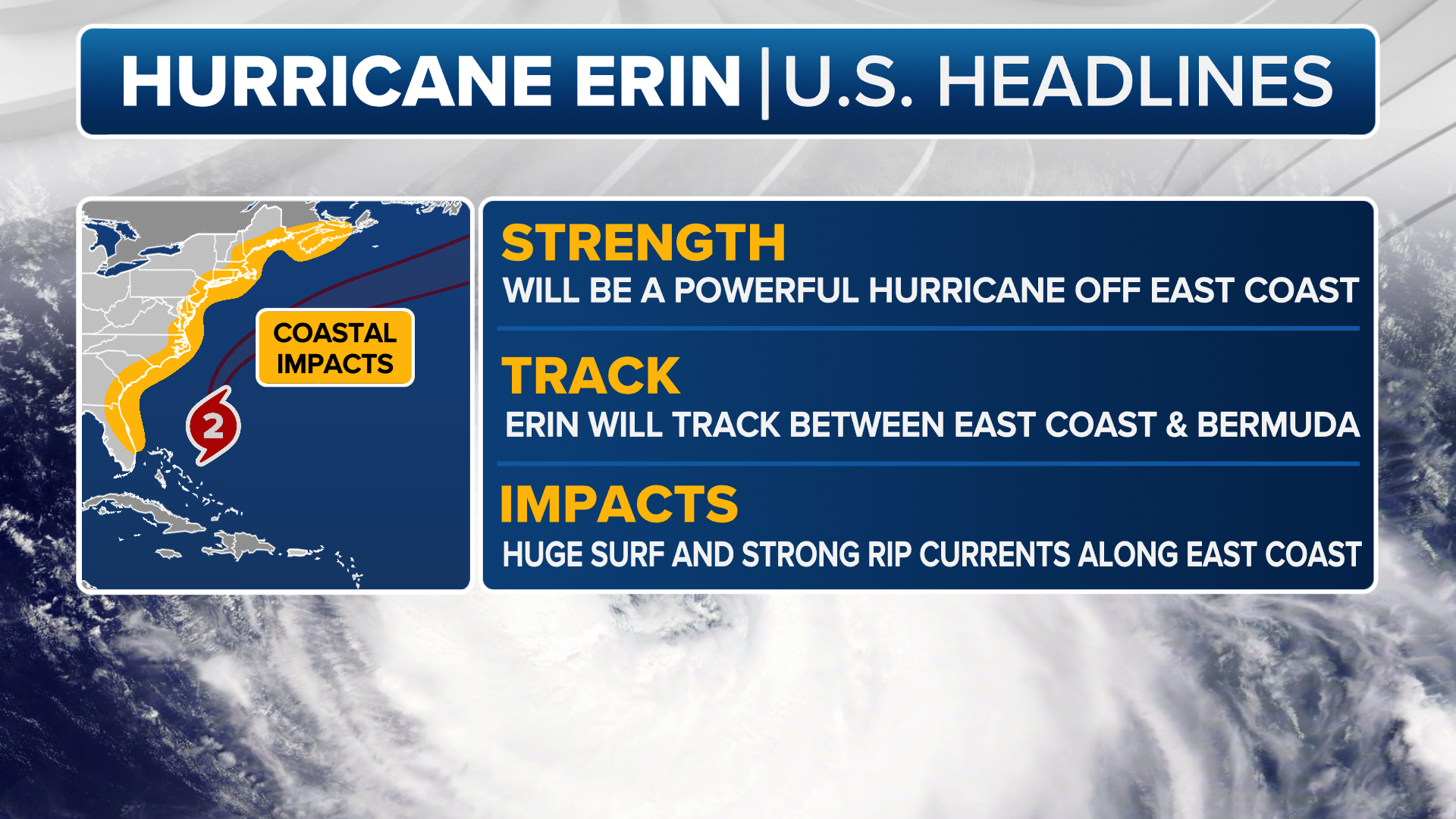
The hurricane experts also urged the public to focus on surge and surf, rather than the traditional impacts outlined by the Saffir-Simpson Hurricane Wind Scale.
"This is going to be a tricky storm," Rhome stated. "It’s going to [cause] big storm surge and coastal erosion and wave impacts along the Outer Banks and portions to the north as well."
(FOX Weather)
The NHC last estimated Erin’s maximum sustained winds to be at around 105 mph, making it a Category 2, though observations suggest that value may be on the high side.
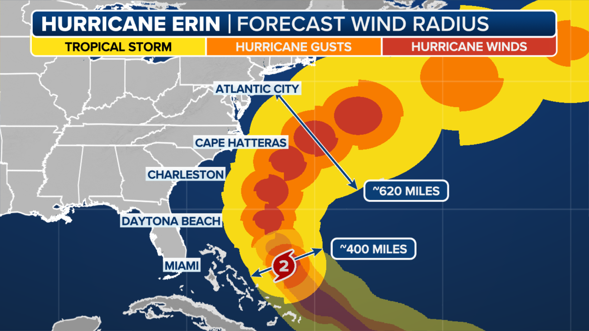
Rhome stressed that the Saffir-Simpson scale will not tell the full story on Erin as the cyclone’s vast size is likely to push water over vulnerable barrier islands along the North Carolina coast.
HURRICANE HUNTERS FLY INTO WORLD'S WORST WEATHER. SEE WHICH STORM WAS THE BUMPIEST
"They’re flooding today with the high tide right now," said Rhome. "The wind hasn’t even come up. The biggest of the waves haven’t even arrived and they’re already flooding in spots today."
In areas under a Storm Surge Warning from Cape Lookout to Duck, North Carolina, forecasters expected water levels to rise at least 3-4 feet above normal high tide.
Impacts will not be limited to North Carolina, as waves generated by Erin are radiating hundreds of miles from the center, reaching from Florida’s Treasure Coast to New England.
"It’s really a coastal event," said Norcross. "And it’s going to be felt a long way from where the center of Erin passes offshore."
Forecasters expect New Jersey, Long Island and much of New England to experience multiple high tide cycles of large waves later in the week.
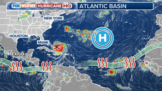
As Erin grows in size and pushes northward, it could also impact other disturbances meandering in the Atlantic.
(FOX Weather)
SCENIC HIGHWAY IN FLORIDA TO GET EXTRA PROTECTION FROM HURRICANES, EROSION
Other disturbances swirling behind Erin are not an immediate concern
The NHC is actively tracking two disturbances across the Atlantic basin, but neither Norcross nor Rhome believe they are an immediate threat to land.
"The more you stir up the ocean, the more likely you are to get to cool water in a wake. And indeed, the one that is not an invest that looks like it may eventually turn north, although the model's all over the place, and it might experience some of that cooler water, if it does indeed follow Erin," Norcross stated. "There's also really strong cold front coming down, a fall cold front, and a big dip in the jet stream coming down to the eastern part of the US, which is going to keep things away from the U.S. coast."
Both disturbances may face impediments such as cold fronts, dry air, a significant trough and the wake of cooler water left over by Hurricane Erin.
Tracking the tropics map
(FOX Weather)
"These long-range predictions or models that you see people throwing around recklessly on social media - there's no predictability. There is no predictability at all," Rhome stated about the chances of tropical development outside of Erin. "I mean, anybody who does this seriously for a living knows that. And knows that there's not much of a signal there."
For now, hurricane experts stress that residents from the Carolinas to New England should be paying attention and preparing for days of rough surf, dangerous rip currents, coastal flooding and erosion.