Bryan Norcross: Hurricane season keeps going with a new disturbance, Invest 92L, developing in the Atlantic
The strong consensus of the various computer forecasts is that the depression or possible-Sean will turn north into the open ocean and not be a threat to land. So if it gets named, it will just add to the 2023 hurricane season’s stats

FOX Weather is your Hurricane HQ, streaming free 24/7.
(FOX Weather)
Updated at 9:30 a.m. Sunday
A large tropical disturbance just off the coast of Africa is showing signs of organization. The National Hurricane Center has tagged it Invest 92L and given the system a high chance of developing over the next few days. It has a decent chance of becoming Tropical Storm Sean in its relatively short life.
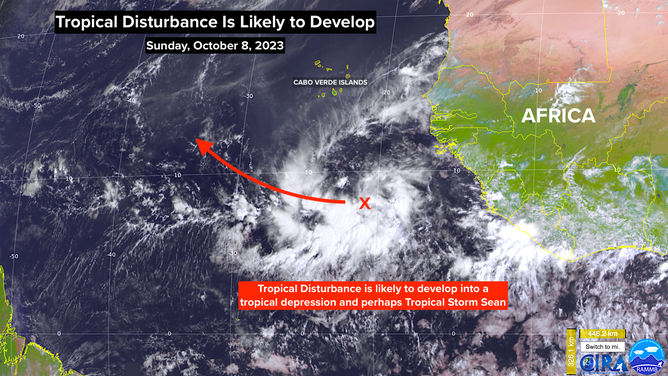
A satellite image of Invest 92L off the coast of Africa on Sunday, October 8, 2023.
The strong consensus of the various computer forecasts is that the depression or possible-Sean will turn north into the open ocean and not be a threat to land. So if it gets named, it will just add to the 2023 hurricane season’s stats.
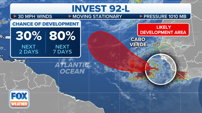
Invest 92L off the coast of Africa has a high chance of developing over the next week.
(FOX Weather)
The Pacific coast of Mexico is forecast to be impacted by a couple of storms this week. One just-developing system looks likely to make landfall north of Acapulco as a tropical storm tomorrow night. Meanwhile, soon-to-be Hurricane Lydia is heading toward the coast near Puerto Vallarta. Arrival time is forecast to be late Tuesday.
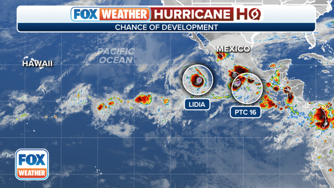
An overview of the tropical eastern Pacific Ocean.
(FOX Weather)
Both of these systems will dissipate over the tall Mexican mountains, but some of the moisture and a bit of one or both disturbances will be pulled across the Gulf. The upper-level winds are forecast to be totally hostile over the northern Gulf of Mexico for the foreseeable future, however, so no development is foreseen – based on what we know now.
The upper-level winds over the western Caribbean and the southern Gulf are fairly conducive for tropical development, but the atmosphere is very dry at the moment, and more dry air is forecast to move in. So there’s no indication of anything developing in that prime zone we watch through this week at least.