

Bryan Norcross: The last day for Subtropical Storm Josephine before it morphs into a non-tropical system
So the bottom line is that hurricane season is probably over, but there is still plenty of warm water and sometimes a pocket of conducive atmosphere can develop. It is almost certainly over for the U.S., however.
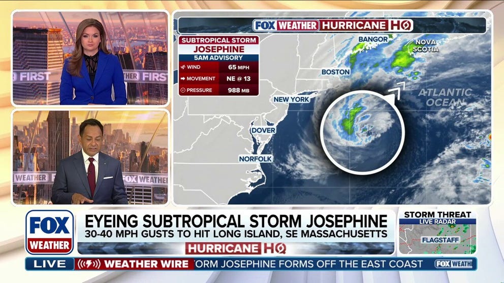
Subtropical Storm Josephine to race away from East Coast, lashing New England with strong wind gusts
Subtropical Storm Josephine is spinning less than 200 miles south of southern New England, lashing parts of the Massachusetts coast and eastern portions of New York's Long Island with strong wind gusts as it begins to accelerate away from the East Coast. Josephine blasted parts of the Carolina and Mid-Atlantic coasts earlier in the week with strong winds, coastal flooding and beach erosion as a strong nor'easter, before acquiring enough tropical characteristics in the warm waters off the Southeast to be named by the National Hurricane Center (NHC) on Wednesday.
Last updated at 10 a.m. on Thursday, Oct. 22, 2026.
The system that was the non-tropical nor'easter and yesterday morphed into Subtropical Storm Josephine is forecast to remorph into a non-tropical North Atlantic system late today or tonight.
Except for southeastern New England, winds are letting up along the East Coast, but large waves will continue to pound the shoreline, so overwash in vulnerable areas is still possible.
LATEST FROM FOX WEATHER HURRICANE SPECIALIST BRYAN NORCROSS
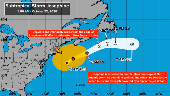
Subtropical Storm Josephine cone
(Bryan Norcross / FOX Weather)
The edge of Josephine's circulation will impact Cape Cod, Martha's Vineyard, Nantucket, and nearby areas of southeastern New England. Conditions should slowly improve today as the storm moves away.
Josephine took advantage of a short opportunity to become tropical at its core, while the rest of the system still had its non-tropical characteristics. Thus, it's called a subtropical storm.
SUPER EL NIÑO FUELED WINTER COULD UNLEASH MORE STORMS, DRIVING MORE ACTIVE PATTERN INTO THE SOUTH
By later today, it will run out of warm water, and a dip in the jet stream will energize it with non-tropical energy and propel it into the North Atlantic. The National Hurricane Center is forecasting non-tropical Josephine to reach hurricane strength as it races south of Atlantic Canada as a typical so-called extratropical storm.
Is hurricane season over?
Another robust non-tropical low-pressure system is forecast to form next week northeast of the Bahamas. There is no sign this system would take on tropical characteristics, even though it will be over warm water. It has strong steering currents behind it and extremely hostile upper-level winds blowing over it, which will be energizing the system.
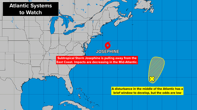
Atlantic Basin on Oct. 22, 2026.
(Bryan Norcross / FOX Weather)
Very strong jet stream winds are forecast to dominate the Gulf, the Caribbean and the Atlantic in a wintertime-type look.
So the bottom line is that hurricane season is probably over, but there is still plenty of warm water and sometimes a pocket of conducive atmosphere can develop. It is almost certainly over for the U.S., however.
As we have seen, non-tropical systems can produce major impacts along the coast. In this El Niño-driven year, we have to expect that more highly energetic non-tropical storms will form.
EYE OF THE SEASON: THE MOST NOTABLE ATLANTIC HURRICANES DURING EL NIÑO YEARS
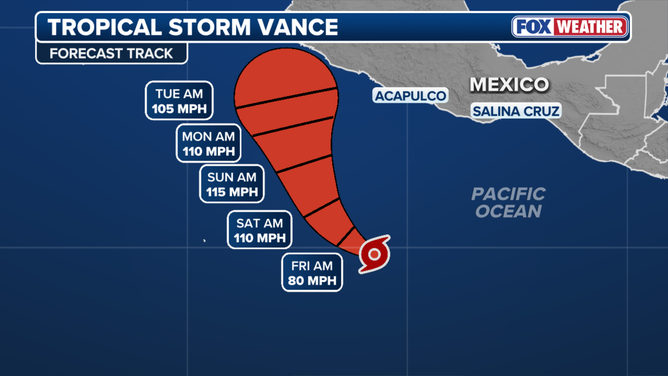
Tropical Storm Vance cone
(FOX Weather / FOX Weather)
In the Pacific
Tropical Storm Vance is forecast to quickly develop into a hurricane, and then a Category 3 hurricane as it tracks north offshore of Mexico. Next week, it will be close to or offshore of the coast in the general vicinity of Manzanillo. They will have to watch it.