Bryan Norcross: Hurricane alert for Florida’s Gulf Coast beginning Tuesday
The National Hurricane Center is forecasting Idalia to be a Category 1 hurricane when it approaches the Florida coast on Wednesday.

FOX Weather is your Hurricane HQ, streaming free 24/7.
(FOX Weather / FOX Weather)
UPDATED on Sunday at 11:30 a.m. --
Tropical Depression TEN is now Tropical Storm Idalia. The storm is drifting around in the Caribbean Sea near Cancún, Mexico. It’s currently stuck between two high-pressure systems with no steering currents to nudge it along. By tomorrow, however, it will begin a slow move to the north. On Tuesday, an unusually strong dip in the jet stream for this time of year will reach into the Gulf and scoop the system north. Combined with strengthening high pressure over the Atlantic, a corridor to the north will open up.
That jet-stream scoop will lift Idalia toward Florida and, at the same time, drag moisture out of the storm well ahead of the circulation. The current forecast shows the moisture starting to spread over Florida on Tuesday, with the strongest winds and storm surge impacting the Gulf Coast on Wednesday.
The only thing keeping the system from intensifying at the current time appears to be dry air wrapping into the west side of the circulation, but with time, the system should moisten and strengthen. Significant intensification is possible.
Idalia will be moving at a pretty good clip after the jet stream scoops it up on Tuesday, so it will only have a day over the very warm Gulf waters. The upper winds are forecast to be reasonably conducive for strengthening. The National Hurricane Center is forecasting Idalia to be a Category 1 hurricane when it approaches the Florida coast on Wednesday.
The zone of greatest concern is nominally between Panama City and Sarasota, although effects will likely occur farther south down the Gulf coast. The areas so dramatically affected by Hurricane Ian last year will likely be on the fringe of the system but could still experience some gusty winds and storm surge, although nothing like what occurred in Ian.
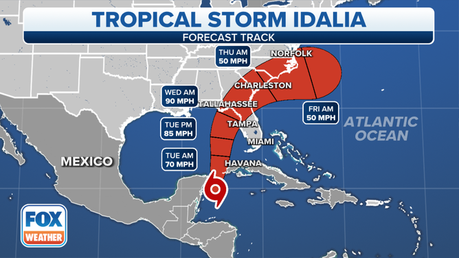
Tropical Storm Idalia cone.
(FOX Weather)
Remember, when a Category 1 is forecast, preparation should be for at least a Category 2. And we have to be ready for the forecasts to be adjusted higher. Some computer forecasts indicate a stronger storm.
Tonight or tomorrow, Storm Surge Watches will be issued for parts of the Florida west coast. At the same time, the initial forecasts for the amount of storm surge will be released. Critically, the storm surge will occur well outside the cone, as we saw with Hurricane Ian last year. Watch for those detailed forecasts for your area.
This storm is not expected to be another Hurricane Ian, but dangerous storm surge is still likely. A Category 2 hurricane can produce more than 9 feet of storm surge in some areas along the Florida Gulf coast. The exact locations where the highest surge will occur won’t be known until closer to landfall. But, the National Hurricane Center will warn people in areas where there’s a reasonable chance of deadly or dangerous water rise well in advance.
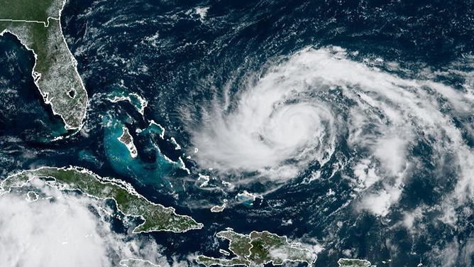
A satellite image of Hurricane Franklin on Sunday, August 27, 2023.
(FOX Weather)
As we learned last year, it’s critical that everybody pay attention to the warnings and forecasts for their area. Gravitate to credible sources and ignore rumors.
The storm and the forecast will evolve, and information will come quickly over the next two days. Stay informed and listen to instructions from local emergency management officials.
In the Atlantic, Hurricane Franklin is forecast to brush Bermuda as its track bends around the island. Otherwise, the systems in the east Atlantic are not expected to be a threat to land.