

Bryan Norcross: Tropical Storm Fay forms in the Atlantic and a possible hurricane threat for coastal Mexico
FOX Weather Hurricane Specialist Bryan Norcross breaks down the latest in the tropics - from recently-formed Tropical Storm Fay to a potentially strong hurricane that could impact coastal Mexico.
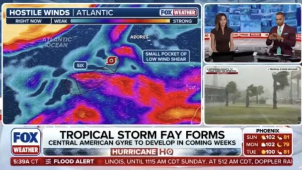
Tropical Storm Fay forms in the Atlantic, expected to hit hostile conditions and fizzle out
The Atlantic's next named storms has formed and it is Tropical Storm Fay. Fay is expected to ultimately fizzle out amid hostile conditions. FOX Weather Meteorologists Melanie Black and Michael Estime have the latest:
Last updated at 10 a.m. on Sunday, Sept. 20, 2026.
BUT FIRST… SEPTEMBER 20, 1926
The Great Miami Hurricane left devastation in its wake across southeast Florida and the western edge of Lake Okeechobee. Two days after landfall, it was honing in on Pensacola.
The center of the storm arrived near the western Panhandle 100 years ago this morning. It then crept slowly to the west, finally making landfall near the Florida/Alabama line in the late afternoon.
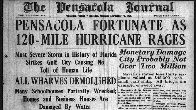
The front page of the Pensacola Journal on Sept. 22, 1926.
(Bryan Norcross / FOX Weather)
Hurricane-force winds arrived at Pensacola overnight and continued through the day. It ripped through the city a reported 17 hours in all. As the storm slowly passed to the south, the backside winds pushed storm-surge water into Pensacola Bay 9 to 10 feet above the normal tide.
The waterfront was devastated. Boats of all kinds were tossed. Roofs were torn off. And power was out throughout the region.
WHAT’S THE DIFFERENCE BETWEEN A TROPICAL DEPRESSION, TROPICAL STORM AND HURRICANE?
The Pensacola Journal was unable to publish that Monday or Tuesday. Finally, on Wednesday, September 22, they got a condensed edition out the door.
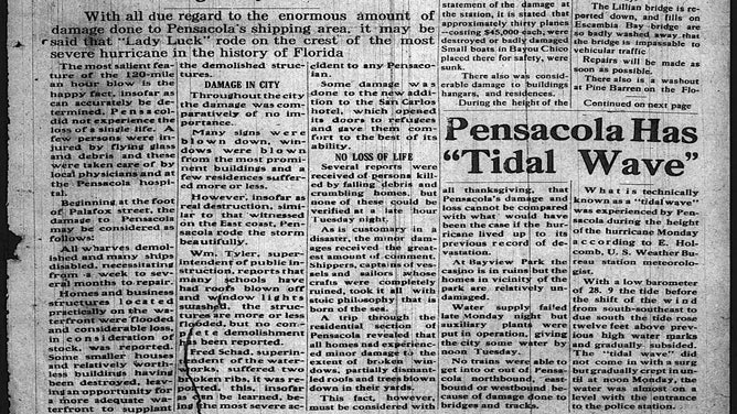
The story on the hurricane of 1926 continues in the Pensacola Journal.
(Bryan Norcross)
Even with the devastation in Pensacola from the great hurricane, people there said they were grateful that they weren't as hard hit as Miami and South Florida.
Mobile took a hit as well. The storm was a bit weaker, but the fierce winds still raged for 19 hours as the giant system slid by to the south.
TALE OF TWO COASTS: EROSION THREATENS HOMES FROM CALIFORNIA TO NORTH CAROLINA
The center of the slowly weakening but still massive storm skimmed the coastline of Alabama and Mississippi. Even though it was finally winding down, hurricane-force winds likely impacted coastal Mississippi on September 21.
Finally, on the morning of September 22, 1926, one of the greatest hurricanes in terms of size, damage, and impact spun down over southern Mississippi.
IN THE ATLANTIC IN 2026
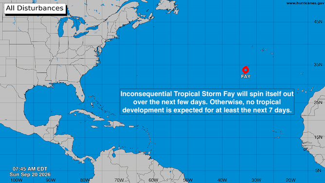
Tropical activity in the Atlantic basin.
(Bryan Norcross)
The small disturbance we were following southwest of the Azores strengthened into Tropical Storm Fay – the sixth named storm of the 2026 hurricane season. It's forecast to drift around for a couple of days and fade out without affecting land.
TROPICAL STORM FAY FORMS IN THE ATLANTIC AMID BREWING SUPER EL NIÑO
IN THE PACIFIC
Tropical Storm Odalys has formed between Central America and Hawaii. It's forecast to become a hurricane over the next few days as it meanders in the open ocean.
The disturbance near Mexico is likely to develop soon. It will likely be named Polo. This system is also forecast to strengthen into a hurricane – possibly a very strong hurricane – over the extremely warm Pacific waters.
TROPICAL STORM ODALYS CHURNS IN THE PACIFIC AS POTENTIAL NEXT HURRICANE FUELS SOUTHWEST FLOOD THREAT
The long-range forecast for both of these storms is unusually uncertain because they might interact. Exactly how one will affect the other is dependent on a number of factors, including how relatively strong they are, when and if they track into each other's proximity.
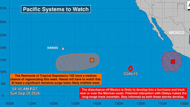
Tropical systems to watch in the Pacific basin.
(Bryan Norcross)
For now, there is nothing to do along the central Mexican west coast, except stay informed.
The remnants of Tropical Depression 15E are southeast of Hawaii on a path that will take them southeast then south of the islands. The National Hurricane Center has the system's odds of regenerating in the medium range.
Computer forecasts are mixed, but some show the system intensifying into a hurricane as it slowly tracks in a general westward direction. Hawaii would be on the north side in this scenario, which means that a significant moisture surge is possible across the islands beginning midweek.
Stay aware of updates from the National Weather Service in Honolulu. This is a slow-moving system, which means the forecasts are prone to higher-than-normal errors.