Alberta Clipper spreads snow from upper Midwest to New England early this week
Up to a few inches of snow is expected in most areas
Alberta Clipper will spread snow from upper Midwest to New England
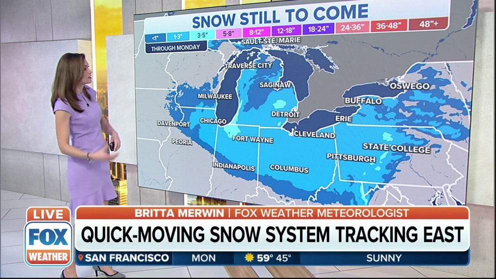
Quick-moving Alberta Clipper systems will produce several inches of snow through Monday, which will be followed by wind chill values that could reach 40 degrees below zero during the workweek.
A fast-moving Alberta Clipper will spread snow across the upper Midwest and Great Lakes on Monday before tracking into New England by Tuesday.
The National Weather Service has issued Winter Weather Advisories for parts of southeastern Wisconsin, northeastern Illinois, northwestern Indiana and portions of Michigan, where the snow could create some travel issues to begin the new workweek.
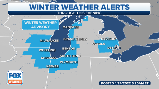
Winter Weather Advisories are in effect for parts of the Great Lakes on Monday, Jan. 24, 2022.
(FOX Weather)
A quick round of light to moderate snow will sweep across the upper Midwest Monday morning, then slide across the Great Lakes and Ohio Valley through the day.
The morning commute could be snowy in Chicago and Indianapolis, while the snow could impact the evening commute in Detroit and Columbus, Ohio.
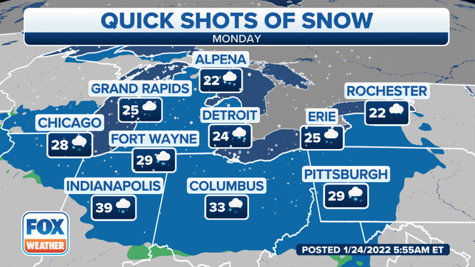
Forecast for Monday, Jan. 24, 2022.
(FOX Weather)
Monday night, the snow will reach the interior Northeast and parts of New England.
Cities that could see snow overnight include Pittsburgh; Buffalo, New York; Burlington, Vermont; and Portland, Maine.
THESE ARE THE 7 SNOWIEST CITIES IN THE U.S.
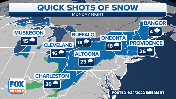
Forecast for Monday night, Jan. 24, 2022.
(FOX Weather)
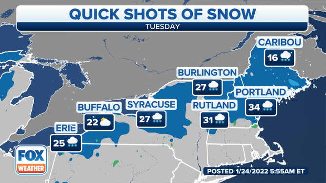
Snow will linger into Tuesday in portions of northern New England as lake-effect snow showers develop in the Great Lakes snowbelts.
The Alberta Clipper will exit into the Canadian Maritimes later in the day.
Forecast for Tuesday, Jan. 25, 2022.
(FOX Weather)
Up to a few inches of snow is expected from the upper Midwest to the Great Lakes and Ohio Valley through Monday night.
Locally higher amounts are possible downwind of the Great Lakes due to lake-effect enhancements into Tuesday.
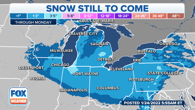
Snow forecast through Monday, Jan. 24, 2022.
(FOX Weather)
From the interior Northeast into New England, 1 to 3 inches of snow is likely for most areas Monday night through Tuesday.
Lake-effect enhancements will also yield locally higher totals downwind of lakes Erie and Ontario in western and central New York.
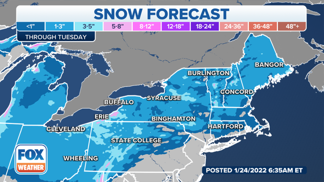
Snow forecast through Tuesday, Jan. 25, 2022.
(FOX Weather)