Former Pacific Hurricane Agatha will likely help develop system in Gulf of Mexico or Caribbean this week
The consensus is that Florida will feel the effects of the system, whatever form it takes, very late in the week or over the weekend
Agatha weakens to tropical depression
Agatha continues to weaken and is now a tropical depression.
Agatha has become one of the strongest known hurricanes to hit North America in May. Its only competition comes from a hurricane that hit the Florida Panhandle in 1863 with winds roughly estimated at 105 mph.
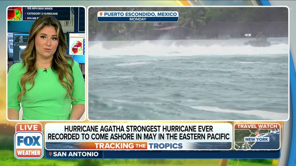
Agatha, the first named system of the Pacific hurricane season, made landfall Monday in the southern Mexico state of Oaxaca with violent winds of 105 mph and crushing storm surge in the coastal sections. The storm is also producing mudslide-causing torrential rain across the mountainous state and the surrounding states as well.
Agatha’s circulation is forecast to dissipate over the mountains by late Tuesday.
HOW TO WATCH FOX WEATHER ON TV

(FOX Weather)

(FOX Weather)
Fragments of Agatha will likely cross the mountains into the extreme southern Gulf of Mexico and mix into a stew of disturbed weather that extends across the Yucatán Peninsula into the Caribbean. By midweek, the consensus of the computer forecast models is that a broad area of low pressure will straddle the Yucatán. The question becomes, where, if anywhere, will an organized system emerge?
HOW ARE HURRICANES RATED? THE SAFFIR-SIMPSON HURRICANE WIND SCALE EXPLAINED

(FOX Weather)
It appears that the general steering flow that would capture a new low-pressure system would push it toward Florida. If the system emerges out of the Caribbean part of the disturbance, it would more likely affect South Florida. If something comes out of the Gulf end of the broad circulation, it would more likely affect Central Florida, although the moisture would likely impact the entire southern peninsula as well.
HERE'S HOW TO PREPARE FOR HURRICANE SEASON NOW

(FOX Weather)
The atmospheric pattern over the Gulf is not forecast to be conducive to a fast-developing tropical system, so a hurricane does not appear to be in the cards at this time. In fact, what develops, if it does, might be more of a comma-shaped quasi-tropical rainstorm with gusty winds. It’s simply too soon to know, and nothing should be ruled out.
South Florida is already saturated from rounds of heavy rain, and the rainy season is barely underway. If another big rainmaker comes along, flooding will be a concern.
CLICK HERE TO GET THE FOX WEATHER UPDATE PODCAST
The consensus is that Florida will feel the effects of the system, whatever form it takes, very late in the week or over the weekend.
Stay updated on the latest weather forecast. Download the FOX Weather app to get the forecast for your area as well as any weather alerts that are issued for your location.