Bethany, LA
See RadarCurrent Weather Forecast for Bethany
LA 71007 | 8:48pm
Weather Conditions
Tonight
Tomorrow
Tomorrow night
Local Weather Radar - Bethany, LA
Live Bethany Local Radar Forecast by FOX Weather
Next 12 Hours Forecast in Bethany
Hourly Weather Forecast & Temperature
Latest Stories from Louisiana
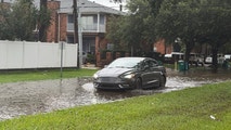
Life-threatening flash flooding fueled by days of heavy rain slams multiple states as Arthur sweeps the South
Post-Tropical Storm Arthur is now unleashing potentially catastrophic flooding throughout the South as days of heavy rain will slam communities in Louisiana, Mississippi and Alabama.
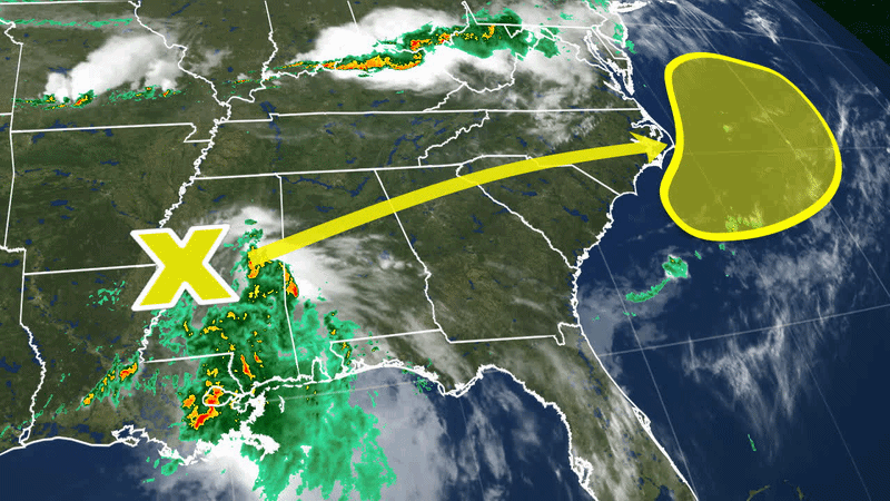
Arthur’s remnants eye East Coast revival as historic flooding ravages the Gulf Coast
Just 12 hours after forming, a short-lived Tropical Storm Arthur degenerated into a remnant low Wednesday, but models warn its lingering moisture could still trigger redevelopment along the East Coast.

Life-threatening flooding and damaging winds slam the Gulf Coast as Arthur packs a punch
Arthur was downgraded from a tropical storm to a post-tropical cyclone, but life-threatening flooding associated with the storm will still pack a punch in the South overnight and into Thursday.

Track Tropical Storm Arthur: Live radar, forecast cone, flood threat, spaghetti models and warnings
The newly designated Tropical Storm Arthur begins to brew as it moves into the warm waters of the Gulf of America and lashes the Texas coast.