This Hurricane Hunter plane uses 3 radars to see storms in unique ways
One of the three radars on NOAA’s Lockheed WP-3D Orion airplanes scans storms both horizontally and vertically to give forecasters a 3-D look at the weather.
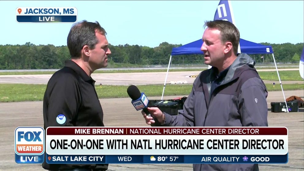
National Hurricane Center Director breaks down hurricane safety
National Hurricane Center Director Mike Brennan joins FOX Weather to talk about the dangers of hurricanes and to detail how the hurricane center helps provide essential information during hurricane season to those in the path of storms.
The National Hurricane Center is responsible for hurricane forecasts and for providing critical information about them, but they get a big assist from the men and women who are part of the Hurricane Hunters.
This elite squad of pilots, engineers and meteorologists from both NOAA and the Air Force Reserve fly into some of the worst weather on the planet to collect valuable real-time data about a tropical system.
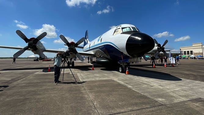
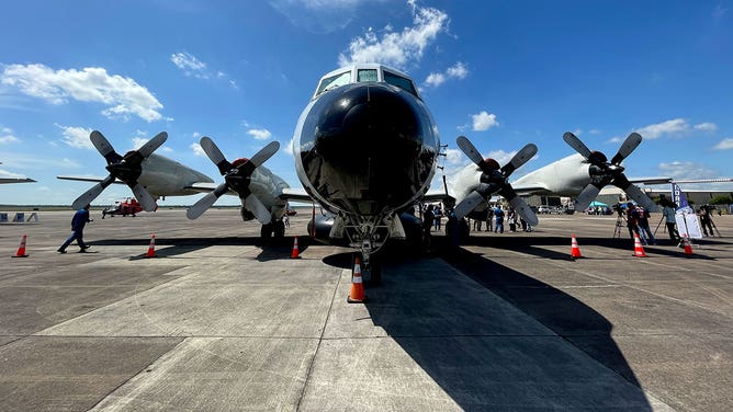
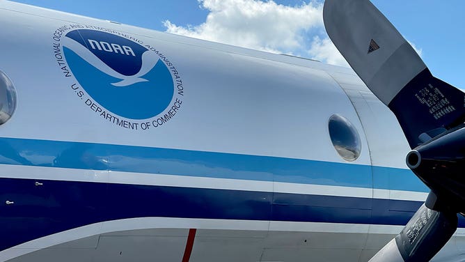
One of the planes used by NOAA’s Hurricane Hunters is the Lockheed WP-3d Orion – a four-engine turboprop that is used to punch through the eye of a hurricane. It is packed with instruments and technology to measure wind speed and direction, barometric pressure, temperature and humidity.
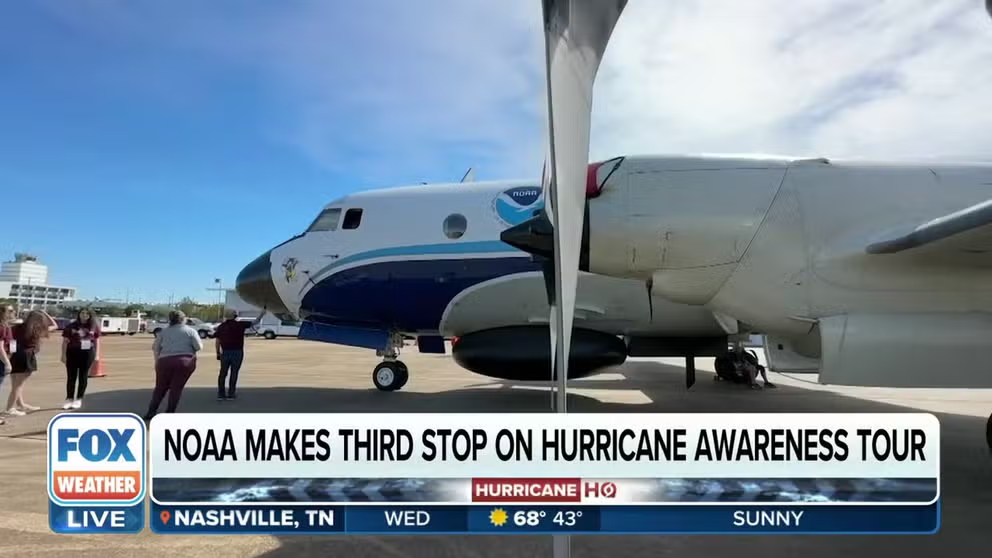
NOAA provides tour of Hurricane Hunters aircraft in Mississippi
NOAA’S Hurricane Awareness Tour makes its third stop at the Jackson Medgar Wiley Evers International Airport in Mississippi. FOX Weather correspondent Robert Ray tours the aircraft that collects crucial data from storms and keeps Hurricane Hunters safe.
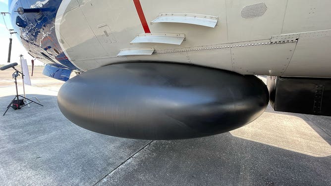
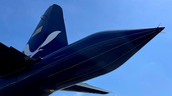
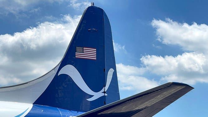
The Hunters’ Orion airplanes are unique because they have three weather radars aboard. One of them is located in the nose of the aircraft, which is the same place most commercial planes house a radar. However, the Orion has two more – one on the belly of the plane and a third in the tail.
HOW ‘KERMIT’, ‘MISS PIGGY’ AND ‘GONZO’ HUNT DOWN HURRICANES
![A WP-3D Orion airplane used by NOAA's Hurricane Hunters is seen during a stop in Houston, Texas, on May 1, 2023.]() Image 1 of 12
Image 1 of 12A WP-3D Orion airplane used by NOAA's Hurricane Hunters is seen during a stop in Houston, Texas, on May 1, 2023. (Aaron Barker)
![The nose of a WP-3D Orion airplane used by NOAA's Hurricane Hunters is seen during a stop in Houston, Texas, on May 1, 2023.]() Image 2 of 12
Image 2 of 12The nose of a WP-3D Orion airplane used by NOAA's Hurricane Hunters is seen during a stop in Houston, Texas, on May 1, 2023. (Aaron Barker)
![The lower fuselage radar on a WP-3D Orion airplane used by NOAA's Hurricane Hunters is seen during a stop in Houston, Texas, on May 1, 2023.]() Image 3 of 12
Image 3 of 12The lower fuselage radar on a WP-3D Orion airplane used by NOAA's Hurricane Hunters is seen during a stop in Houston, Texas, on May 1, 2023. (Aaron Barker)
![The tail of a WP-3D Orion airplane used by NOAA's Hurricane Hunters contains a unique Doppler radar that provides a 3-D view of a storm. This photo was taken in Houston, Texas, on May 1, 2023.]() Image 4 of 12
Image 4 of 12The tail of a WP-3D Orion airplane used by NOAA's Hurricane Hunters contains a unique Doppler radar that provides a 3-D view of a storm. This photo was taken in Houston, Texas, on May 1, 2023. (Aaron Barker)
![Flags of countries visited by a WP-3D Orion airplane used by NOAA's Hurricane Hunters are seen in Houston on May 1, 2023, along with hurricane emblems for the storms the aircraft has been used to invesitgate.]() Image 5 of 12
Image 5 of 12Flags of countries visited by a WP-3D Orion airplane used by NOAA's Hurricane Hunters are seen in Houston on May 1, 2023, along with hurricane emblems for the storms the aircraft has been used to invesitgate. (Aaron Barker)
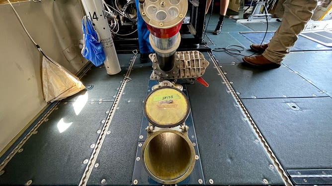
![A member of NOAA's Hurricane Hunters shows a dropsonde that is used aboard a WP-3D Orion aircraft. This photo was taken in Houston, Texas, on May 1, 2023.]() Image 6 of 12
Image 6 of 12A member of NOAA's Hurricane Hunters shows a dropsonde that is used aboard a WP-3D Orion aircraft. This photo was taken in Houston, Texas, on May 1, 2023. (Aaron Barker)
![The dropsonde launching station on a WP-3D Orion airplane used by NOAA's Hurricane Hunters is seen during a stop in Houston, Texas, on May 1, 2023.]() Image 7 of 12
Image 7 of 12The dropsonde launching station on a WP-3D Orion airplane used by NOAA's Hurricane Hunters is seen during a stop in Houston, Texas, on May 1, 2023. (Aaron Barker)
![The cockpit of a WP-3d Orion airplane used by NOAA's Hurricane Hunters is seen during a stop in Houston, Texas, on May 1, 2023.]() Image 8 of 12
Image 8 of 12The cockpit of a WP-3d Orion airplane used by NOAA's Hurricane Hunters is seen during a stop in Houston, Texas, on May 1, 2023. (Aaron Barker)
![A WP-3D Orion airplane used by NOAA's Hurricane Hunters is seen during a stop in Houston, Texas, on May 1, 2023.]() Image 9 of 12
Image 9 of 12A WP-3D Orion airplane used by NOAA's Hurricane Hunters is seen during a stop in Houston, Texas, on May 1, 2023. (Aaron Barker)
![A WP-3D Orion airplane used by NOAA's Hurricane Hunters is seen during a stop in Houston, Texas, on May 1, 2023.]() Image 10 of 12
Image 10 of 12A WP-3D Orion airplane used by NOAA's Hurricane Hunters is seen during a stop in Houston, Texas, on May 1, 2023. (Aaron Barker)
![The NOAA logo is seen painted on the tail of a WP-3D Orion airplane used by the agency's Hurricane Hunters during a stop in Houston on May 1, 2023.]() Image 11 of 12
Image 11 of 12The NOAA logo is seen painted on the tail of a WP-3D Orion airplane used by the agency's Hurricane Hunters during a stop in Houston on May 1, 2023. (Aaron Barker)
![The patch of the NOAA Hurricane Hunters is seen on a uniform in Houston, Texas, on May 1, 2023.]() Image 12 of 12
Image 12 of 12The patch of the NOAA Hurricane Hunters is seen on a uniform in Houston, Texas, on May 1, 2023. (Aaron Barker)


"When we’re flying, the nose radar is really the operational radar," said NOAA meteorologist Ashley Lundry in a 2020 YouTube video about the plane. "It’s the one that’s keeping us safe. We can see right what is in front of us and make sure that we’re not flying through anything that is too dangerous to fly through."
The belly radar, also called the lower fuselage radar, is used for both safety and research.
The radar in the tail of the aircraft scans weather the plane has already flown through, so its goal is purely research.
"The tail Doppler radar points to the front and to the rear, and it’s essentially painting a 3-D picture of what the hurricane looks like, and that’s being sent back, and forecasters at the National Hurricane Center can get a better idea about what the storm is doing," Lundry said.
INSIDE THE 'FLYING LABORATORY' USED BY NOAA'S HURRICANE HUNTERS
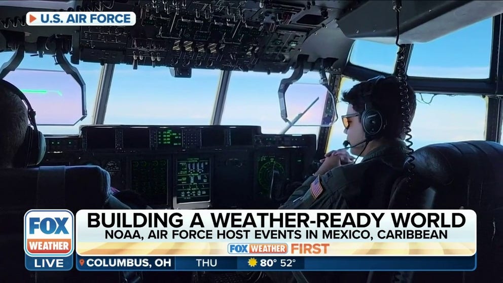
Hurricane Hunters prep for 2023 hurricane season
The Hurricane Hunters are embarking on a preparedness mission to Mexico and Caribbean to help areas often impacted prepare for the fast approaching 2023 hurricane season.
Combine that unique perspective of a storm with all the other data being collected by the aircraft, and you’ve got an information buffet that is used to help refine hurricane or tropical storm forecasts.
In addition to two Orion airplanes in NOAA’s Hurricane Hunter fleet, there is also a Gulfstream IV-SP jet. It is used to fly above and around a storm at an altitude of 45,000 feet and collect upper-atmosphere data about storms. It also supplements the data collected by the Orion planes.