Watch: Pilot's jaw-dropping journey through exploding thunderstorm clouds
A flight from Ontario to Montana featured a gorgeous display of developing cumulonimbus clouds as they exploded in development across Minnesota.
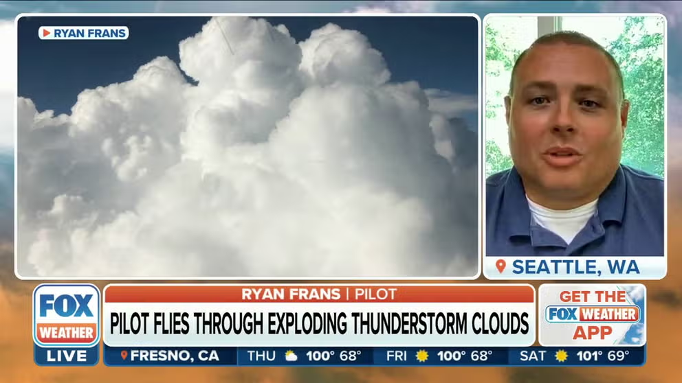
Incredible flight: Pilot captures explosive cloud development during storms
Pilot Ryan Frans shares his jaw-dropping experience of flying through storms where cumulonimbus clouds grew exponentially in real time.
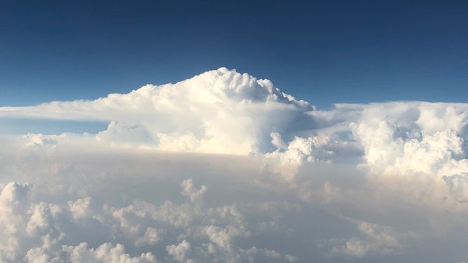
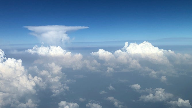
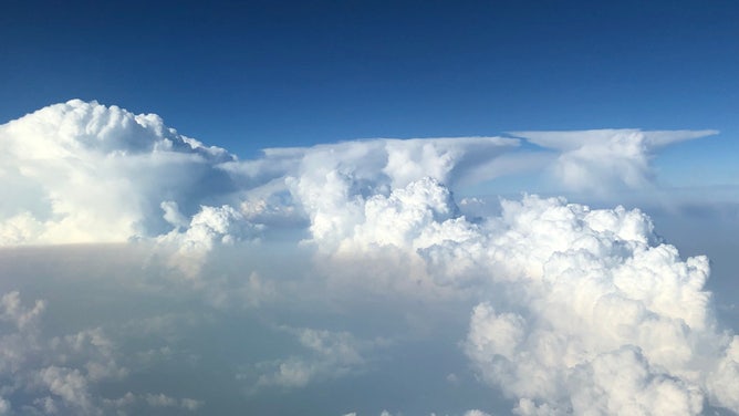
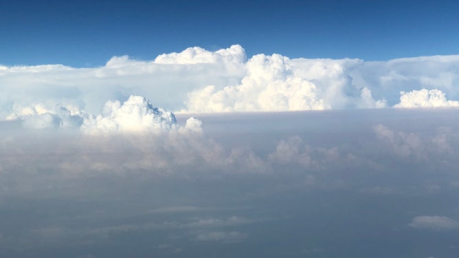
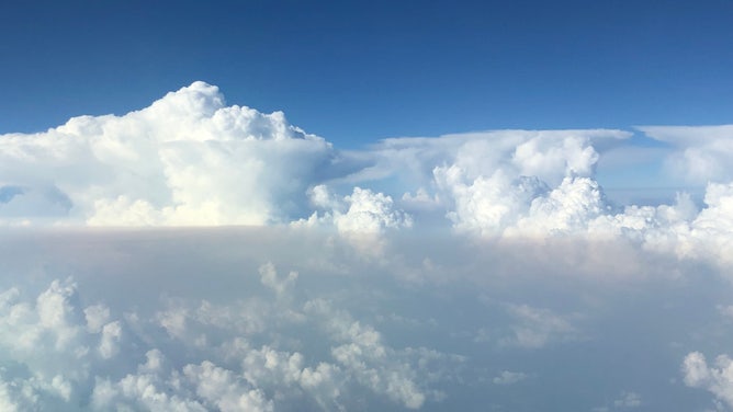
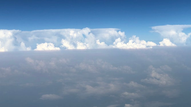
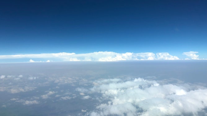
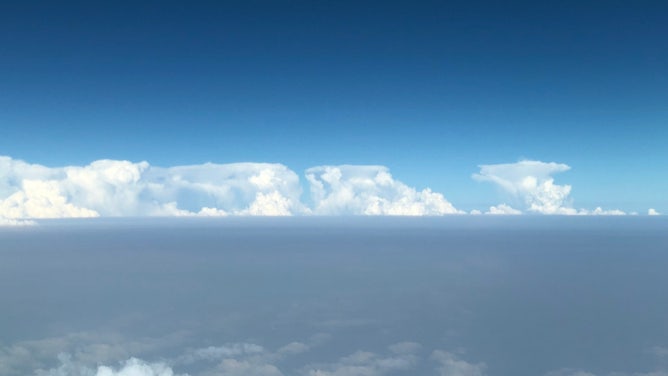
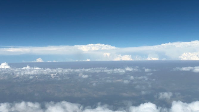
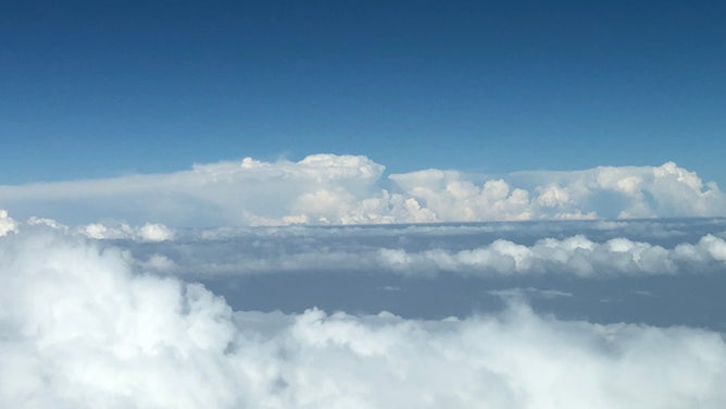
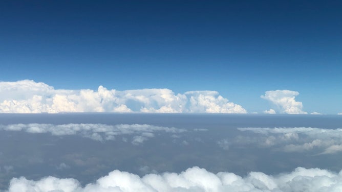
SAULT STE. MARIE, Ontario – A pilot on a flight over the Upper Midwest in June got a front-row seat to what was developing into a rather stormy day, watching cumulonimbus clouds explode around him amid a very unstable atmosphere.
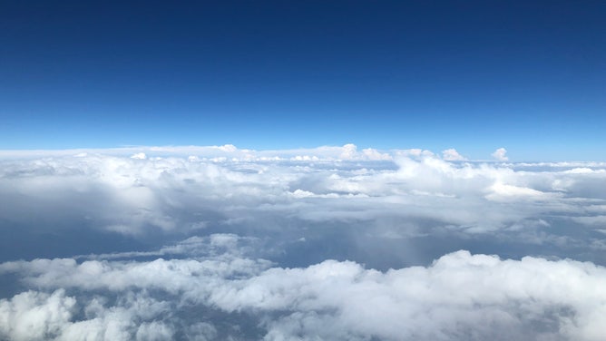
"When we left Sault Ste. Marie (Ontario), we climbed up through the clouds only to find towering thunderstorm buildups all around us," Ryan Frans told FOX Weather. "They were so tall and close together that it was almost disorienting. In a relatively steep climb, the clouds still made it seem like we were level, and I had to check my instruments to make sure I didn't pitch up too much."
![Thunderstorms over Minnesota]() Image 1 of 19
Image 1 of 19(Ryan Frans)
![Thunderstorms over Minnesota]() Image 2 of 19
Image 2 of 19(Ryan Frans)
![Thunderstorms over Minnesota]() Image 3 of 19
Image 3 of 19(Ryan Frans)
![Thunderstorms over Minnesota]() Image 4 of 19
Image 4 of 19(Ryan Frans)
![Thunderstorms over Minnesota]() Image 5 of 19
Image 5 of 19(Ryan Frans)
![Thunderstorms over Minnesota]() Image 6 of 19
Image 6 of 19(Ryan Frans)
![Thunderstorms over Minnesota]() Image 7 of 19
Image 7 of 19(Ryan Frans)
![Thunderstorms over Minnesota]() Image 8 of 19
Image 8 of 19(Ryan Frans)
![Thunderstorms over Minnesota]() Image 9 of 19
Image 9 of 19(Ryan Frans)
![Thunderstorms over Minnesota]() Image 10 of 19
Image 10 of 19(Ryan Frans)
![Thunderstorms over Minnesota]() Image 11 of 19
Image 11 of 19(Ryan Frans)
![Thunderstorms over Minnesota]() Image 12 of 19
Image 12 of 19(Ryan Frans)
![Thunderstorms over Minnesota]() Image 13 of 19
Image 13 of 19(Ryan Frans)
![Thunderstorms over Minnesota]() Image 14 of 19
Image 14 of 19(Ryan Frans)
![Thunderstorms over Minnesota]() Image 15 of 19
Image 15 of 19(Ryan Frans)
![Thunderstorms over Minnesota]() Image 16 of 19
Image 16 of 19(Ryan Frans)
![Thunderstorms over Minnesota]() Image 17 of 19
Image 17 of 19(Ryan Frans)
![Thunderstorms over Minnesota]() Image 18 of 19
Image 18 of 19(Ryan Frans)
![Thunderstorms over Minnesota]() Image 19 of 19
Image 19 of 19(Ryan Frans)


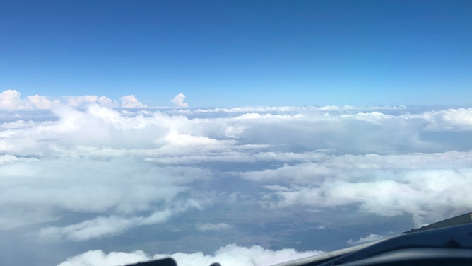

Frans said they could maneuver around the clouds easy enough, but once they leveled off and were on a course approaching eastern Minnesota on their way to Montana, they learned they would have to deviate north or south due to the line of thunderstorms ahead.
ADVICE FOR DEALING WITH STORM ANXIETY WHEN SEVERE WEATHER THREATENS
"Based on the weather radar, we decided to deviate north and were still getting very strong returns on the onboard weather radar," Frans said. "The clouds were too tall to be able to visually determine a safe route, so we were relying on (air traffic control) reports, the satellite radar report and the onboard weather radar to attempt to navigate a safe path through."
Watch: Stormy cumulus clouds bubble over Minnesota
Pilot Ryan Frans had a front-row seat as cumulus clouds exploded in development over eastern Minnesota on June 15.
Frans said they had to veer north across Lake Superior to stay out of the worst of it.
A bumpy ride awaits those who dare enter
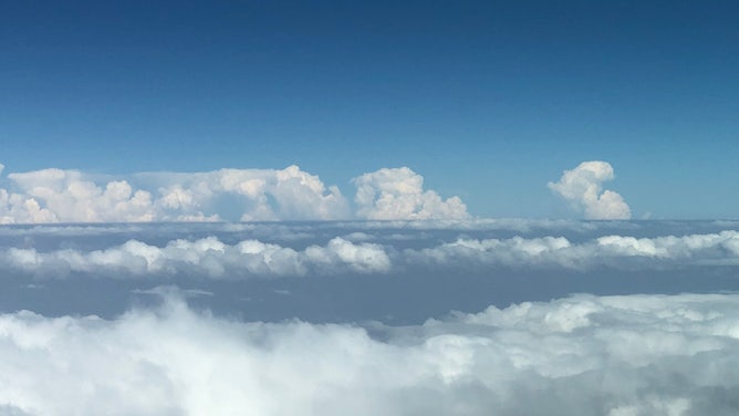
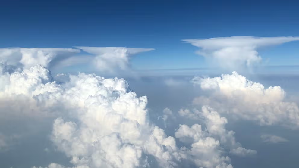
But along the journey of their equipment reposition flight, Frans documented rapid development of the cumulonimbus clouds, as heat from below raced skyward into the much cooler atmosphere, exploding into convection along the way. The flat tops of the storms in the distance are informally known as anvil tops due to their obvious resemblance to anvils.
HOW TO WATCH FOX WEATHER ON TV
Anvils are caused when the rising air hits a stable layer of the atmosphere where the temperature profile prevents the clouds from rising further, instead acting like an invisible wall where the clouds will then spread out along the boundary layer. They're signs of a mature thunderstorm and something you want to avoid flying through as a pilot.
"We would have probably encountered at least moderate turbulence and likely worse," Frans said. "Generally the tops of clouds – especially cumulus – dump a TON of ice into the airframe as you fly through, so the windshield (where it's not heated) would instantly be covered in ice."
What's more, with temperatures below freezing and strong updrafts in the clouds, the precipitation you'd be flying through is not rain, but hail.
LIGHTNING STRIKES ON AIRPLANES CAN BE SCARY - JUST ASK MILEY CYRUS
"So it would be very loud with 1/4-inch ice balls slamming into the windscreen at 400 mph," Frans said. "And of course the planes are designed to take most of that but if it's severe that's beyond what it's designed for. Also, it can be dangerous if people aren't seat-belted in."
Best to add a few miles to the journey and fly around the towers.