What is Hurricane Ian's path and impacts to Florida?
The expected increase in the size of Hurricane Ian and its potential to slow down in forward progress as it approaches Florida will increase the threat of life-threatening storm surge, regardless of the hurricane's intensity at landfall. Already, some 300,000 residents in and around the Tampa Bay Area are being told to evacuate.
Hurricane Ian expected to bring 'life-threatening' storm surge to Florida's Gulf Coast
Hurricane Ian is expected to bring heavy rain, strong wind, and life-threatening storm surge to Florida’s Gulf Coast as the storm moves closer.
Visit the FOX Weather Wire for live updates on Hurricane Ian as it barrels toward Florida. Click here for the latest forecast, evacuation orders and more.
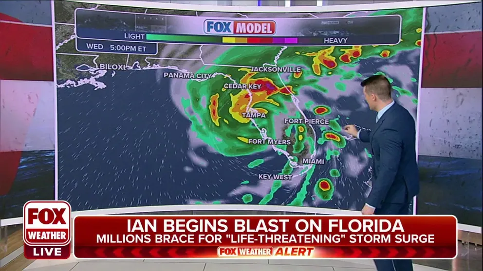
TAMPA, Fla. — As Hurricane Ian churns toward the Gulf of Mexico this week and sets eyes on a potential landfall along Florida’s western peninsula this week, here are the storm’s forecast impacts for the Sunshine State.
Hurricane Ian intensified into an extremely dangerous Category 4 hurricane early Wednesday morning, hours from an expected landfall. Hurricane Warnings stretch from the Tampa area south to Fort Myers.

(FOX Weather)
The expected increase in the size of Hurricane Ian and its potential to slow down in forward progress as it approaches Florida will increase the threat of life-threatening storm surge, regardless of the hurricane's intensity at landfall. Already, some 300,000 residents in and around the Tampa Bay Area are being told to evacuate.
But Hurricane Ian's expected impacts extend far beyond the Tampa area.
"We’re all focused on Tampa as Tampa is the biggest city on the west coast, and the risk in Tampa is very, very high," says FOX Weather Hurricane Specialist Bryan Norcross.
But Norcross worries areas not frequently mentioned such as Sarasota, Bradenton, and other cities down the coast may erroneously think they’re outside the danger zone.
"Just because the attention is on Tampa, I don’t want anybody on the west coast of Florida to say somehow we are less threatened if we’re just a little bit outside of that area," he said. "That is indeed the zone that seems like the biggest threat but a little bit of deviation can take the maximum effect here and move it just a little bit - the maximum storm surge; the maximum wind, and so forth. So everybody in that part of the coast needs to be very, very aware — and inland from those counties as well."
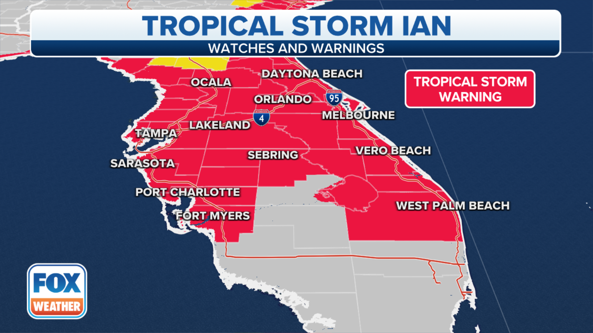
Hurricane Ian's expected winds
Hurricane Warnings are in effect for parts of the Florida Gulf Coast, including Tampa Bay, with Tropical Storm Watches and Warnings in effect for areas on the southwestern shores of the Florida Peninsula and the Florida Keys.
Sustained winds of 39 mph are expected in the Tropical Storm Warning areas in the lower Florida Keys by Tuesday. Tropical-storm-force winds are then possible in the Tropical Storm Watch areas along Florida's Gulf Coast beginning Tuesday evening.

(FOX Weather)
Hurricane-force winds (74-plus mph) are possible along Florida's Gulf Coast in the Hurricane Warning areas on Wednesday, with tropical-storm-force winds possibly beginning as soon as Tuesday night.
(FOX Weather)
(FOX Weather)

(FOX Weather)
Hurricane Ian's expected storm surge
Storm-surge flooding might begin as soon as late Tuesday in far South Florida, then along the rest of Florida's Gulf Coast by Wednesday. Most of the Gulf Coast of Florida should see peak storm-surge inundation either Thursday or Friday before water levels slowly subside on Saturday.
WHY FLORIDA'S GULF COAST IS SUSCEPTIBLE TO A HURRICANE'S STORM SURGE

(FOX Weather)
According to the National Hurricane Center, the water could reach the following heights above ground somewhere in the indicated areas if the peak surge occurs at the time of high tide:
- Anclote River to the middle of Longboat Key, Florida, including Tampa Bay: 5 to 10 feet
- Middle of Longboat Key, Florida, to Englewood, Florida: 5 to 8 feet
- Englewood, Florida, to Bonita Beach, Florida, including Charlotte Harbor: 4 to 7 feet
- Bonita Beach, Florida, to East Cape Sable, Florida: 3 to 5 feet
- East Cape Sable, Florida, to the Card Sound Bridge, Florida, including Florida Bay: 2 to 4 feet
- Florida Keys, including the Dry Tortugas: 2 to 4 feet

(FOX Weather)
TRACK HURRICANE IAN WITH THESE MAPS
Hurricane Ian's expected rainfall
Bands of locally heavy rain were already beginning to spread into portions of Florida on Monday. This heavier rain will gradually spread northward through the Florida Peninsula in the days ahead and eventually into the Florida Panhandle and parts of the Southeast by late week.
Between 8 and 10 inches of rain is expected in western portions of Central Florida, with isolated amounts up to 15 inches possible. The rest of the Florida Peninsula is projected to pick up 3 to 8 inches of rainfall, while the Florida Keys are forecast to receive 4 to 6 inches of rainfall.

(FOX Weather)
Widespread considerable flash and urban flooding, as well as prolonged significant river flooding, are likely mid- to late week in parts of Central Florida given already-saturated soils in the region. Flash and urban flooding are also possible with the heavy rain across the Florida Keys and the Florida Peninsula through midweek.
Limited flooding impacts and rises on area streams and rivers are then possible over North Florida, the Florida Panhandle and portions of the Southeast mid- to late week.
DeSantis warns of power outages
Florida Gov. Ron DeSantis warned in a Sunday press conference of likely power outages once Hurricane Ian moves closer to Florida.

(FOX Weather)
"Anticipate, particularly the closer you are to where the eye of the storm makes landfall, anticipate power outages," DeSantis said. "That is something that will likely happen with a hurricane of this magnitude."
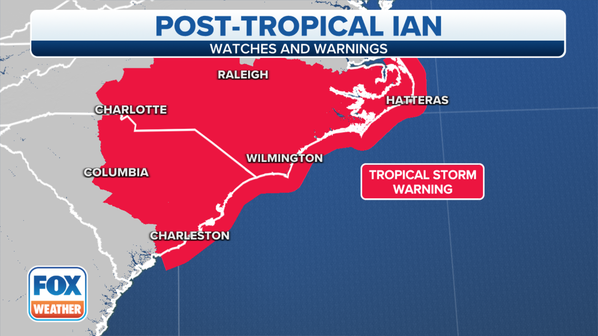
Where does Hurricane Ian go after landfall?
According to the FOX Forecast Center, Ian will move inland over the southeastern U.S. following its Florida landfall.
HOW TO PREPARE FOR A HURRICANE

(FOX Weather)
Heavy rain, gusty winds and isolated tornadoes are possible across parts of the Southeast from late Friday into the weekend.
Florida's emergency management agency is advising residents to prepare for the coming storm now.
Floridians can check their evacuation zone by typing their address into an interactive map.