Drone video shows floodwater surrounding New Hampshire homes
The flooding was caused by a powerful storm that ravaged the Northeast, leaving nearly a half-million customers without power.
Watch: Major flooding seen over Hampton Beach, NH
An emergency was declared Wednesday morning as a result of extremely high seas and flooding in Hampton, New Hampshire. Drone footage over Hampton Beach shows water creeping up to doorsteps as cars float in driveways.
HAMPTON BEACH, N.H. – Video shot on Wednesday morning captured the aftermath of a powerful winter storm that inundated the coastal town of Hampton Beach.
Located in southeastern New Hampshire, Hampton Beach experienced heavy rain, but it was the winds pushing seawater ashore that flooded homes.
The flood stage for the Hampton Beach area is 11 feet. After the storm on Tuesday, the water level exceeded 13 feet by Wednesday morning, according to the National Weather Service.
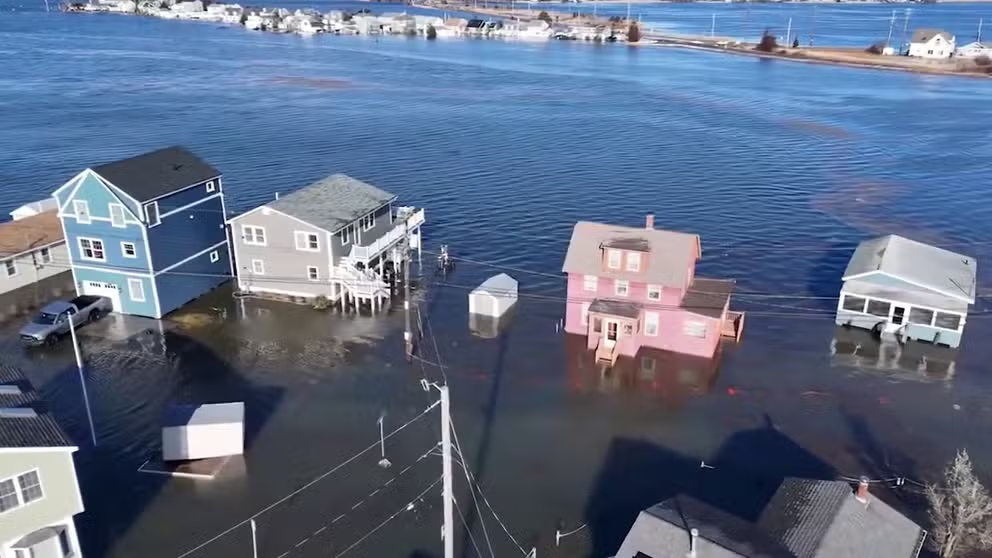
Flooding at Hampton Beach, New Hampshire. Jan. 10, 2024.
(henrysweatherchannel / FOX Weather)
The drone footage above captured images of the flooding impacts. The boundary between Hampton Beach and the Atlantic Ocean blurs, causing homes to appear like islands as their driveways and streets have disappeared under floodwater.
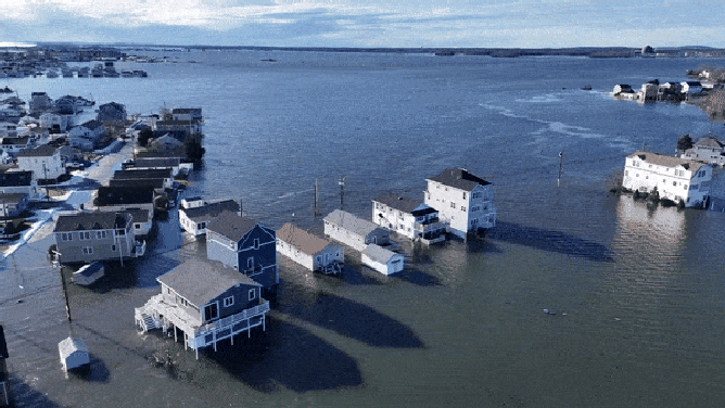
Enough water had stranded many residents to make driving to and from their homes virtually impossible.
Flooding at Hampton Beach, New Hampshire. Jan. 10, 2024.
(henrysweatherchannel / FOX Weather)
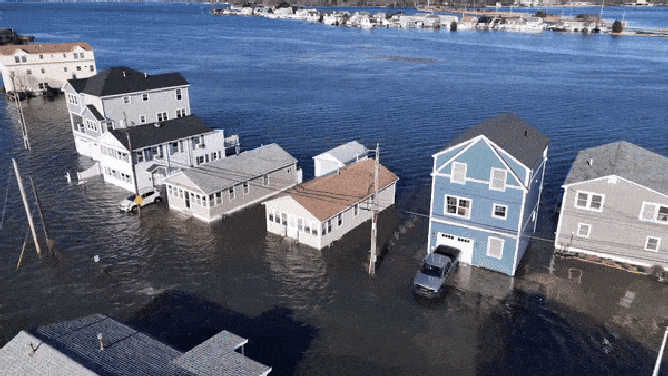
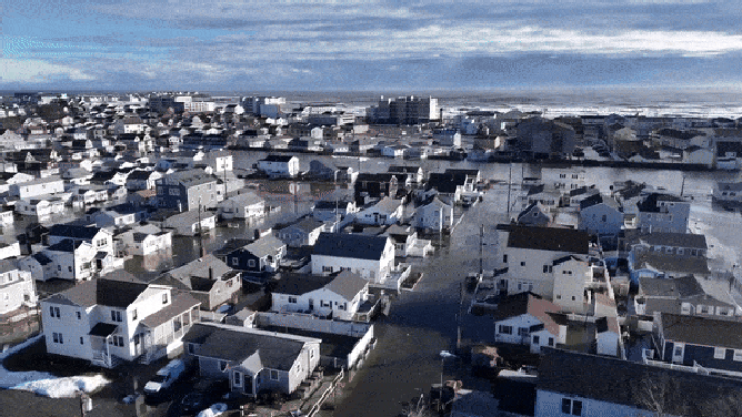
Entire neighborhoods were swallowed up by the floodwater. The drone shot below showed how a more packed area of Hampton Beach was not immune from the impact of the rising water.
Multitudes of homes and businesses were overtaken, as the waves of the Atlantic crash ashore in the background.
Flooding at Hampton Beach, New Hampshire. Jan. 10, 2024.
(henrysweatherchannel / FOX Weather)
HOW FLOODWATER CAN MAKE YOU VERY SICK
The storm behind the flooding event has caused road closures around Hampton Beach, along with half a million homes being without power in the Northeast.