Will forecast be 'Go' for GOES-T? All eyes on weather ahead of NOAA satellite liftoff
Weather 70% 'Go' for GOES-T liftoff Tuesday
New satellite weather data will help forecasters
We are just days away from the launch of the GOES-T weather satellite, the latest and greatest tool in NOAA’s arsenal to observe the weather and monitor the climate. FOX Weather Senior Digital Content Producer Heather Brinkmann has the latest as the excitement builds ahead of the launch.
CAPE CANAVERAL, Fla. – NOAA's most advanced weather satellite yet is ready to launch from Florida Tuesday, and forecasters are keeping a close eye on the weather around the launchpad.
A United Launch Alliance Atlas V rocket is poised for liftoff from Cape Canaveral Space Force Station, carrying the GOES-T spacecraft to orbit. The two-hour launch window opens at 4:38 p.m.
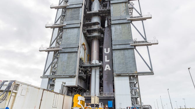
NOAA’s GOES-T mission is mounted atop its ride to space, the United Launch Alliance (ULA) Atlas V rocket, in preparation for launch for NASA’s Launch Services Program (LSP). (Photo Credit: United Launch Alliance)
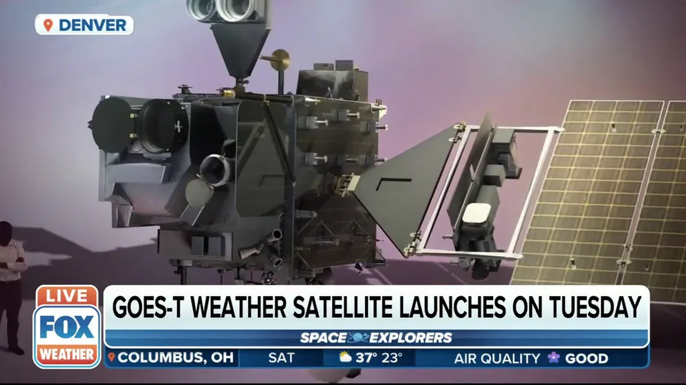
GOES-T is the third in a series of upgraded spacecraft part of the Geostationary Operational Environmental Satellites (GOES) program, a joint program between NASA and NOAA. The real-time data from GOES-T will help meteorologists around the country forecast hurricanes, better predict tornadoes and provide advance warnings for wildfires.
'IT SAVES LIVES': GEOSTATIONARY LIGHTNING MAPPER CRUCIAL FEATURE FOR GOES SERIES
Currently, the 45th Weather Squadron gives the liftoff window an 70% chance of good weather for launch. The primary concern will be possible cumulus cloud cover and liftoff winds.
"Winds are slightly higher than previous forecasts due to the low off the southeast coast intensifying more than models indicated," according to the launch forecast. "This low will continue to keep breezy winds through the launch window, with the possibility for
winds to increase even a few more knots by mid-afternoon with afternoon mixing."
If the launch is delayed to Wednesday those winds are expected to calm down leaving cloud cover as the only concern.
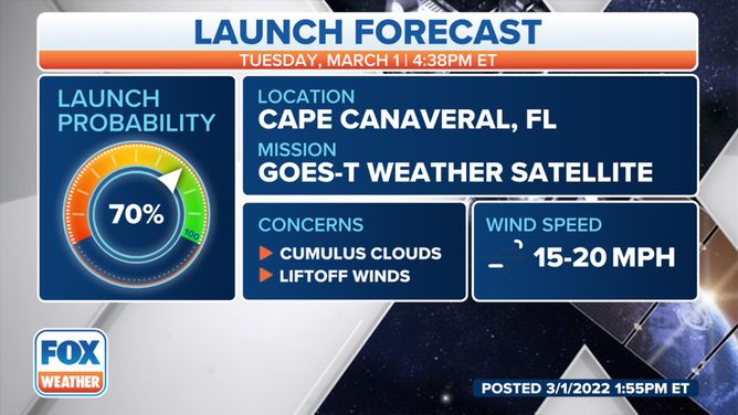
GOES-T launch forecast
(FOX Weather)
HOW NOAA'S NEW GOES SPACECRAFT WILL IMPROVE SPACE WEATHER FORECASTING
If liftoff delays 24 hours, chances decrease to 70% when the primary concern is cloud cover but the chances of rain showers decrease.
Once in orbit, about 22,000 miles above Earth, GOES-T will be renamed GOES-18 and take over for GOES-17, monitoring the western U.S., Alaska, Hawaii, Mexico, Central America and the Pacific Ocean.
The GOES program dates back to 1975, when the first satellite known as GOES-A launched from Cape Canaveral. The most recent satellites in the series started launching in 2016, providing higher-resolution images of the planet in near real-time.
One of the instruments called the Advanced Baseline Imager, or ABI, on GOES-T can take an image of the Earth every 10 minutes while simultaneously looking at regional pictures for severe storms.
L3Harris built the ABI and contributed its first GOES weather imager in the early 1990s.
"[ABI] takes pictures in 16 different colors or spectral bands, ranging from the visible blue out to thermal infrared wavelengths," said Daniel Gall, Chief Systems Engineer for the L3Harris ABI team. "That helps forecasters characterize many aspects of the atmosphere and what's going on there."
GOES satellites in orbit view western hemisphere from over 22,300 miles above
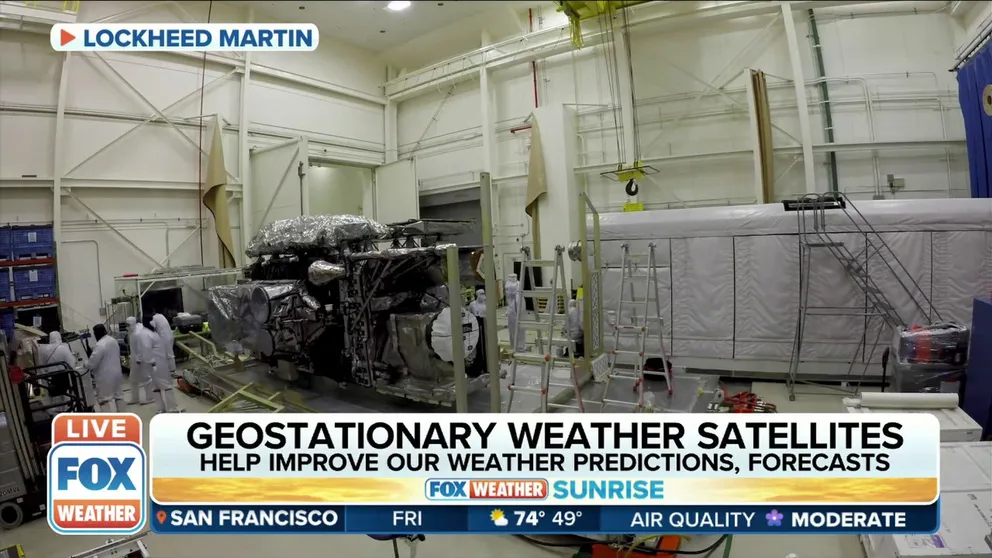
FOX Weather correspondent Steve Bender is in Littleton, CO, as he previews the GOES-T satellite's enhanced features along with Lockheed Martin.
L3 Harris also provides the ground system that helps command, control and downlink data from the GOES series.
"The ground system ensures that that data gets out to NOAA forecasters … less than 30 seconds after it's collected on-orbit, down to the ground and out to users," Gall said.
The ground system handles about 3.5 terabytes of data every day from the satellites.
Like the hundreds of people who have contributed to the GOES program, Gall said he's looking forward to seeing Atlas V liftoff with the new satellite.
"A launch is always a fun event," Gall said. "It's nice to see the culmination of, really, decades of people's lives put into developing, testing and ensuring these satellites are ready to meet the mission."
On Monday, ULA will begin rolling out the rocket and its payload to Space Launch Complex 41.