Before NOAA satellites can improve weather forecasts, here's where they are built
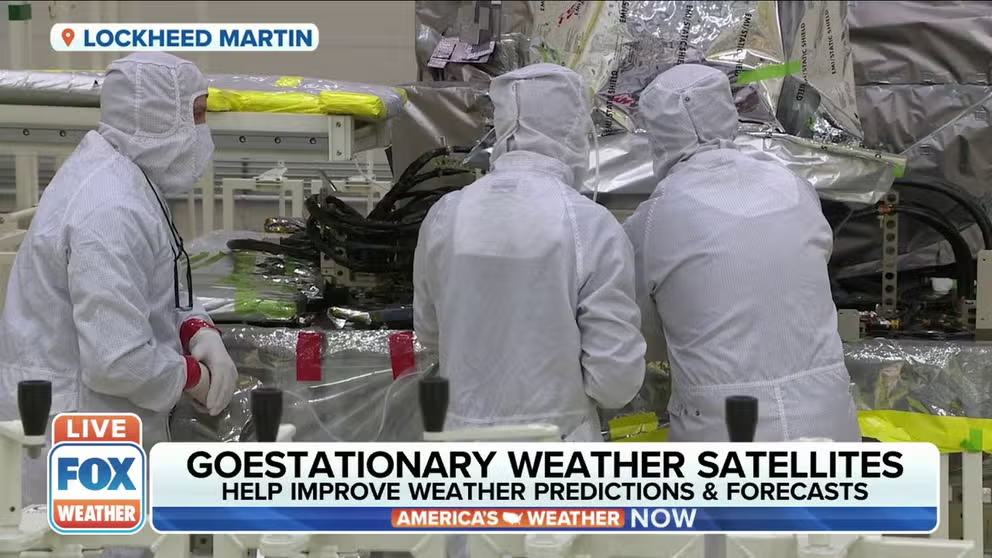
FOX Weather goes inside the Lockheed Martin clean room in Colorado
GOES satellites help improve weather predictions, forecasts
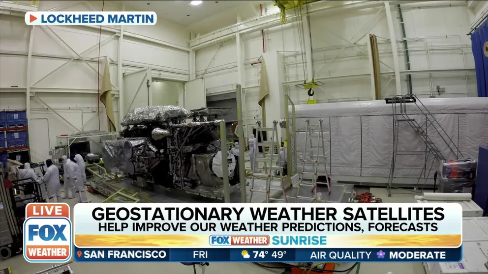
The weather satellite's latest edition will launch on March 1 and is currently being built in Littleton, CO.
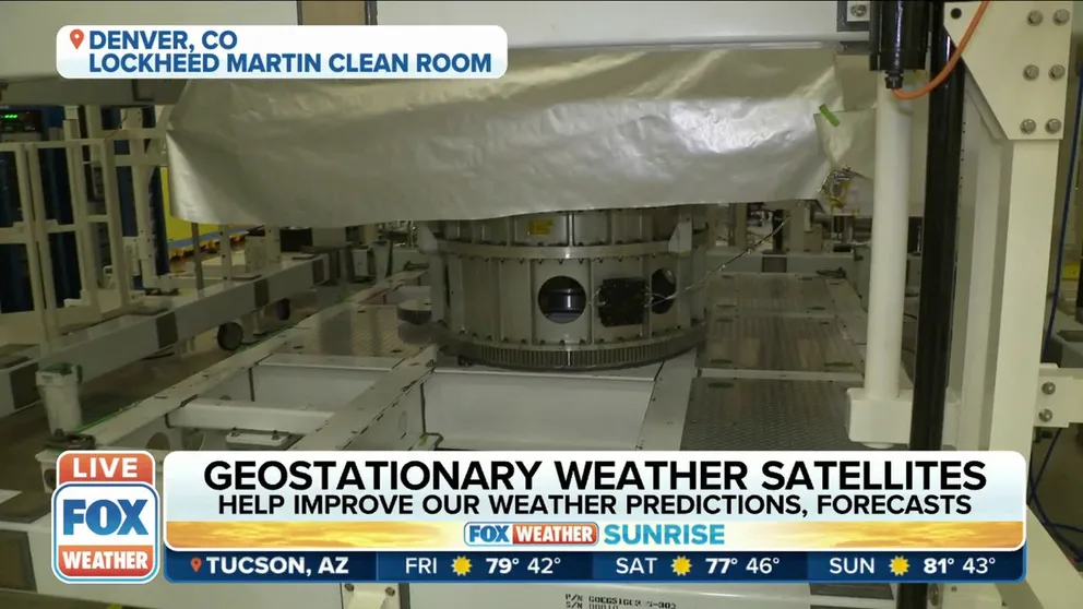
LITTLETON, Co. – NASA and NOAA are preparing to launch the most sophisticated weather satellites yet to continue improving forecasting of severe weather events. Before blasting off from Florida's coast, engineers at Lockheed Martin in Colorado are building the spacecraft to ensure they can act as meteorological eyes in the sky.
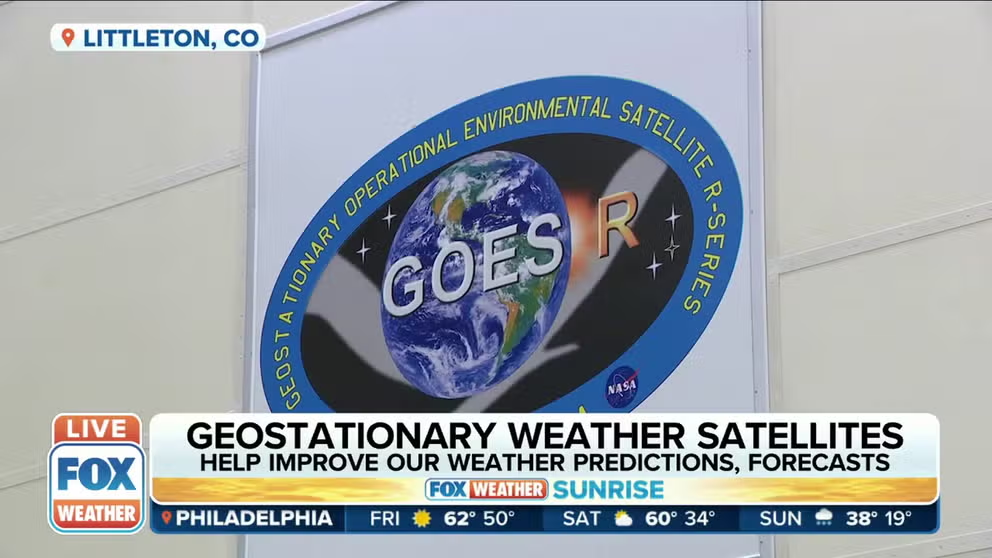
The Geostationary Operational Environmental Satellite (GOES) program is a partnership between NOAA and NASA. The history of the satellites dates back to some of the first Earth-imaging satellites in the 1960s.
Currently, in orbit, more than 22,000 miles above Earth, are GOES-16 and GOES-17. Combined, the satellites can continuously observe the western hemisphere. Both are part of the GOES-R generation of spacecraft. In March, another satellite in the series, GOES-T, will launch from Cape Canaveral on a United Launch Alliance Atlas V rocket.
GOES Series to Help Improve Weather Forecasts
FOX Weather goes inside the Lockheed Martin clean room in Colorado.
The final satellite in the series, GOES-U, is currently in Littleton, Colorado undergoing final preparations in Lockheed Martin's cleanroom.
GOES-T SATELLITE ARRIVES AT KENNEDY SPACE CENTER IN PREPARATION FOR LAUNCH
FOX Weather correspondent and meteorologist Steve Bender visited the spacecraft clean room and spoke to engineers who designed, created and tested the GOES spacecraft.
GOES-16 was the first satellite to include a Geostationary lightning mapper. The instrument detects lighting at the top of the clouds, including at night.
Arleen Knaub is the deputy program manager for GOES at Lockheed Martin. She said the lightning mapper has improved severe weather forecasting, including tornadoes.
Geostationary Lightning Mapper will help GOES satellites better detect lightning strikes
The Geostationary Lightning Mapper will better help GOES satellites detect lightning strikes.
"Weather prediction has greatly improved in the last four years, and it's mainly due to the machine learning combined with the science data we're collecting, so they get this science data down, and they're able to see trends," Knaub said.
Forecasters can predict when and where tornadoes will form using the lightning mapper. GOES-16 has observed an uptick in lighting strikes and then a sharp decrease.
"They know that a tornado is going to form within the next 15 minutes, which gives us advance warning," Knaub said. "We actually save lives."
'WE GO WHERE THE STORMS ARE ’: NASA PILOTS FLY INTO SNOWSTORMS TO STUDY SNOWFALL
The lightning mapper has increased the lead time on thunderstorm and tornado warnings and helped the National Weather Service warn earlier of potential lightning ground strike hazards.
GOES satellites in orbit view western hemisphere from over 22,300 miles above
FOX Weather correspondent Steve Bender is in Littleton, CO, as he previews the GOES-T satellite's enhanced features along with Lockheed Martin.
GOES satellites synchronize their orbits with Earth, imaging the planet every 30 seconds using a range of instruments.
One of those instruments, called the Advanced Baseline Imager (ABI), can image Earth's weather, climate, oceans and environments using 16 spectral bands, providing five-times faster coverage than the previous generation of GOES satellites.
‘IT’S LIKE A GHOST TOWN’: LOUISIANA FISHING VILLAGE STILL REELING AFTER HURRICANE IDA
This instrument can detect ocean temperature, which helps hurricane forecasting, most recently with Hurricane Ida.
"The latest hurricane that hit as it was going through the Gulf it was decreasing but in the past, we would have said, 'Ok this is dying out,' but we knew due to the ABI imagery there was a lot of warm water it was going to hit," Knaub said.
As a result, NOAA accurately predicted the rapid intensification of Hurricane Ida in August 2021, which made landfall in Louisiana as a Category 4 storm packing 150 mph winds.
The GOES-T satellite is scheduled to launch on March 1 and become GOES-18 once in orbit. GOES-U is set to launch in a few years.