'We go where the storms are': NASA pilots fly into snowstorms to study snowfall
NASA collecting snow data to learn why not all snowstorms are created equal
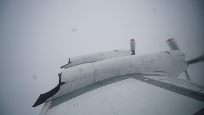
The P-3 flies through a snowstorm somewhere between Kentucky and Indiana on Thursday, February 3, 2022. (Image: NASA's Goddard Space Flight Center)
While most pilots avoid flying into extreme weather, several NASA aviators have been heading toward snowstorms and passing through them to collect valuable data that could improve weather forecasts.
NASA scientists are trying to better understand structures within snowstorms known as snow bands, why they form, and why some don't contain those structures.
The mission is called IMPACTS, an acronym for Investigation of Microphysics and Precipitation for Atlantic Coast-Threatening Storms. Since January, two NASA planes have chased down snowstorms, mainly on the east coast, to get as much data as possible.
Flying where no one else wants to be involved a lot of forecasting and working with air traffic control towers across the country. According to NASA P-3 aircraft pilot Rod Terbeck, because most commercial airline pilots want to avoid turbulent storms coordinating with air traffic control has been the easy part.
"I spent 26 years of my life trying to avoid what science wants us to go into today," Terbeck, a former military pilot, said. "So it is good in the sense that most pilots in the airline industry are trying to avoid the stuff we're flying in. So in one sense, as much as we thought the coordination would be difficult, quite often it's actually somewhat easier because we're going where they are trying to avoid."
WHAT MAKES A STORM A NOR’EASTER?
IMPACTS mission scientist Lynn McMurdie said the team begins looking at potential snowstorms to study about 72 hours before they would fly, looking at all the available models until the forecasts start to agree.
"Hopefully, by 24 hours, we have a good chance, a good idea. And we generally fly patterns … where we anticipate where (snow) bands are," McMurdie said.
While the pilots focus on flying through and above the storm, including the most recent Nor'easter in New England, NASA researchers monitor the data collected by the science instruments outfitted on the planes.
The wings of the P-3 Orion aircraft are equipped with probes that measure the size, shape and distribution of precipitation particles as it flies through the clouds. Meanwhile, an ER-2 jet flies above the storm, measuring precipitation from a view much closer than any satellite.
The ER-2 jet can fly up to 70,000 feet, but Pilot Greg "Coach" Nelson says they usually keep it around 65,000 feet.
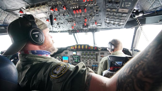
NASA pilots flying the P-3 aircraft navigate turbulence, bad weather, and flight coordination with the ER-2 on Thursday, February 3, 2022. (Image: NASA's Goddard Space Flight Center)
"Because we're so high altitude we have to wear a full pressure suit … it's actually the same spacesuit that NASA shuttle astronauts were wearing when they flew the shuttle," Nelson said. "So imagine that's what you're wearing all day long when you fly this aircraft."
Since January, the team has conducted about 10 flights flying over New York, Maine, into Canada and Indiana.
"We're kind of mostly focused on New England and New York because that's where it usually is snowing, but we go where the storms are," McMurdie said.
Ultimately, NASA wants to understand what makes snowstorms tick. The snow band structures are not as well understood.
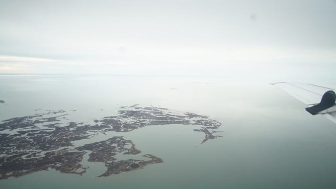
The P-3 nears the end of its flight close to Wallops Island, Virginia on Thursday, February 3, 2022. (Image: NASA)
"We really actually need to know the character of the snow crystals and the snow characteristics, how much water or how much total water, how much total liquid water," McMurdie said. "We're trying to understand what are the processes that are contributing to these banded structures and why some storms have a lot, have multiple banded structures and others have none."
The IMPACTS mission is a multi-year campaign and the first holistic look at snowstorms in the eastern U.S. in 30 years, according to NASA.