West Coast storm could bring 6 to 9 feet of snow to California mountains
"Yardsticks will be required to measure snow at some locations after this storm," says NWS forecaster.
Monster storm developing for the West
It's been a slow start to the winter season in the western mountains, but a major winter storm is bringing several feet of snow to the higher elevations.
SACRAMENTO, Calif. -- It's been a slow start to the winter season in the western mountains, but a major winter storm is bringing several feet -- nay, yards? -- of snow to the higher elevations.
A potent front is working its way through the West. More than 20 inches of snow fell across Washington's Stevens Pass by Saturday afternoon and another 12-15 inches was expected overnight. Heavy snows of 1-3 feet were also expected in the Oregon Cascades through Sunday morning.
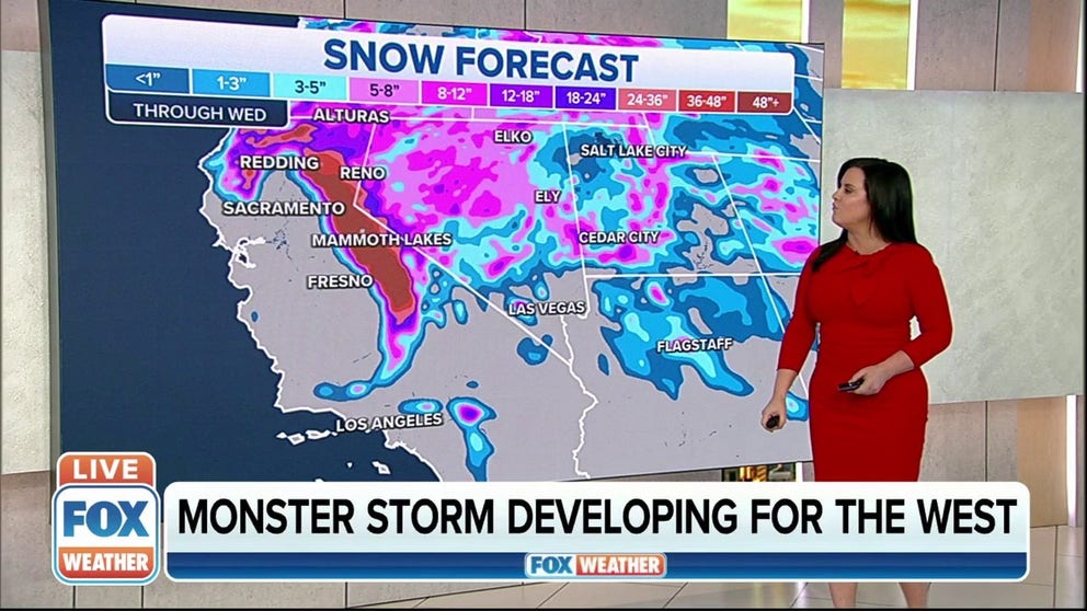
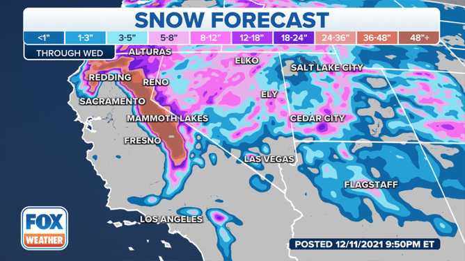
But the storm is revving up as it moves into California Saturday evening and taps into some tropical moisture, juicing the amount of precipitation available. Snow will begin falling in the Sierra Nevadas later on Saturday and extreme amounts of snow are expected Sunday, Monday and into Tuesday.
(FOX Weather)
"Yardsticks will be required to measure snow at some locations after this storm," forecasters at the National Weather Service office in Sacramento wrote in their Thursday afternoon forecast discussion. "A few to several feet of snow can be expected above 4,000 ft. with this storm, increasing to a few to several yards of snow above about 6,000 or 7,000 feet."
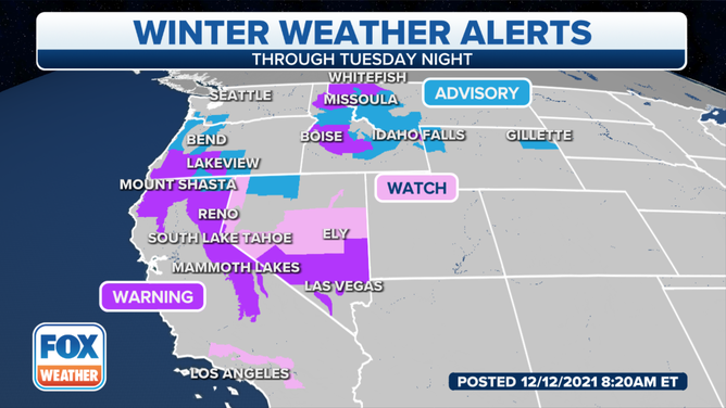
In all, a Winter Storm Warning is advising of potential for 3 to 5 feet of snow above 4,000 feet and 6 to 9 feet of snow above 6,000 feet. That's over 100 inches at the upper end.
That area includes the heavily traveled I-80 corridor over Donner Pass, as well as Highway 50 over Echo Summit and Highway 88 over Carson Pass.
(FOX Weather)
"Strong winds will result in white-out conditions over the mountains with extremely difficult to impossible travel," forecasters warned.
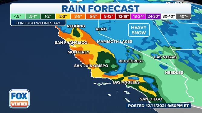
But even the California lowlands aren't escaping the storm's impact, with heavy rains forecast from the Bay Area all the way south into Los Angeles.
(FOX Weather)
The San Francisco Bay Area and Los Angeles metro area may see 1 to 3 inches of rain between Sunday night and Tuesday, causing the potential for significant roadway flooding.
The storm will move off to the east by Wednesday.