Watch: Curtain of hail drapes over Seattle's skyline
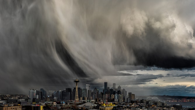
A hail storm moved right over Downtown Seattle on Saturday evening, and photographers were ready to capture the incredible scene!
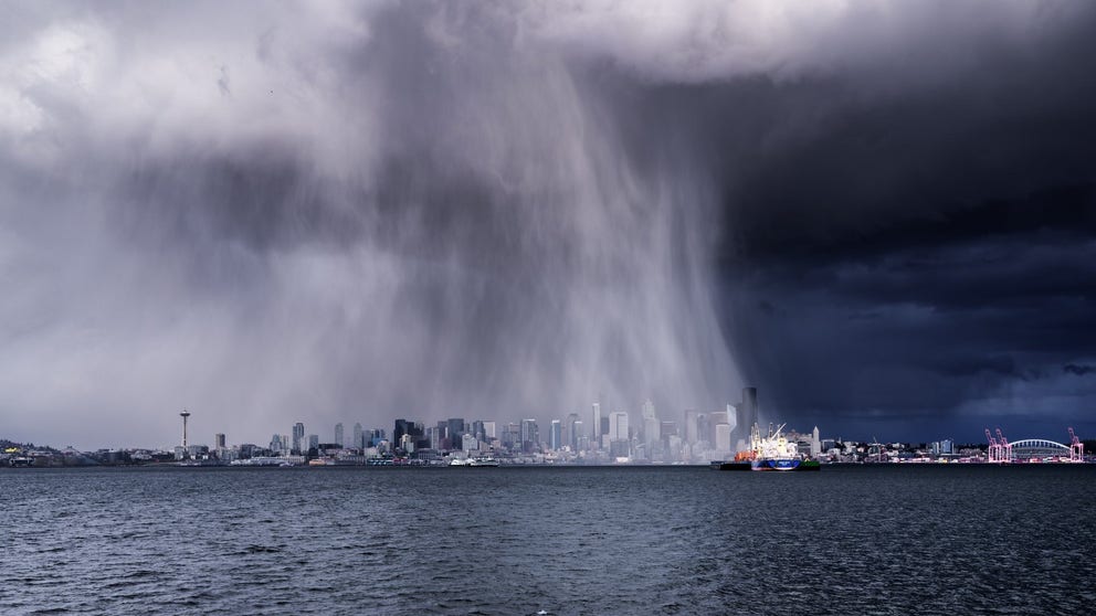
Watch: Dramatic curtain of hail drapes over the Seattle skyline
Ribbons of hail fell across Downtown Seattle Saturday putting on a show of nature across the Emerald City's skyline.
SEATTLE -- A hail storm moved right over Downtown Seattle on Saturday evening, and photographers were ready to capture the incredible scene!
A cold, unstable air mass rushed into the Pacific Northwest over the weekend, slashing temperatures that had briefly touched 73 degrees on Thursday.
In contrast, Saturday's temperatures never made it out of the 40s -- about 10 degrees below normal.
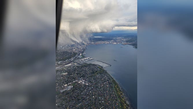
Hail falls over Downtown Seattle as seen from an Alaska Airlines flight.
(Chris Higgins)
While snow needs temperatures near freezing to make it to the surface, hail can fall at temperatures well above freezing.
Hailstones form when strong updrafts inside storm cells blow raindrops high up into the upper reaches of the cloud where temperatures are well below freezing. The raindrop will freeze into a pellet and fall back toward the ground, picking up additional raindrops along the way.
If the updrafts remain strong enough, this new wet hailstone will once again be blown skyward, where this new coating of water will freeze, enlarging the hailstone.
Hail falls over Downtown Seattle on April 9, 2022.
The process repeats until the hailstone is heavier than the updraft can support, gravity wins the battle, and the stone falls to the ground.
HOW LARGE IS ‘GOLF BALL-SIZED HAIL’? – AND OTHER HAIL MEASUREMENTS
In the Pacific Northwest, large hail is rare as the moderating effect of the Pacific Ocean limits thunderstorm developments and updrafts remain weak.
In parts of the country where severe weather is more common, updrafts can reach 50-60 mph or stronger, supporting hailstones as large as a golf ball or tennis ball or more. The largest hailstone recorded in the U.S. was 8 inches in Vivian, South Dakota -- about the size of a volleyball!