Boston, Hartford under Winter Storm Watch as potential nor'easter eyes Northeast
Numerous record-high temperatures set in major cities throughout the Northeast through Saturday will quickly become a distant memory as a developing nor'easter arrives late Monday, threatening accumulating snow even along the I-95 corridor.
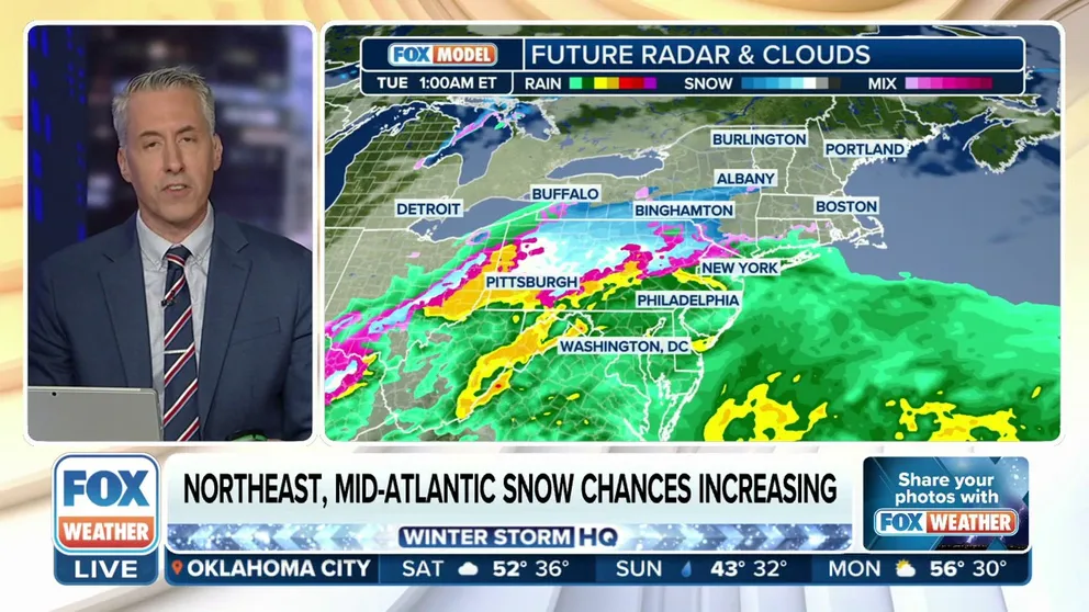
Northeast, mid-Atlantic snow chances increasing from potential nor'easter next week
Based on forecast trends, the track of the low will produce a fairly widespread swath of moderate-to-heavy snow from Pennsylvania to Massachusetts through Tuesday, the FOX Forecast Center said.
Millions of Americans in the nation's busiest corridor in the Northeast will soon experience weather whiplash, going from record February warmth to a potential nor'easter next week that will bring heavy rain, gusty winds and plowable snow.
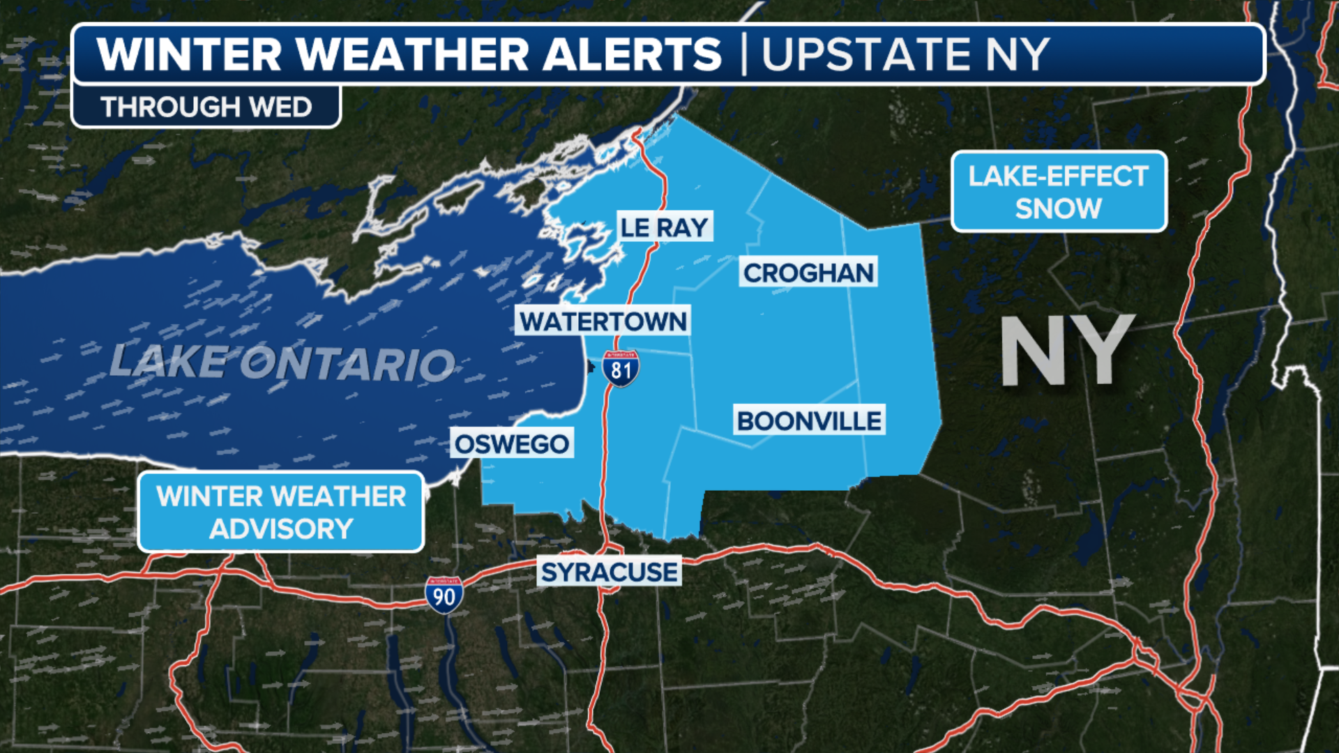
More than 16 million people are under a Winter Storm Watch that stretches from central Pennsylvania to Massachusetts, where some of the heaviest precipitation could fall. It includes major cities such as Boston and Hartford, Connecticut. The alert does not include cities such as Philadelphia or New York.
WHAT MAKES A STORM A NOR’EASTER?
(FOX Weather)
After a weekend of record-setting temperatures, as the highs climbed into the 50s and 60s, cooler air is expected to settle in by Sunday.
Low pressure will roll into the Northeast and slide into the Atlantic Ocean on Tuesday. Meanwhile, colder air will get pulled down from Canada, dropping temperatures close to or below freezing Monday night through Tuesday.
The storm may briefly start as rain for some areas along the Atlantic Coast Monday night, but as the storm strengthens, it'll be able to continuously tap into colder air, ensuring a rain-to-snow changeover that won't revert at any point, the FOX Forecast Center said.
A Gale Watch has been issued for hundreds of miles of coastline from Massachusetts to the Outer Banks of North Carolina, with wind gusts of more than 40 mph.
HERE'S HOW BIG A SNOWMAN YOU CAN BUILD WITH ALL THAT SNOW IN YOUR YARD

(FOX Weather)
Based on current forecast trends, the track of the low will produce a fairly widespread swath of moderate-to-heavy snow from Pennsylvania to Massachusetts through Tuesday.
"So right about mid-morning or late morning hours, it’s rain to snow for you in New York (City), Philadelphia, and then (the snow) hangs on there," said FOX Weather Meteorologist Bob Van Dillen.
Snow is expected to taper off Tuesday evening.
"It’s a quick hitter, but once (the snow) comes down, it comes down pretty hard," he said.
Computer forecast models are trending toward a stronger storm system, so the FOX Forecast Center is talking about higher snow totals being a possibility.
DID PUNXSUTAWNEY PHIL SEE HIS SHADOW OR IS AN EARLY SPRING ON THE WAY?

(FOX Weather)
New York City, Philadelphia, Boston, Hartford, and Pittsburgh could all see snow, but the storm's exact track and ability to strengthen will be key factors in determining how much snow will fall and where.
With the low strengthening off the coast, gusty winds will become a concern along the Interstate 95 corridor Tuesday. This may lead to reduced visibility and maybe even some coastal beach erosion.
Wind gusts of 30-45 mph are possible, which could lead to significant travel problems for major interstates in the Northeast and mid-Atlantic.
HOW RELIABLE ARE OLD WIVES’ TALES FOR FORECASTING WINTER WEATHER?

(FOX Weather)
Anyone commuting or with travel plans for early next week should be keeping a close eye on this forecast, as the storm can potentially create chaos for some of the nation's busiest airports and roads.
Prior to arriving in the Northeast, the storm will produce a stripe of snow from the Southern Plains into the Ohio Valley from Sunday into Monday.
Ground temperatures at or above freezing will make good accumulating snow hard to come by east of the Texas Panhandle, except where high snow rates develop. Those in cities such as Oklahoma City and Tulsa in Oklahoma, Springfield and perhaps St. Louis in Missouri could see the flakes fly.