Unsettled weather continues in the northwest US
Arctic air filtering in from Canada, along with a low-pressure system, is providing more unsettled conditions across the region.
New storm rolling into the West with more rain, snow
Travel across portions of the Pacific Northwest and northern Rockies could be tricky as another storm is bringing more rain and snow to the region.
A weather system situated off the Pacific Northwest coast continues to funnel moisture onshore, providing rain and much-needed snow to the northwest U.S.
Arctic air filtering in from Canada, along with a low-pressure system, is providing more unsettled conditions across the region.
A stalled cold front over southern Washington and the Idaho Panhandle will provide precipitation across Oregon Sunday. Several inches of rain are expected.
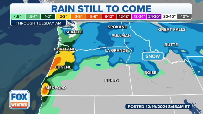
Rain forecast for Pacific Northwest - Dec. 19, 2021.
(FOX Weather)
The front will eventually move northward late Sunday into Monday, pushing the unsettled weather northward into Washington.
Further east, an arctic front dips south, providing heavy snow chances for northern Idaho and Montana.
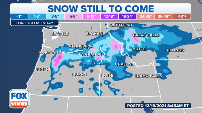
Snow forecast for the northwest US - Dec. 19, 2021.
(FOX Weather)
Areas shaded in blue could see several inches of snow, while more than a foot of heavy snow is forecasted in the Cascades and Northern Rockies.
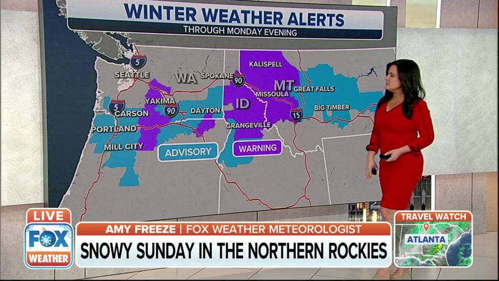
Winter Weather Alerts are in place for parts of Washington, Oregon, Idaho, and Montana.
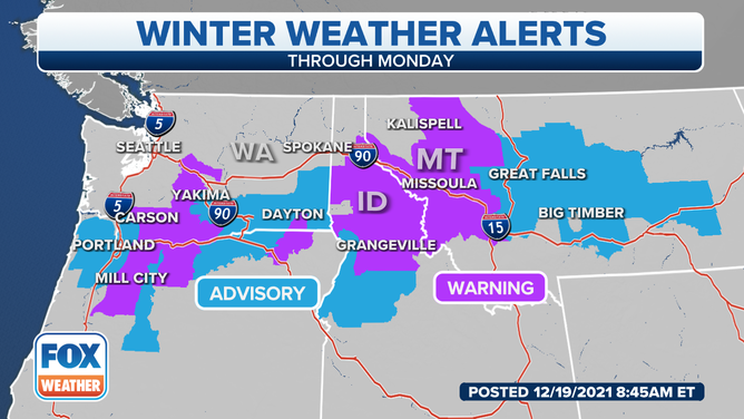
Winter Weather Alerts - Dec. 19, 2021.
(FOX Weather)
As the front continues to push south, the snow, gusty winds and flash freeze risk will also move south. Drivers are urged to use caution as travel conditions could be hazardous with the icy and conditions.
The rain and snow will start to taper off by Tuesday morning, but another storm on Wednesday will impact the region.