Heat alerts return to South Florida as moisture from tropical disturbance departs
As the weekend progresses, some coastal communities such as Miami, Fort Lauderdale and West Palm Beach are expected to slowly dry out as the tropical moisture impacts cities further northward, along the Southeast coast.
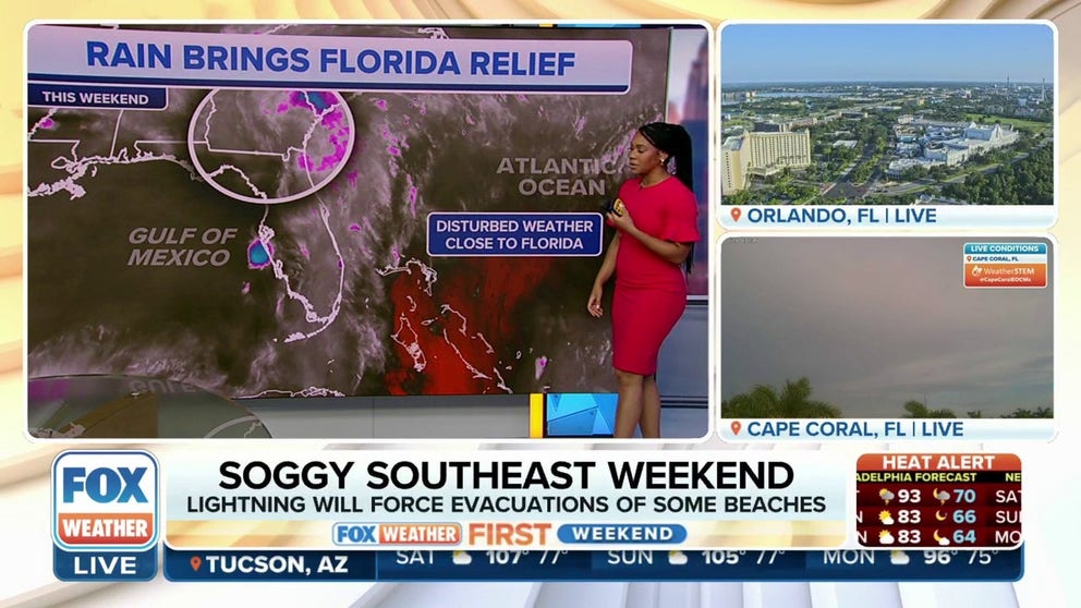
Florida experiences break from heat during rainy weekend
The storms will most certainly ruin outdoor plans Saturday, and Sunday in some spots, sending beachgoers running for cover. Central Florida's theme parks won't be immune, and anyone headed to the parks should be prepared to seek shelter from the storms. July 29, 2023.
MIAMI - Heat alerts have returned to parts of the Florida Peninsula following enhanced rainfall over the past couple of days that led to localized flooding.
A tropical disturbance that the FOX Forecast Center tracked across the western Atlantic, helped to enhance shower and thunderstorm activity from South Florida to the Interstate 10 corridor.
"It’s like being at a water park, and that big tub of water comes out and splashes on top of you," said FOX Weather meteorologist Craig Herrera.
As the weekend progresses, some coastal communities such as Miami, Fort Lauderdale and West Palm Beach are expected to slowly dry out as the tropical moisture impacts cities further northward, along the Southeast coast.
NEW TO FLORIDA? HERE'S WHEN THE SUNSHINE STATE'S RAINY SEASON GETS UNDERWAY
The heat index is expected to reach over 100 degrees again in much of the state through the weekend as a more normal, daily summer pattern returns.
In communities under heat alerts, such as West Palm Beach, Fort Lauderdale and Miami, heat indices are expected to be between 105-110 °F over the weekend.

(FOX Weather)
Flooding reported in South Florida
Slow-moving thunderstorms on Thursday dropped several inches of rain around the Fort Lauderdale and Hallandale Beach communities, stranding some drivers.
Traffic cameras captured flooding along U.S. 1 and several vehicles became disabled in the high flood water.
The heavy rain also caused problems at Fort Lauderdale-Hollywood International Airport, where several flights were delayed and at least one of the entrances to the airport was temporarily closed due to standing water.
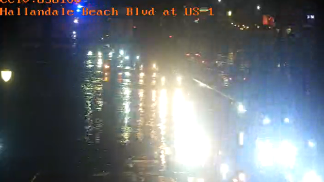
Several inches of rainfall produced flash flooding in Hallandale Beach
(FDOT 511 / FOX Weather)