Waterspout spotted off the coast of South Carolina amidst tropical downpours
Tropical Storm Colin formed off the Southeast coast early Saturday morning
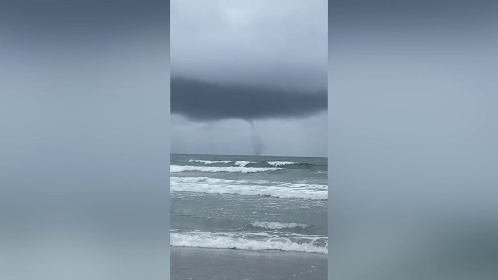
Waterspout spotted off Cherry Grove Beach, SC
Waterspout spotted off Cherry Grove Beach, South Carolina on Friday afternoon. (Video: Cecily Rogers)
CHERRY GROVE BEACH, SC – Tropical moisture along the coast of the Southeast will not only produce flooding rains over the weekend but also increase the chances of seeing waterspouts as beachgoers did on Friday afternoon near Myrtle Beach, South Carolina.
The heavy rainfall is courtesy of a tropical disturbance off the coast of South Carolina that quickly organized into Invest 96L on Friday.
An invest is simply a naming convention used by the National Hurricane Center to identify an area of weather that it is investigating for possible development into a tropical depression or tropical storm.
By early Saturday, the storm intensified into Tropical Storm Colin.

HOW TO WATCH FOX WEATHER ON TV
The impacts will continue to be felt along the coasts of Georgia and Carolinas through at least Saturday.
A Flash Flood Watch has been issued from Savannah, Georgia, through Charleston, South Carolina, where an additional two to four inches of rain is possible, with locally higher amounts.

The area has already seen several inches of rain, so forecasters warn any additional precipitation could cause flash flooding.
More widely scattered storms are expected to remain in the forecast after the low-pressure system moves northeastward away from the region.
The continued chance for showers and storms means some holiday goers will have to dodge raindrops through Independence Day.
4TH OF JULY WEEKEND COULD BE STORMY, HOT FOR SOME ACROSS US
