Invest 96L could become tropical depression in Atlantic while odds wane for Southeast coastal storm
The National Hurricane Center said Invest 96L has a medium chance of development over the next seven days and will eventually move northward and out into the Atlantic.
Atlantic hurricane season heating up with Invest 96L churning over ocean
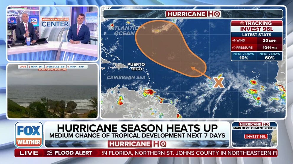
Invest 96L was designated in the Atlantic Ocean on Wednesday, and forecasters say it could develop into a tropical depression or tropical storm late this weekend or next week. FOX Weather Meteorologists Bob Van Dillen and Stephen Morgan break down the latest forecast on Aug. 7, 2025.
A budding tropical disturbance in the central Atlantic Ocean was designated Invest 96L by the National Hurricane Center (NHC) on Wednesday, as it enters favorable conditions for gradual development in the next week.
The term "invest" is a naming convention used by the NHC to identify a system that forecasters are investigating for possible development into a tropical depression or tropical storm within the next seven days. The designation allows the agency to run specialized computer forecast models to track the area's potential storm development.

(FOX Weather)
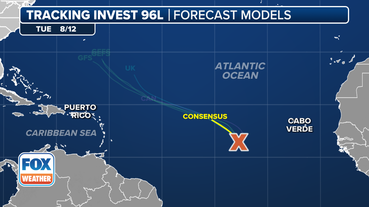
The NHC said Invest 96L is moving west-northwestward to northwestward, attempting to push through an area of dry, dusty air. Most forecast models suggest the system will continue on a northward track into the open central Atlantic and remain relatively weak.
However, some development is still possible. The NHC currently gives the system a medium chance of becoming a tropical depression or tropical storm in the coming days.
It's another tropical wave behind 96L coming off the west coast of Africa in the next few days that the FOX Forecast Center says will get plenty of attention over the coming weeks.
BRYAN NORCROSS: TROPICAL STORM DEXTER AND MORE AREAS TO WATCH IN THE ATLANTIC
(FOX Weather)
Early projections suggest this second wave will follow a more southerly track. While there is strong model agreement that it may remain weak as it crosses the tropical Atlantic, it’s still worth watching through next week and beyond.
The warmest ocean waters in the basin remain concentrated in the western Atlantic, including the Caribbean, the Gulf and areas near Florida and the Southeast U.S.
Any systems that manage to hold a southern course toward these regions will have access to greater fuel for intensification and will warrant close monitoring in the coming weeks.
The next named tropical storm will be Erin.
Area off East Coast has dwindling chances of development

(FOX Weather)
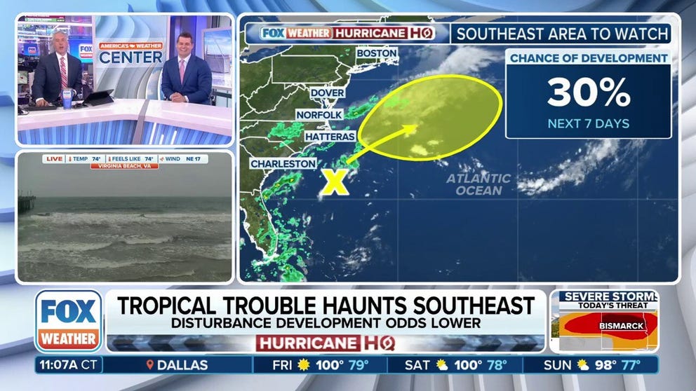
In addition to Invest 96L, the NHC continues to watch a weak area of low pressure a few hundred miles off the Southeast U.S., producing minimal showers and thunderstorms.
This system is forecast to continue to drift north along an old frontal boundary. Development chances have lowered, but there is still potential for gradual organization by late-week as the system first slowly moves west-northwest to northwestward across the central tropical and subtropical Atlantic, away from the U.S.
As of now, the NHC gives this system a low chance of development over the next seven days, which is a drop from earlier this week when it had a medium chance of development. The primary limiting factors include dry air in the mid-levels of the atmosphere and the disorganized nature of the current circulation.
Tropical trouble haunting Southeast coast
The National Hurricane Center is continuing to monitor the potential development of tropical trouble off the Southeast coast. FOX Weather Meteorologists Bob Van Dillen and Stephen Morgan break down the latest forecast on Aug. 7, 2025.
The low may not have a solid opportunity to concentrate storms without relying on the lingering front.
However, a few factors could support development. Sea-surface temperatures in the region, including the Gulf Stream, are above 80 degrees, providing ample fuel for storm formation. Additionally, upper-level winds are forecast to be relatively weak in the area during this period, which could allow for better organization if a tropical low does form.
The Hurricane Hunters had been scheduled to fly into the system, but the missions were canceled for both Wednesday and Thursday as the threat level dropped.
Sept. 10 marks the climatological peak of the Atlantic hurricane season.