Threat for rain, storms exists for Southeast on Thursday
An isolated threat for damaging winds gusts, hail and tornadoes exists on Thursday.
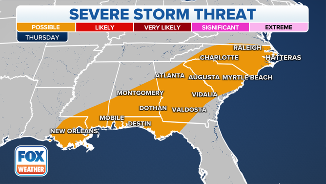
Severe thunderstorm threat on Thursday, Dec. 30, 2021.
(FOX Weather)
Showers and thunderstorms will continue their march eastward on Thursday across the Southeast, but meteorologists say the ingredients will not be in place for any type of widespread severe weather outbreak.
Heavy rains will be the primary concern from Mississippi through the mid-Atlantic, where upwards of three inches could fall in isolated locations.
SIGNIFICANT DAMAGE REPORTED IN WINFIELD, ALABAMA AFTER POSSIBLE TORNADO
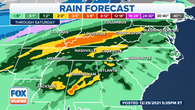
Heavy rainfall is expected from Alabama through northern Georgia on Thursday.
(FOX Weather)
Because temperatures will be warm and there will be plenty of moisture around, a few of the storms could be strong to severe, with the chance of damaging wind gusts, hail and a brief tornado.
The round of rain will make its way off the coast into the Atlantic before attention turns to the next wet weather system in the nation’s heartland for New Year’s Eve.
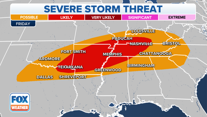
Severe thunderstorm threat on Friday, Dec. 31, 2021.
(FOX Weather)
NEW YEAR'S FORECAST: ACTIVE WEATHER TO RING IN 2022
Forecast models show showers and thunderstorms developing during the evening hours on Friday from northeast Texas into central Kentucky. The Storm Prediction Center says all severe-weather hazards will be possible, including large hail, damaging wind gusts and tornadoes.
The exact timing of the storm system will be crucial for New Year’s Eve celebrations across the Tennessee Valley.
Large outdoor celebrations are scheduled to take both in Memphis and Nashville, but organizers warn partygoers to pay close attention to the weather forecasts.
The severe weather threat is expected to continue into New Year’s Day for areas from the Gulf Coast into the Tennessee Valley.
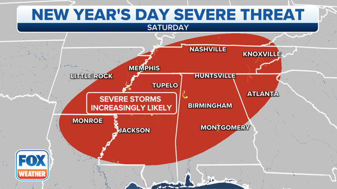
Severe thunderstorm threat on Saturday, Jan. 1, 2022.
(FOX Weather)
Download the FOX Weather app now to plan out the forecast for where you’ll be celebrating the arrival of 2022.