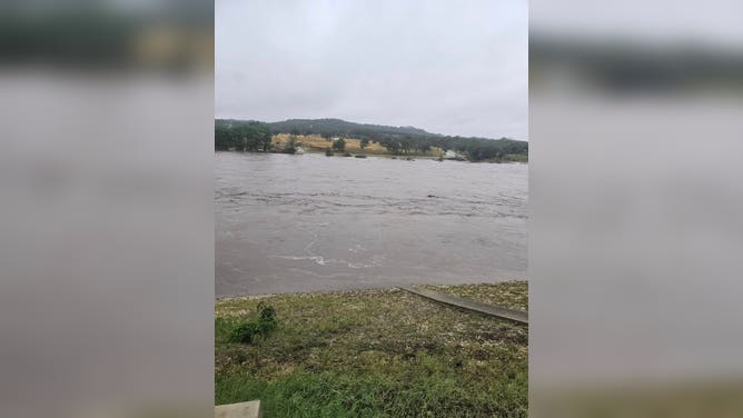
Texas Hill Country keeps close eye on next wave of storms headed to state after deadly flooding
The heaviest precipitation is expected to remain north and west of the hard-hit Hill Country.
Rain and thunderstorms return to Texas this weekend, worst to stay north of hardest hit areas
After more than a foot of rain caused historic flash flooding across South Central Texas on the morning of July 4, conditions are expected to deteriorate once again heading into the weekend. Guidance increasingly supports the return of showers and thunderstorms across much of west-central Texas, including portions of the Hill Country. The worst of the rain is expected to stay north and west of the hardest-hit areas but the NOAA's Weather Prediction Center has issued a flash flood risk for the area.
AMARILLO, Texas - The risk of heavy rainfall and severe weather is expected to return to the Lone Star State over the weekend, but the worst of the storms are expected to pass north of the areas recently devastated by July Fourth's historic and deadly flooding.
Given the already saturated and highly vulnerable landscape across the Texas Hill Country, the FOX Forecast Center warned that people in the area should remain especially alert for any storms that develop in the region.
Thunderstorm complexes are forecast to develop Saturday afternoon over parts of the Texas Panhandle, Big Bend and North Texas, forming on the eastern edge of a persistent heat dome gripping much of the western U.S.
The storms are expected to bring flash flooding, hail and damaging wind gusts, with cities such as Amarillo, Lubbock, Midland, Abilene and Dallas facing a risk of thunderstorms through the weekend and into the early part of next week.

(FOX Weather)
NOAA's Weather Prediction Center has issued a Level 2 out of 4 flash flood threat that covers most of west Texas, the Panhandle and North Texas.
Computer model guidance suggests some locations could receive as much as 2-4 inches of rain, though the heaviest precipitation is expected to remain north of the hard-hit Hill Country.
"The problem is that the ground is super-saturated," said FOX Weather Meteorologist Michael Estime, regarding the places devastated in the July Fourth floods. "It will take in spots, less than a half-inch of rain to actually lead to flooding."

(FOX Weather)
According to the National Weather Service, atmospheric moisture levels are forecast to climb into the 90th percentile for this time of year, primarily north of Interstate 20.
A weak steering flow means storms could move slowly and behave erratically, increasing the risk of flooding where thunderstorms train over the same area for an extended period.
Just 6 inches of fast-moving floodwater can knock over an adult, and a foot of rushing water is enough to carry away a passenger vehicle.
In areas that see rainfall and increased cloud cover, temperatures are expected to remain below seasonal averages into next week, providing some relief from the summer heat. However, much of central and southern Texas – areas in the recovery phase from the catastrophic flooding – will face dangerous heat instead of renewed flooding.
Temperatures are forecast to reach the low 90s for the foreseeable future, with heat index values climbing above 100 degrees at times.
Hundreds of first responders and volunteers continue to search for the missing a week after a deadly flood wave swept through several recreational sites along the Guadalupe River.

(FOX Weather)
WHAT’S BEHIND ALL THE RECENT EXTREME FLOODING?
Texas won’t be alone in dealing with unsettled weather.
A cold front is expected to stretch from Canada through the Great Lakes and down into the Southern Plains, bringing a broad swath of showers and thunderstorms.


