Tropical moisture spreads through Texas into Southern Plains
Flash Flood Watches are in effect from the Rio Grande Valley of southern Texas to southwestern Missouri.
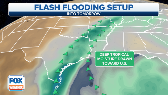
Tropical moisture is expected to continue to stream into the heart of the country.
(FOX Weather)
Flash Flood Watches continue for many counties from Texas to Missouri, as additional heavy rainfall is in the forecast.
A cold front in combination with the tropical moisture from the remnants of Pamela are responsible for producing the torrential rainfall.
Up to five inches of rain fell on Wednesday in parts the Lone Star State, mostly along the I-35 corridor.
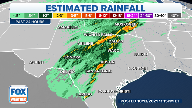
Several areas in Texas reported 3–5 inches of rain on Wednesday.
(FOX Weather)
The moisture will move through eastern Texas on Thursday and could reach the mid-Mississippi Valley by Thursday night, shifting the axis of heavy rain farther north and east.
A few severe thunderstorms are also possible, which could contain gusty winds and perhaps even a brief tornado.
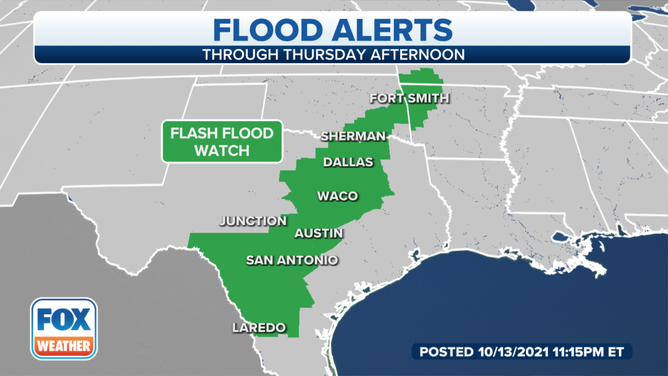
Flash Flood Watches in effect
The greatest flash flood threat extends from eastern Texas into southwestern Missouri.
Rainfall totals of 2 to 5 inches are likely from the Rio Grande Valley to the mid-Mississippi Valley through Friday.
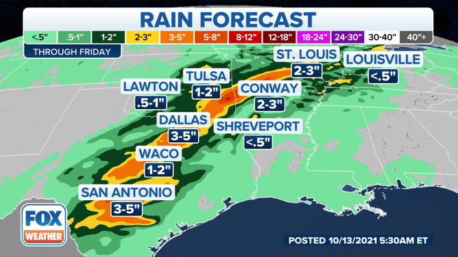
Rainfall forecast through Friday, Oct. 15, 2021.
(FOX Weather)