Summer storms to unleash heavy rain, frequent lightning in Southeast on Wednesday
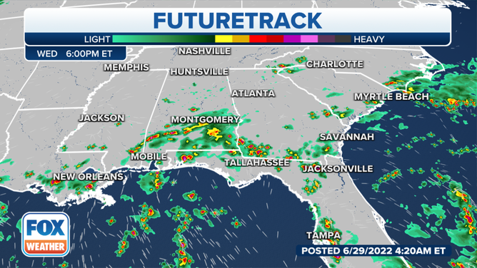
Southwestern Florida will likely see the highest rain totals, with areas near Fort Myers and the Everglades picking up anywhere from 2-3 inches with some locally higher amounts
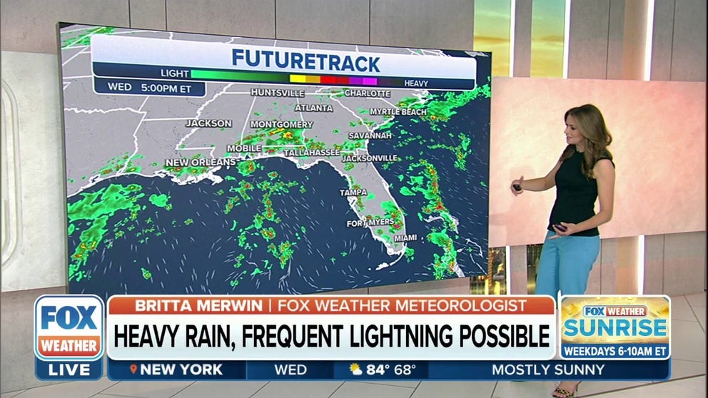
Southeast to see heavy rain, frequent lightning from summer storms
These storms will have the ability to produce torrential rainfall and frequent lightning at times.
A quintessential summer pattern will be in place across the Gulf Coast and Southeast this week as a warm and humid airmass sparks pop-up afternoon thunderstorms.
HOW TO WATCH FOX WEATHER ON TV
Tapping into that humidity, these storms will have the ability to produce torrential rainfall and frequent lightning at times. NOAA's Weather Prediction Center said several inches of rain could fall from the New Orleans area to South Florida.
HOW HEAVY IS IT REALLY GOING TO RAIN?
Southwestern Florida will likely see the highest rain totals, with areas near Fort Myers and the Everglades picking up anywhere from 2-3 inches with some locally higher amounts. The New Orleans area is also expected to see about 1 to 2 inches, but areas around the city and points north could pick up 2 to 3 inches of rain.

(FOX Weather)
Light winds above the surface mean the storms won't move all that much and those that are more stationary will have a greater chance of producing flash floods.
If one of these storms should sit over an urban area, travel disruptions due to flooded streets are likely.
(FOX Weather)
CLICK HERE TO GET THE FOX WEATHER UPDATE PODCAST
Be sure to download the FOX Weather app to track any storms in your area and receive potentially life-saving weather alerts issued by the National Weather Service. The free FOX Weather livestream is also available 24/7 on the website and app and on your favorite streaming platform. The FOX Weather Update podcast also provides weather information for the entire country.