St. Louis sees first snowflakes of the season as wintry system moves through America's heartland
Areas around eastern Missouri and central Illinois are getting a remnant dose of minor snow Friday.
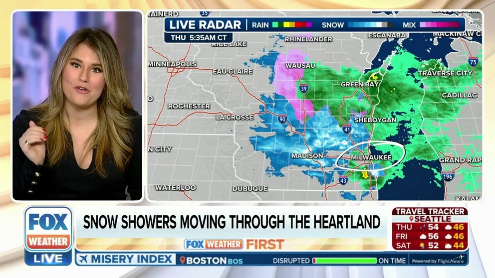
Snow showers moving through heartland on Thursday
The Christmas blizzard may be over, but the storm system that brought several inches of snow, and near hurricane-force winds to the Plains earlier this week survives Thursday in the form of light snow.
ST. LOUIS — The Christmas blizzard may be over, but the storm system that brought several inches of snow, an inch of freezing rain accretion and near hurricane-force winds to the Plains earlier this week is straggling on in the form of light snow for the upper-Mississippi Valley.
Areas around eastern Missouri and south-central Illinois received a light coating of snow on Thursday.

(FOX Weather)
That includes St. Louis, which had light snow showers already blowing through since Wednesday, making for a "picturesque night" at the National Weather Service office.
The official gauge at Lambert Airport in St. Louis reported its first measurable snowfall of the season, with 0.2 inches Wednesday through midnight Thursday morning.
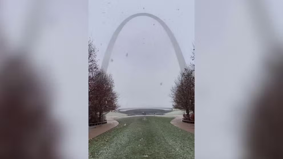
Snow falls on Gateway Arch in St Louis
Snow fell on the famous Gateway Arch in St Louis on Wednesday, as the National Weather Service said rain would turn to snow across the region.
Snowfall amounts are forecast to be light, with an inch or less accumulations — mainly on elevated and grassy surfaces.
Some snow winners may get up to 1.5 inches in a heavier burst of snow, but the NWS estimates any travel impacts on the St. Louis area Thursday evening at just 20%.

(FOX Weather)
The dose of winter weather will slide off into the Southeast Friday, bringing a late-year chill there, but a return to dry weather around the mid-Mississippi Valley with seasonal temperatures.