Rockies snowstorm blankets Colorado ski resorts in fresh powder ahead of Halloween weekend
The FOX Forecast Center is tracking heavy snow, likely to bring hazardous travel and the potential for the first measurable snow of the season in the Front Range Urban Corridor of Colorado.
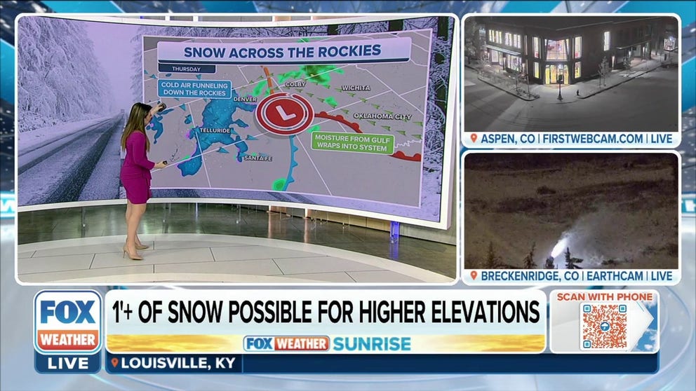
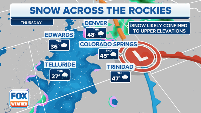
Accumulating snow to blanket the Colorado Rockies on Thursday
Snow showers could be heavy at times, with snow rates exceeding 1"/hr. Thundersnow is also a possibility this afternoon as some instability will be present.
DENVER – Talk about an early taste of winter. An autumn storm is dumping a significant amount of snow on the Rockies.
The FOX Forecast Center is tracking heavy snow, likely to bring hazardous travel and the potential for the first measurable snow of the season in the Front Range Urban Corridor of Colorado.
(FOX Weather)
Snow has already overspread the mountains in central Colorado Thursday morning. It is expected to expand in coverage and intensity throughout the morning.
Snow showers could be heavy at times, with snowfall rates exceeding 1 inch an hour in the heaviest bursts of snow.
Thundersnow is also a possibility Thursday afternoon as some instability will be present. This is most likely in the Sawatch Range in central Colorado, the Sangre de Cristo Mountains in southern Colorado and northern New Mexico and the San Juan Mountains in southwestern Colorado and northwestern New Mexico.
THUNDERSNOW: WHAT CAUSES LIGHTNING AND THUNDER DURING A SNOWSTORM?
(FOX Weather)
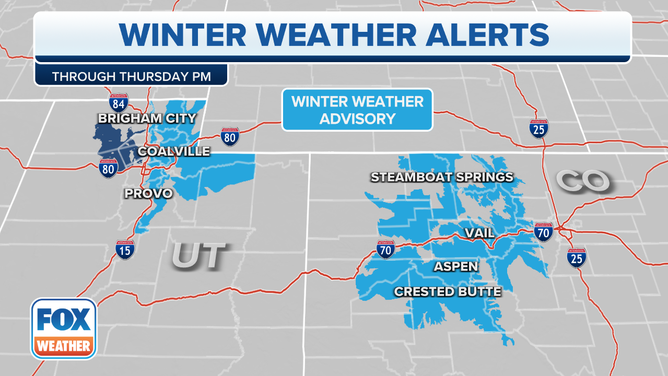
Due to the threat of hazardous travel, a Winter Weather Advisory has been issued for most of the mountain ranges in Colorado.
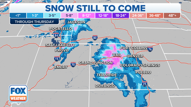
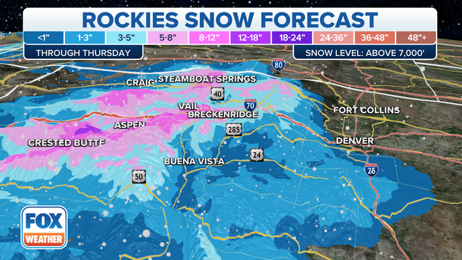
How much snow is expected to fall?
- 5 to 8 inches above 8,000 feet in elevation
- 3 to 5 inches above 7,000 feet in elevation
- 1 to 3 inches above 6,000 feet in elevation
- Up to 1 inch below 6,000 feet in elevation
WHEN IS THE EARLIEST IT CAN SNOW IN YOUR CITY?
(FOX Weather)
For the Palmer Divide, including Colorado Springs, what will initially start as a rain-and-snow mix will turn to mostly snow by Thursday afternoon. Around 1 inch of snowfall will be possible.
"Temperatures are sitting well into the 30s, especially up into our higher elevations through the afternoon," FOX Weather Meteorologist Jane Minar said. "Scattered showers will certainly continue. We will see maybe a little bit of snow start to creep its way down into the lower elevations – not anticipating any accumulation. Temperatures in the 40s could support a few snowflakes in Denver, but it's not going to amount to anything on the ground."
(FOX Weather)
Along the northern Interstate 25 corridor, including the Denver metro, this is currently expected to be primarily a rain event. A few snowflakes could mix in Thursday with less than an inch expected, but it could be the first measurable snow of the season for some spots along the urban corridor.
Winds will be gusty through Friday, as gusts could reach 30 to 40 mph. Temperatures will also plunge, and a hard freeze is expected as overnight lows dip into the mid- to upper 20s.