Central Plains slammed with 4-8 inches of snow, making for treacherous post-Thanksgiving travel
The FOX Forecast Center said moderate to heavy snowfall is expected to move through the Plains into the Midwest. The snowfall will come with gusty winds, as well as heavy snow bands at rates of 1 inch per hour at times, which will create hazardous travel conditions.
First holiday winter storm targets Great Lakes
Several inches of snow are expected to fall over the Midwest on Sunday. The wintry weather could impact travel through Minneapolis, Chicago and Denver.
WICHITA, Kan. – A winter storm rolled through the Central Plains, including a large part of Kansas, as millions of Americans made their way home from the Thanksgiving holiday.
The first snow of the holiday season brought bitter cold across the Central Plains, while precipitation was forecast to head through the Midwest and Great Lakes on Sunday.

(FOX Weather)
Winter weather alerts were in effect for more than 10 million people from Texas through Michigan.
In addition to the snow, a mix of sleet and freezing rain was reported across the Texas Panhandle into northwestern Oklahoma and southern Kansas.
The mixed precipitation was expected to be light but add to travel difficulties on roadways.
Several crashes were reported around Wichita, Kansas as road conditions deteriorated on Saturday.
Local National Weather Service offices warned drivers of the treacherous conditions and at times, some roadways in the heart of the storm system were completely covered in snow.
The FOX Forecast Center expected moderate to heavy snowfall across southwestern Kansas to northwest Missouri with precipitation totals of 4-8 inches.
The snowfall came with gusty winds, as well as heavy snow bands with rates of around 1 inch per hour at times.
Despite clearing expected on Sunday in the Plains, temperatures in the teens and 20s will ensure that icy conditions will remain a threat for the next several days.
WINTER STORM WARNING CRITERIA FOR U.S. REVAMPED BY NATIONAL WEATHER SERVICE
![Crews preparing to treat the streets in Kansas]() Image 1 of 4
Image 1 of 4Snow crews preparing to treat the streets to reduce ice in Overland Park, Kansas, (City of Overland Park, Kansas)
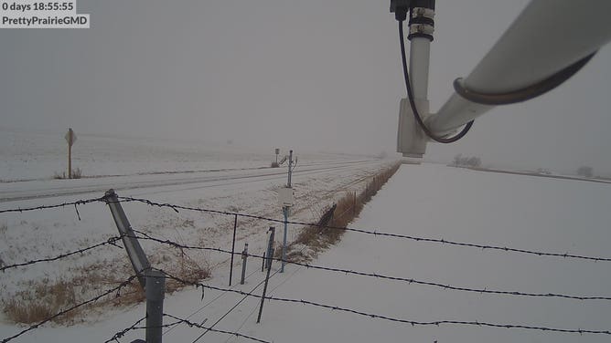
![Kansas Mesonet]() Image 2 of 4
Image 2 of 4Snow was widespread in central Kansas on Saturday. (Kansas Mesonet)
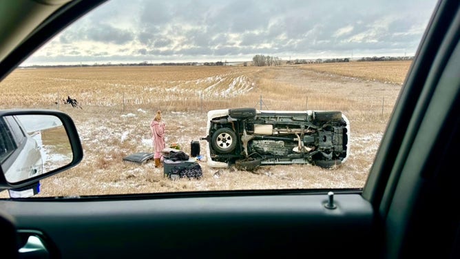
![Kansas Snow Crash]() Image 3 of 4
Image 3 of 4A rollover crash along Interstate 70 in Gorham, Kansas on Nov. 25, 2023. (Kansas Highway Patrol)
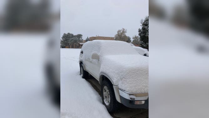
![New Mexico snow]() Image 4 of 4
Image 4 of 4More than 3" of snow fell in northern New Mexico as of Saturday morning. (@HDD_santafe)

Sunday travel impacts
Snowfall is expected to push into the Great Lakes on Sunday and impact cities such as Chicago, Detroit and Milwaukee.
A coating to as much as 3" will be the general rule of thumb according to the FOX Forecast Center.
Snowfall enhancements are possible south and east of the lakes, meaning some sports in Indiana and Michigan might see isloated higher amounts.

(FOX Weather)
Temperatures around Interstate 80 and northward are expected to be cold enough that most of the precipitation will fall in the frozen variety.
This means that many communities will see their first snowfall, on what AAA says could be the busiest travel day of the year.
The Transportation Security Administration expects to screen around 2.9 million airport passengers on Sunday, which could set an all-time record.
Airport hubs such as Minneapolis, Chicago and Detroit all face the threat of wintry weather, and, therefore, the need for deicing.
Airports in Albuquerque, New Mexico, Denver, Minneapolis and Kansas City, Missouri, implemented deicing procedures on Saturday to help remove snow and ice from planes.
FlightAware.com reported delays in Denver averaged nearly an hour as the snowy weather met travelers' return rush after the Thanksgiving holiday.
DOES EVERY PLANE NEED DEICING? THE SAFETY MEASURE WAS NOT ALWAYS STANDARD

(FOX Weather)
Arctic blast: Wind chills to drop below zero
According to the National Weather Service, temperatures will be lower than usual in much of the country this weekend. However, the biggest temperature differences will occur in parts of the Central and Southern Plains.
On Saturday, temperatures in the Central Plains will range from the 20s to the 30s, while in the northern portion of the Southern Plains, temperatures will be in the 40s.

(FOX Weather)
On Sunday, it will be colder, with lows in the teens and 20s. This may cause wind chills in the single digits or even below 0 in some areas.
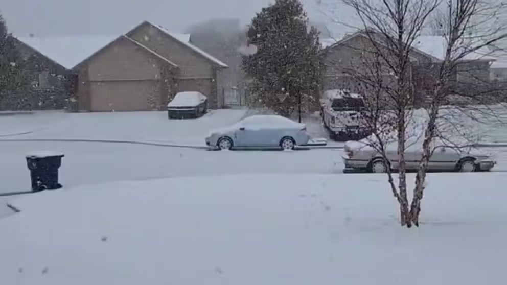
Kansas turns into a winter wonderland
Communities around Wichita, Kansas, reported more than 4" of snowfall as of Saturday afternoon.